Pasadena Mountain
El Centro Field Office, BLM
Click for map.
Now on to the main hike of the day: Pasadena Mountain. I know there's a trail up a lot of it because there's a geocache rather high up that claims to be the end of "the mystery trail". It doesn't say where the trail begins, though. I expect to try coming down it, but for up I'm trying a route I am calling "long and easy". How true that last bit is remains to be seen, but it looks to have a gentle climb. How wise it is to be using a "long" route when I only have a little over 4 hours to sunset also remains to be seen. A summary of "long and easy" is as follows: First I get myself to the north end of the mountain where even the USGS map, which seems reluctant to call anything around here a 4WD road says I better have that. From there, take a right into a large wash and just follow it up in a gentle climb until I've just slightly overshot the peak. Then turn left where there is a feeder wash that climbs steeply, but hopefully not too steeply, up to the ridge line above. Finally, head north again along the ridge to the high point. I drive about as far as seems wise in a small car without scouting ahead first and pull off into the flat desert to park. It is still about a mile from the north end of the mountain, but it's all easy road walking and I'll be coming out the south side so it hardly seems to matter.

The road deteriorates quickly enough for me to be glad I took the parking I did. Once they start following the bottom of washes, they get rather unpredictable and parking is harder. This one passes by a few prospects, then gets down into a wash. There are more roads than I expect, but there seem to always be more around these desert areas. It is not very hard to follow the right one around. After the wash, a full blown mine and more prospects. Serving those is what the road is here for, after all. When the road turns to 4WD on the map, it makes a dramatic turn for the worse. And then starts getting creative where the old road has washed out.


The road does not go all the way to the entrance of the big wash I am aiming at, but there do seem to be a lot of attempts to have road get that far. It all gets to be a confusing mess and confusing to follow, so I leave it for a higher flat and there is an old prospector trail instead. This is not the least bit difficult to follow. This is even better than pony trails!


As I come to the wash, I am hopeful there is trail entering it to give me easy footing on the way up. This hope is in vain. There is nothing but the clutter of rocks along the bottom for me to walk along. These are what will make it questionable if this really is an "easy" route. Even if it climbs gently, if every step is moving up or down a couple feet, that really isn't so easy after all.
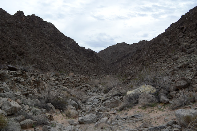
There are a couple steeper washes to the left that might be reasonable routes to the top, but I am following my plan. Sometimes I can use the flat of old wash bed left along one side or the other, but they tend to be short and then not at all. It is not choked with vegetation in any sense, so that makes it better than it might have been. It's really not that bad, but it's not fast.

There is a claim in the middle of the wash and then a lone ocotillo marks my turn up. It is the first I've seen in quite a while. I'm starting to get superstitious about ocotillo. They seem to mark a lot of good turns. It looks steep, but that is at least partly because I have overshot it a few feet not sure I'd really got there and am looking up the slight channel to the side of it. Once I've followed that into the side of the planned gully, everything seems to be working out beautifully.


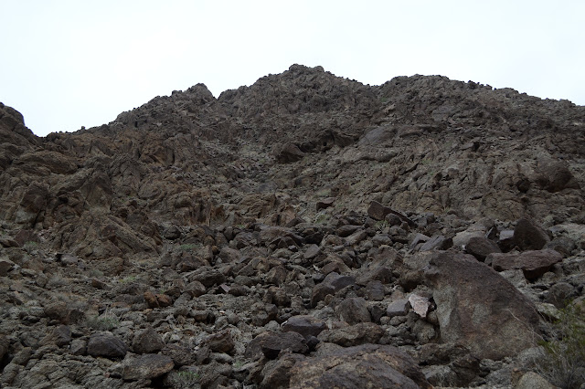
The main channel is rocky and slow to work upward, but beside it there is usually a nice spot to climb upward. Sometimes I have to change sides, but it is not a bad walk at all and I seem to magically gain views. Every time I look back, there's a lot more to see. Along the way, there is some blood red quartz. Maybe I should be making my own quartz claim? Everybody's doing it.

Finally I'm at the top and what do I find but a cairn beside a thin but usable trail. I bet that leads south to that "mystery trail" that "ends" a quarter mile off. For now, I want to check if it leads north to the peak. It cuts around the first bump along the ridge. It's often nice to leave out extra climbing.
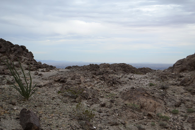
So I follow it around and up. There's a spot where there seems to be a difference of opinion of trail users. The right side seems to have a break, so I go left. Wiggling upward to a spot that has seen surveyors.


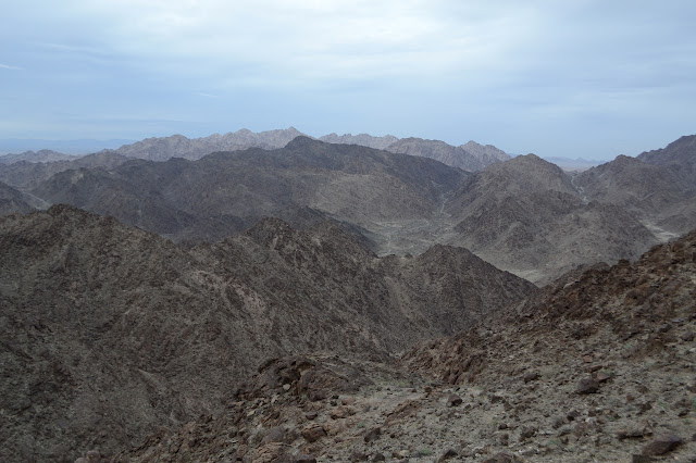

And then I turn around to find I have been celebrating too soon. It's a nice spot to get the views to the north, some of which are hidden by it from the actual peak, but it is not the top.
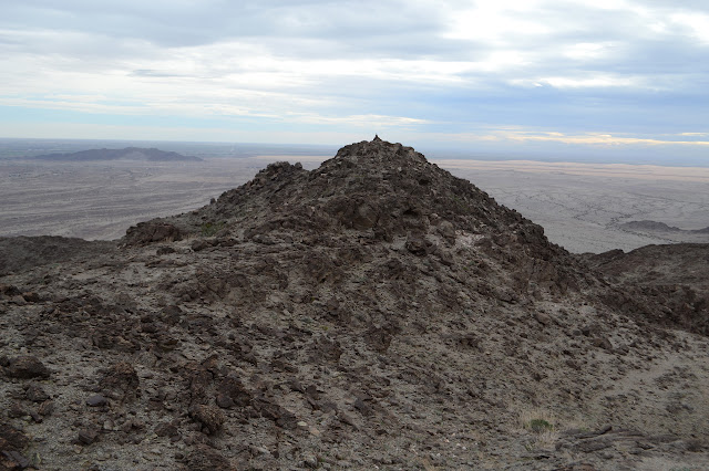
So I get moving on just a little bit further to the real top. Glancing around to make sure, but it is comfortably higher than everything around it. The easy to spot register is a good hint, too.


I leave on trail going further south expecting it to meet up in that spot where there was such a difference of opinion. It does, but there is a missing bit in the middle that I have to make up as I go along. I did that a lot coming up, so it is not the worst that could happen to me. There are a few spots where it gets hard to follow as it proceeds south as expected, right to within 20 feet of the geocache where it suddenly becomes a much more distinct thing.
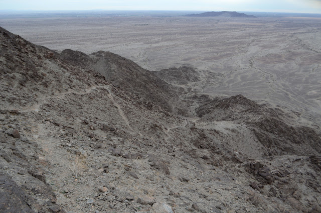
It resembles the prospector trails in size, but wiggles a lot more. There is a note in the geocache from someone who says they met the fellow who built it on their way up, so it would seem to be a more modern route. I just figure it'll make figuring out how I want to get down a lot easier and is unlikely I'll lose it along the way.

The trail stretches out across the flat to a road. Its light color is very distinct against the generally dark landscape. I figure it won't help me get back to the car faster, so cut out to the west giving the mountain's toes a little bit of space as I go. I find myself passing claim markers and pits and random tire marks. Back to the land of claims and prospects and full off-roading no matter what the sign says. (It says stay to the roads.)

I eventually bump into a bit of road after all. It might even be the same one the trail was heading toward. As I pass one hill, I scramble to the top for just one more geocache. It also allows me to take a moment to look for my car and plot an approach. The first dark car sized thing I see doesn't seem to be in the right place, but eventually I figure out where the car really is. There is a pair of faint tracks heading right for it, so I get down and follow those. I lose them as I cross another road, then have to scramble down and back up a deep wash before finally getting back. Still a couple minutes to sunset, so I guess "long and easy" wasn't too long after all. And I feel like I really did the mountain going up on the north and coming down on the south side.
©2019 Valerie Norton
Written 21 February 2019
Liked this? Interesting? Click the three bars at the top left for the menu to read more or subscribe!


Comments