Eureka Waterfront Trail and 2nd Street
Eureka City Park
(map link)
Sometimes, when it's been gently dribbling rain with scattered heavy torrents for five days straight, I get to thinking the sun is a lie. This is the real Eureka! It's not really true. Neither is the true Eureka because there's too much of both to leave out either. I decided not to stay in on the dribbly day and instead wander along the Eureka Waterfront Trail (including the bit in the middle I'd skipped before) and pop up to 2nd Street on the way out to see the old buildings. Other old buildings are available, but this one happens to have an "Adventure Lab" along it that points out a couple of the numerous historic plaques that tell a little about them. I started at the Eureka Slough unpowered boat launch, which is a small lot behind Target and put my umbrella up against the eternal dribble falling from above.

I turned away from the highway and started along the paved path around the shopping center. After the new industry comes old industry at the Blue Ox Millworks and original electricity generation building. Then it's on to an expanse of green and the bay. As if weary of it all, the drizzle quit and I put away the umbrella under the thick, dark clouds.

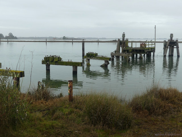

The green space becomes parking and then park after passing under the undulations of the highway as it bridges the bay. There's public toilets and a public boat launch and everything. Fish and Wildlife was out making sure everyone was fishing with a license, I suppose.

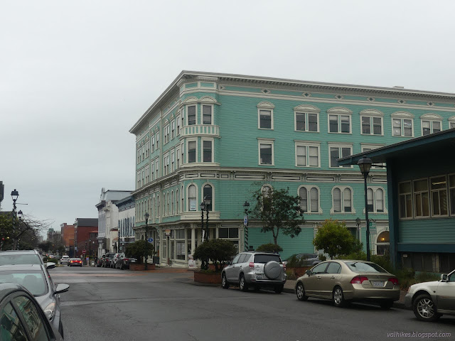
I wasn't altogether certain how I would get up to 2nd Street, but I spotted some public steps up the bluff and went for them. A path along the top of the bluff behind the library got me to one end of this disconnected street as is starts its journey through old town Eureka.

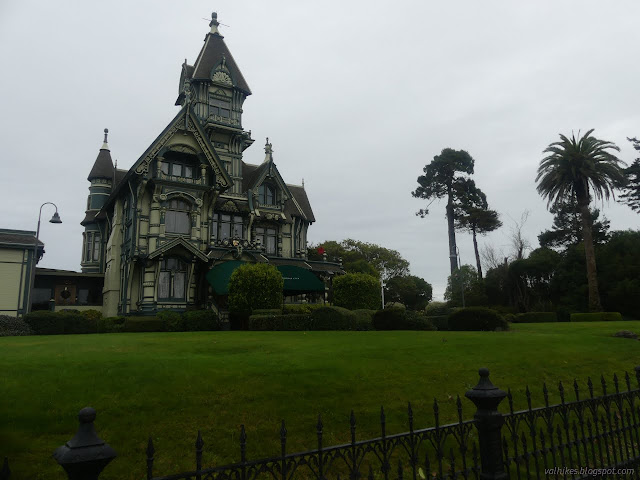
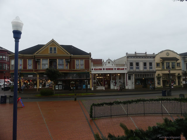
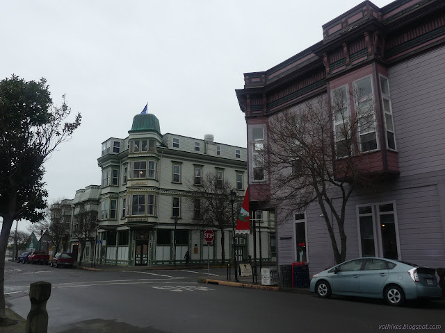
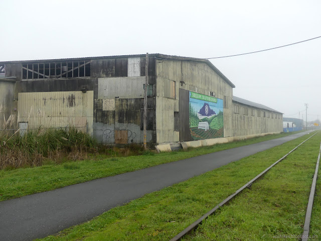
Having made it to 2nd Street, I started down it. The buildings get less fancy, but no less old. They tend to date back to the 1880s. Small plaques tucked in here and there offer a few more details about them than "Victorian". Some are brief just mentioning the style of architecture. Some are longer going into details about the history. For instance, across from the current post office is "the first building purpose built as a post office". It was built with the local postmaster's own money! (I'm sure he got it back in rent.)

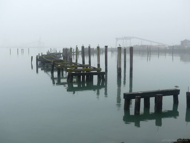
2nd Street turned more industrial and lost the sidewalk on one side, then just ran out. I jogged over to Waterfront Drive and the Waterfront Trail once more, promptly finding Eureka's four stranded locomotives. They're right where they should be, in the train yard. They were here when the tracks failed 30 years ago and tracks are how they move. They do look a bit chunky for putting on trucks. There's a sign to tell about the train yard as a historical thing, but nothing about the locomotives.

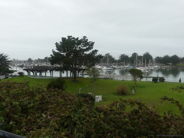
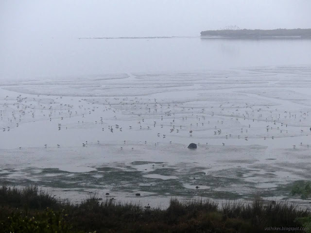
The marina is on the bay side. Further on is Eureka's very last lumber mill. A sign mentions that there were many more all along here. Now there's "Soilscape Solutions" to help people out with today's crop. There's not much to see on the way to the pier at the end of West Del Norte Street. I headed out on the pier, but not far.

Then I noticed it was an hour to sunset and hurried the other way. This time I kept to the Waterfront Trail as best I can. I'm not exactly sure how it is supposed to go near Coast Guard Plaza and the recreation center. I took the plaza and the sidewalk.


I put my umbrella back up for the last mile. The drizzle had started again. I noticed no change in the quality of the light as the sun presumably went down.
I got back to find a few flashing lights around as the firefighters were up to something. Training or emergency, I couldn't say. Some were chatting at the launch, so the excitement had likely passed. I threaded my way out.
*photo album*
©2022 Valerie Norton
Written 12 Jan 2022
Liked this? Interesting? Click the three bars at the top left for the menu to read more or subscribe!


Comments