Klamath River, Aikens Creek to Bluff Creek
Six Rivers National Forest
(map link)
There's a piece of riverside trail along the Klamath between Bluff Creek and Aikens Creek, or so it says on the map. I decided to start it on the south end, so headed into the much reduced Aikens Campground. It had running water, flush toilets, and even a dump station once. Now it doesn't even have pit toilets to serve the people who might choose to camp, updated fee: free for up to 14 days, in the wide open spaces between the hills. It does look like it gets some use, but was completely empty. Nothing points to the trail, but I found it very easily from the closed campground loop by walking around the gate and through the first site. The only indication that it was once a camp site was the stone base for an iron stove. Everything else is vanishing under the leaf litter.

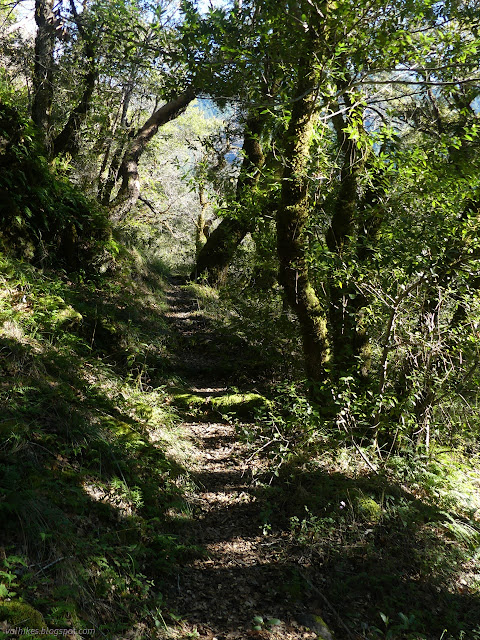
The trail, in contrast, was beautifully built and still getting some use just like the upper sites. There was no mistaking this thing for an animal trail. There was a large tree down that was difficult to squeeze under, but this was the only damage as I passed the derelict campground loop.
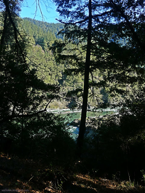
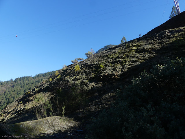
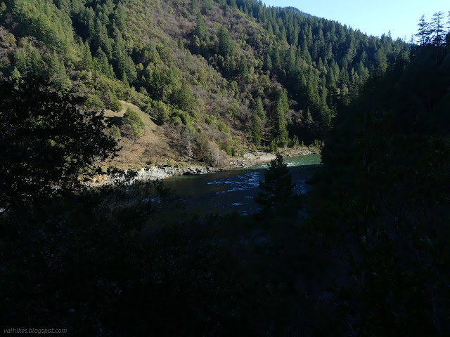
That is until a sudden sprouting of small trees all over the trail. Five feet later, it ended in a cliff. The river had at some point decided it really wanted a little bay of sorts right there. It grabbed the land and ripped it away. It was a nice, though somewhat obscured, viewpoint, but the trail wasn't going to carry me to Bluff Creek Campground at the far end.


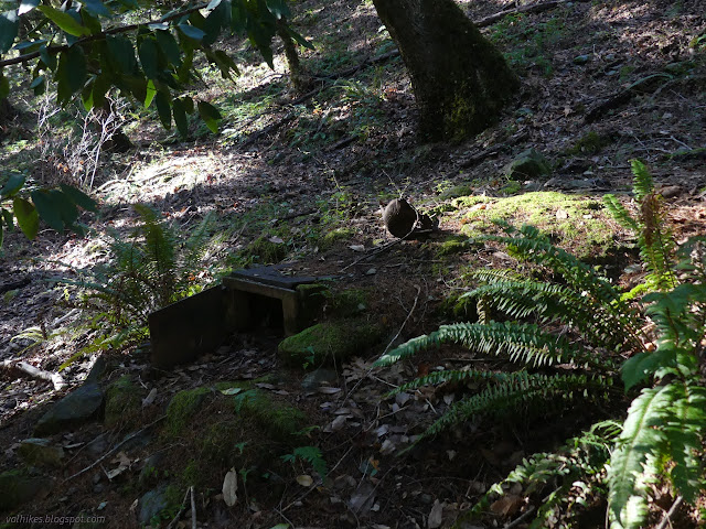
I poked around the decaying part of the campground a little. Many fixtures were removed. The stoves were removed except for one. A second had been built for the site because the trail goes right over the older one, so the now extra stove got forgotten. I usually only see ones like it in backcountry camps.
Then I followed the trail back to the road. There's no sign, but the trail is still quite easy to spot. There were also more of those yellow ribbon marking the trees that I'd seen along the Bluff Creek Historic Trail.

So, that's one way for a trail to fail next to a river. The people who come to camp must still be finding use for this little track.
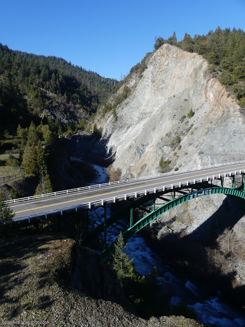
I drove around to Bluff Creek Campground. It's hard to determine which part is the campground now. There likely never was much to it and now there's even less. The entry road has been moved away from the bridge and sites take some creativity to see. There's no indication of a trail on this end either. I went for the low hanging fruit of possibilities and crossed the highway to a large flat with probably old road heading north. It was choked with greenbark ceanothus backed up by blackberries. Around closer to where the trail is marked, I found a hillside with possible trails wearing off the side of it and temporary road to a power post. I decided to head up to the top. There would at least be a view.

Down the steep north side, I saw someone had placed a polka-dotted pink ribbon. Down the south side, I saw some more yellow ribbons. I went toward neither, just down the road. Someone had recently cut some more greenbark away in a line off the old road away from the highway and following that, I found the trail.

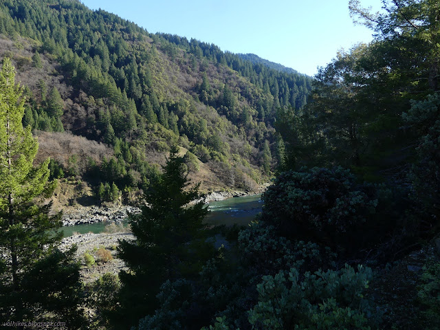
I followed the good trail up to the top and didn't find it quite so nice down the other side. Looking closely, it appears there was a switchback wrapping around some old hardware (water gathering in purpose?) but the people are scrambling down more directly now. Below, there was good tread again, traveling downstream as expected. A short switchback was again decaying and an extra trail looked to be going down to the water (a long way) rather directly, but overall the tread kept up heading south.


Then the used tread started on a steep climb next to a rock, the sort of thing use trails like to do, while it looked a bit like decaying brushy tread continued on the flat, a bit like abandoned trails like to do. Knowing it wouldn't get through to the end, I lost the will to keep on trying it and turned back.


I had a go at getting through the ceanothus from the visible trail side, but ran into too much blackberry, so I returned the way I'd come. Then I poked around the camp a little. The paved road the camp entrance was moved to actually looked in pretty good shape. The white lines down the sides marking it as not quite two lane were still there and a sign designated it as 13N01. It's littered with clay pigeons near the creek, but no one was contributing to the mess while I was there. The change is old enough that the old USGS quads don't have the road, but Google seems to have decided to show it. Google maps has more things wrong than right in this area.
I figured I would hike the trails around Fish Lake on Sunday and wanted the earliest start, so camping at Fish Lake sounded good. I started up FS-13 (AKA 13N01 now). It is signed for Fish Lake, so the turn is easy to make. I saw the gated and dark with vegetation road that is the old route to Fish Lake (which Google will likely direct you down, not knowing about the current road that is older than Google) and then started hitting a lot of blow down. It looked like a microburst had hit and there was some heroic clearing of fresh trees. No sweeping up after like Caltrans, but speeds are much lower on 1.5 lane paved roads. I was about 4.3 miles up and came around a corner to a tree that was not yet cleared. That is still 1.5 miles, give or take, to the closest place that trail meet road. There's a little over 5 miles of trail around Fish Lake and then up to Red Lake and Blue Lake. I wasn't sure I really wanted to do it if I had to add 3 more paved miles to get there and back and might be facing a lot of freshly downed trees. Then I realized even the road had a potential for a lot of annoying and difficult trees. I left it for another time.
I noticed a dirt road just before the corner on the way down. It had tire tracks and a broken sign post and shows on none of my maps. I guess that's what people needed to get to.
Somehow, in spite of the trip being a string of failure and finishing a day early, I was actually feeling accomplished. Plus, I wasn't going to miss the Dune Ecosystem Restoration Team day. I seem to have grown emotionally attached to this bit of community gardening, eradicating invasive marram grass and lots of ice plant that particular day.
*photo album*
©2022 Valerie Norton
Written 24 Jan 2022
Liked this? Interesting? Click the three bars at the top left for the menu to read more or subscribe!


Comments
I wonder at what the age of the two remaining ends of the trail (on either side of the washed out middle) might be? This seems to have been a more popular recreation area many years ago.
The Bluff Creek Rd. has a checkered history. Originally it ran for many miles up the west side of Bluff Creek, not too far from the creek bottom. The plan was for it to be the start of the proposed Gasquet-Orleans Rd. A big part of it got absolutely destroyed in 1964. That led the Forest Service people to revise their thinking, and to start putting major roads on ridge lines instead of in the bottoms of drainages. Some decades later, the set of switchbacks rising from near the mouth of Bluff Cr. also failed. So the Forest Service decommissioned that segment, and built the current Bluff Creek Rd. on the alignment of some old logging roads.
The trail was probably built with the campgrounds. I'm sure it got lots of use back when the iron ranger at Aikens Creek would get stuffed with envelopes with camp fees and dump fees within. The northern section might even have got within a few hundred feet of the southern section if I'd just tried the path of least resistance going up. The mapped trail is high enough and there are no other chunks taken out of the river bank in the areal photography. Actually, as I zoom in, it looks like I might have just needed to turn around and find a switchback that climbed up and over the slide, although the slide has likely grown since the building. Now I need to go look again. I clearly need to build up more endurance for the searching of the trail.
I downloaded the latest 15' USGS quad (Hoopa 1952) to see the changed creek route you mentioned elsewise. Although it's obvious, it's so far below the level of that little valley now that it's nice to verify. I also wanted to see how the campgrounds fit into it all. Instead, there were loads of buildings beside Bluff Creek from all around the Bluff Creek Guard Station (which was near the E-Ne-Nuck Campground, now moved south and being used for something else if at all) and on up to where the bridge over Bluff Creek is now, not campgrounds.
None of this excuses Google's creative mapping of the area since public maps showed today's roads before Google decided to do maps of their own.