High Rock River Trail
Humboldt Redwoods State Park
Click for map in new tab.
While the High Rock River Trail is an official trail shown on the map provided with the Humboldt Redwoods State Park brochure, it certainly doesn't seem that way when starting out on it. I turned down a narrow and unsigned road which happens to be the High Rock River Bar Access and parked in the wide spot just before the open gate. I was a little past an opening into the forest beside a cut log where there is an unsigned trail. I started down it with a sureness set very precariously. The slightest hint could have sent it tumbling into an abyss of dread.


Fortunately, the signs were good. In fact, I started passing huge grove dedication signs. This was some sort of official trail traveling in the right space, so likely the one I was aiming at.


The trail splits without indication of where each side goes. I chose right and got on with some climbing. It split a couple more times for access to the road near the work camp, one with a turnout. FOr those, it was obvious where the extra trail went. It almost split, but someone doing maintenance had simply started down a game trail instead of taking the switchback. Up I climbed until I found my self quite high up overlooking a precipitous drop to the river below.
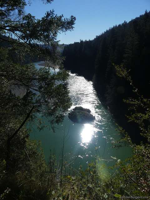
The map indicates the majority of the trail is south of High Rock. I only saw steep use trails continuing on. Perhaps one of them is not quite so unofficial as it looked to me. I turned back to see what the other fork would have gotten me.

The downward path at the split brought me to the southern end of the gravel bar. The river and rock blocked all further travel in that direction.

So I turned to return along the gravel bar. There were 3 or 4 vehicles of fishermen that had taken advantage of the access to park where they wished and wade out into the waters. There was even a small boat out on the water. The bar extends quite a ways north of the access road, but I didn't go that far.


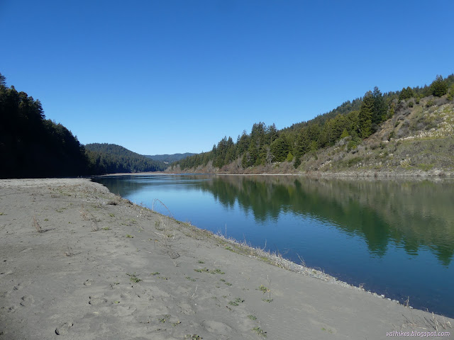
*photo album*
©2022 Valerie Norton
Written 12 Feb 2022
Liked this? Interesting? Click the three bars at the top left for the menu to read more or subscribe!


Comments