Somes Creek
Klamath National Forest
DAY 1 |(map link)
I finally sorted out that what I should be doing with all these nice, sunny, winter days is trying out some of the speculative backpacking trips on my winter suggestions! Then this one rainy night popped up to interrupt the sunny days, but I got everything together to go. The rain oozed into the next morning and I sort of delayed because I didn't want to be in it. I drove out pelted with rain and looking at an impressive amount of recently completed work by Caltrans making CA-299 clear and safe for the usual speeds. There were even big groups of workers at a couple turn outs getting either some congratulations or prep for the next step. I got to the start of trail only delayed by the current road workings on CA-96. Since it was already lunchtime, I went for the one that seemed the most reliable at the end of a little road on the south side of the Salmon River. The start, on Somes Mountain Trail, is marked only by a chain across the road at the stream gauge, but there is a sign just past a cabin at the end of the road.

I didn't park quite at the end and was passed by some locals out to walk their dog. They recommended I take the creek when I got to a Y in the trail for creek or mountain because I would probably just encounter a lot of blow down going for mountain. That seemed like at least a mild vote of confidence for the plan, which was indeed to follow the Somes Creek Trail once I came to it. This does have a potential to be extra cold as it is a north facing canyon. The spot weather from the National Weather Service was predicting lows around 40°F, not that I was believing it. Still, the actual temperatures at Somes Bar had been a little above freezing.

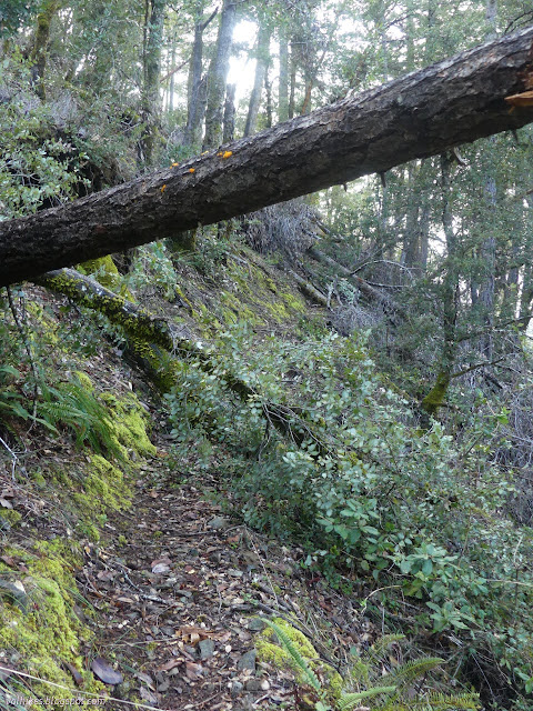
I was already stepping over logs before I got to the split for river or mountain. One of them was notched to help with stepping over. None of them were on the mildly scary narrow, high bits of trail, so that was nice.
It was immediately clear that there would be no point in trying to count the downed trees. Maybe that was the Y they meant? But they very clearly said "creek" and not "river" and everyone knows that the Salmon is a "river". Anyway, it only goes for another 0.4 miles. I wouldn't expect to find a place to camp along it.
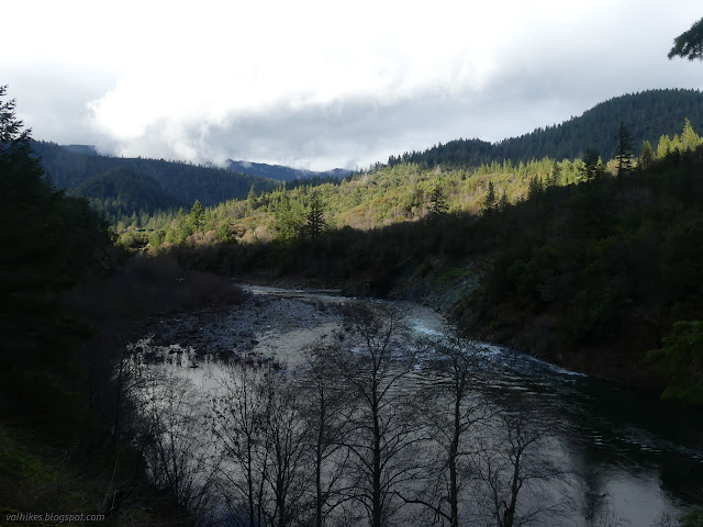
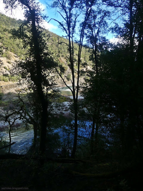
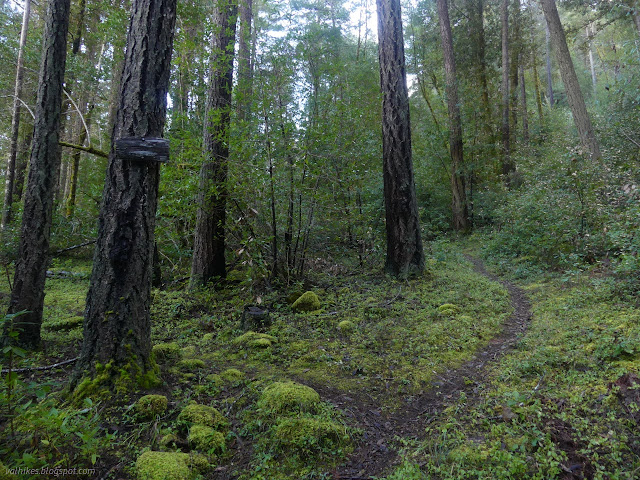
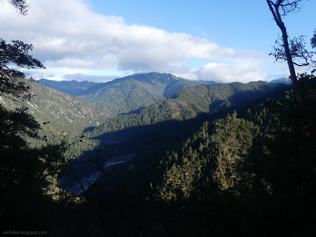
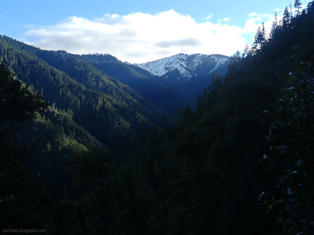
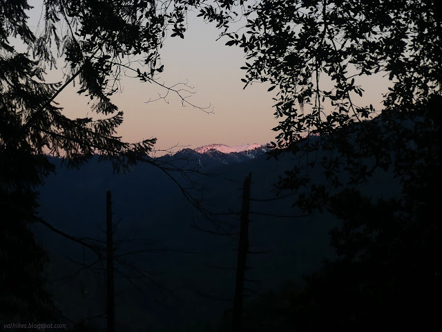
I wound my way up on good tread with one section marked by orange ribbons. The flags didn't seem needed, but were still welcome with downed trees across the trail and a couple apparent old roads creating tiers across the ground. Some more switchbacks and trees to clamber over brought me to a crest and the only sunlight on the trail. If I stood facing east, I could hear one roar of the Salmon River in my left ear and a second distinctive clatter of Somes Creek in my right ear.


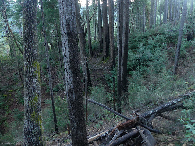
From the crest, the trail wasn't exactly clear. Some more orange ribbons would have been welcome, but they weren't forthcoming. Bears sometimes go over the top and down again. A path through the moss on the crest was easily visible and the most logical continuation, so I followed it. I came to a small bowl south of the crest and the trail seemed to head south again. I followed that, but it started turing into something more like a bear trail. I backtracked and found something maybe heading on the south side of the bowl. I decided to just keep on following the crest up. It got steep, but it ran into some nice, clear tread coming up from the other side of the bowl. Looking back, I saw a huge pine down across the tread. Walking up and around it wouldn't be too hard except that it was backed by a downed branchy thing that effectively cut off travel on the hillside. Continuing the switchbacks up, I had many more trees to squirm over, under, and around. I thought I'd have to take my pack off for one, but somehow managed to fit between the branches as I went under one part and over another.
The switchbacks ended and the trail stretched south on a gentle climb in front of me, obviously drier and at least initially tree free. It was relaxing just to look at how tree free it was. The effect was ruined a little as I took in how narrow it was on a steep, dry slope. Then I determined to do no more falling or slipping on it than I had on the other bits of trail and headed along it and its few views.

Of course, it didn't last. There were some easy logs at first, but the situation quickly went downhill as I climbed slowly up. It seemed that every time the land formed a little bit of a dip and things got more moist, there would suddenly be blow down. Some of it was quite massive and fresh.


I managed to clamber up and around one freshly downed clump of trees and found the tread on the far side only to find another and maybe found tread on the far side. I was getting into a mildly burned area and started getting ceanothus across the trail. A gentle greenbark rather than one of the nasty whitethorns like buckbrush, but still annoying. I came around to a gully where I couldn't find the trail at all. I found space to drop down and across and up and might have found tread across the shoulder before a second gully. From there, it was all thrashing. I had no idea where the trail might be or even if I was likely above or below it.

I was starting to have to push past blackberries to get anywhere, ripping at my brand new thin mat. I wasn't really streamlined enough to keep pushing through all that brush and wasn't seeing much path anyway. It was only half an hour to sunset, so I needed to make some decisions. The map says seasonal streams up ahead. I thought I could maybe make a spot work on the bench between the gullies. I could try drop the pack and try to find water ahead. My ears told me of no water except that pouring along the bottom of the canyon. If I was going to go back, I wanted to be over the bad trees nearby by sunset and probably should be to the crest by dark. I didn't have time to push forward and fail to find water. I jittered a little, but finally turned around. I had to give up on the visions of wandering along the creek trail to a camp, then wandering up to see how far to the peak I might be able to get.
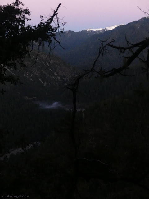
I did get back over the tough trees by sunset. It darkened quickly as I made my way down the switchbacks toward the crest. I was crawling under trees through unseen mud and becoming extraordinarily grimy. The temperature continued to feel mild, even with my shoes soggy from water off all the leaves. I didn't make it to the crest by dark.
I hadn't had any lunch when I started, not when I got to the view, not when I decided to turn around. I finally sat down and had the first bit of lunch of the day when I returned to the crest. Had I been prepared to dry camp, I would have made camp up where I had wandered a bit trying to find the trail. Instead, I turned to follow the now easier trail down the rest of the way. I did miss it where I could no longer see the orange ribbons. I checked the GPS, noticed, I was getting off to the east of upward my travel, made my own switchback, recognized a gully I had eyed on the way up, and easily made my way back to the trail just before the flags started. At the junction, I thought about taking the Salmon River Trail. Then I thought about the narrow bits I had already seen and decided not in the dark. Then I was back at the car without incident.
There's actually a long and detailed description of various bits of recent tree clearance in the trail conditions document found here. Chris doesn't think I'd get all the way down to Somes Creek by the old Red Wing Mine, but there's a spot less than an mile in that could be good for camping in season. I shouldn't have lost the trail altogether around mile 4, not even to the junction, as I did. Minus all the tree clambering, this is really a nice little climb with some excellent view spots.
*photo album*
©2022 Valerie Norton
Written 19 Jan 2022
Liked this? Interesting? Click the three bars at the top left for the menu to read more or subscribe!


Comments