Gold Hill
Carson National Forest
Click for map.
Alright, I am in place to head up to the top of New Mexico! Says it right there on the free tourist map from the Welcome Center. Not that that's what I'm doing today, but it will be. Oh, it will be. I feel like in between catching up with writing and suddenly driving to Needles to get the car a smog check (what lovely lack of planning that was) and failing to get my window fixed that I need something to get the legs moving before doing something I really want to work out. So I'm going for something longer: Gold Hill. It may not sound like much, but it is the high point of its wilderness and should get me out of the trees again. "Hill" might be a bit of a misnomer. The plan is up Bull-of-the-Woods Wheeler Peak and Gold Hill Trails, which are longer but should be more interesting, then down Long Canyon, which is shorter.

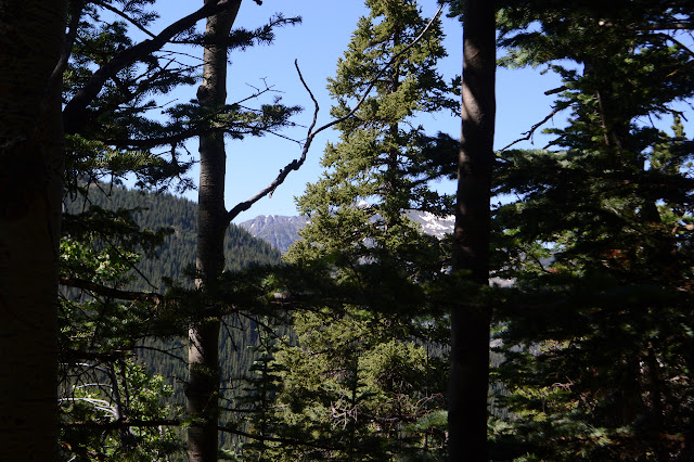
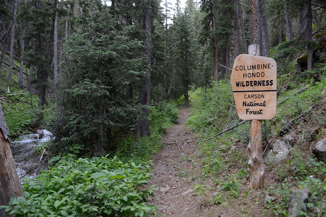
Either way, it starts the same, climbing up along a creek. An older sign marks this as the Columbine-Twining National Recreation Trail and USGS marks it as Twining Blue Lake Trail. Perhaps a history of changing interests of area hikers? It is a thick, green corridor and if the idea of climbing 3300 feet in about 4.5 miles doesn't elicit the thought that the trail up ahead might be steep, the alternate horse trail that splits off quickly helps suggest the idea. I could pretend I am a horse and take the gentler trail, but I won't. All along the creek are some of the lushest, most bold, vibrant, strong columbines I have ever seen. Something about these just seems perfect. But I'm climbing, not looking at flowers, so up I go with one creek crossing on a very suspect log group.

After the crossing, the trail quickly distances itself from a much smaller creek and then Long Canyon breaks off to the left amidst both old and new signs. There is even one for Twining, which seems to be what the parts of the area that are not ski resort used to be called. Now it seems to be all Taos Ski Valley. Perhaps it avoids confusion, perhaps it makes the billionaire who purchased the resort and is currently building it up happy. Changes are afoot. As I stay on the (now) Wheeler Peak Trail, it quickly connects to an old road that might not be so old. There are signs a bulldozer has been up it recently making sure it is open. Trails break off to the side of the road sometimes, but they seem to be unofficial.


It meets up with a better used road at Bull-of-the-Woods Pasture where I have my own silly little distraction to find the monument at the corner of a large inholding. People or cows have been walking that way for their own reasons, so it is easy to get there along a row of cut trees. I am hoping it might be something old and funky, but if it was replaced in 2008 by an ordinary cap on a pipe.

So back to the junction I go and on down the older road, which only seems to get me closer to the yurt beside the pasture. I may have missed something. Turning around, the trail climbing away from the road is obvious. The sign says 3 to Gold Hill and 3 to Goose Lake. There's a junction along the way to turn to one or the other, so that's possible. Two trees down right at the start are gaining a walk around trail that skips the junction, but that's no excuse to miss it. So I climb, up to the wilderness and up to the ridge above that the trail follows.

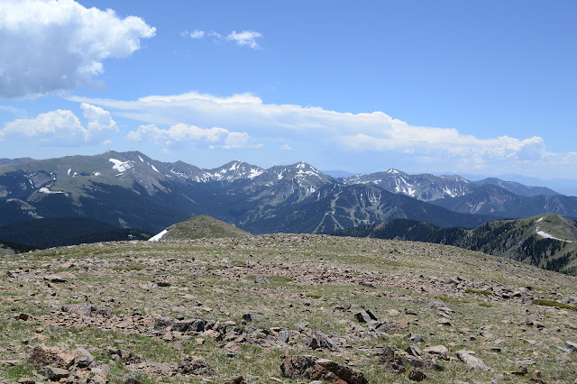
The walk up includes a gate with fence only on one side. Presumably the cattle are not here yet. The top of the ridge comes with patches of snow under the sheltering trees. I am still feeling energetic enough to just stomp right through them even if it is only a step or two to go around. I had expected views from the ridge, which wasn't really an informed expectation and didn't even account for the elevation of the ridge in its creation, so all the trees is slightly disappointing. Still, they start to thin out and then leave patches of meadow where there is view.


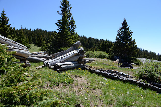
It seems that all Gold Hills have some sort of rich mining history, and this one has a little right along the side of the trail. There is a mostly collapsed cabin made of logs far larger than any trees currently in the area and behind it a huge pile of tailings from a couple of holes. Mystery metal is scattered about.
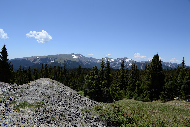
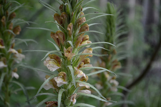
At the cabin, the trail takes a turn to meet with Long Canyon, then turns to meet Lobo Peak Trail, then finally climbs. The sparse trees are left behind for meadows filled with generally small flowers and one or two old cow patties. It includes that purple paintbrush I seem to find in the Rockies.
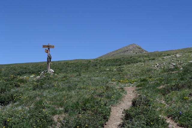


The trail does not stop for the top but goes right over on its way to Red River to the north, so I step off for the last few feet to the rocky top. Somewhere here, there should be a benchmark. Oh, also a geocache that should be about... 8 feet away. I'm practically standing on top of it. I get to sign it in the "first to find" slot, which is a coveted spot among many geocachers. Once or twice I've had a preprinted log claim I was first to find when someone had recently replaced it, but this one is hand written. Personally, I'd rather look when I can't still see the footprints from the hide, but this one has been here over a year so it's good. This makes it all the more surprising that the next person up, who is no help in finding the benchmark, was actually trying for that "first to find". It's like buses! You wait a whole year for something and suddenly two come at once. Strolling circles around the top, I can find a reference. This particular peak only has one, so there can be no triangulation, but it should be 44 feet from the station. The fellow's friend is useful for keeping me in the direction of the arrow as I pace out 44 feet into the large collection of rocks at the top. (A natural scattering, not a cairn.) It puts me right next to a hole someone has dug into them, perhaps trying to find that station. Besides being a couple feet to the side, it also seems to have some rather large rocks in the bottom. I'm pretty sure I'm not going to be seeing the station today. So it goes. I'll just have to enjoy the nice view under the building clouds. One group is already raining.


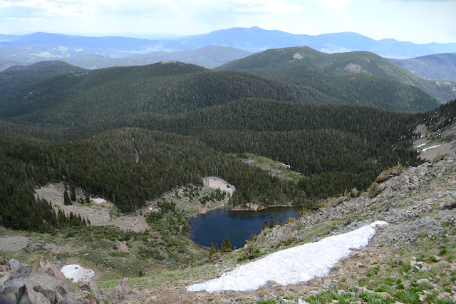
Eventually I head down again, this time noting that a well worn lookout is a spot where one can look down and see Goose Lake. I hadn't seen it on the way up. That is where the other two started after a jeep ride. As distant rumbles start up, I suspect I might have enjoyed the view too long to also take the ridge walk out to the next point.


With all the weather building quickly, I decide to just head down Long Canyon after all. It is a nothing of a peak... oh, but the lovely long nude ridge, views the whole way. I did so want to wander along it. More distant thunder and I go down among the trees. There are little patches of snow along this trail too.


The canyon is dry at first except for the snow. Lower down, water becomes abundant. Many little sources seep out to create and then join a rushing central creek.

The threats of rain do not materialize, the distant thunder never gets closer. I flinched. I would have been find wandering the open ridge after all. Too late now, I'm going down.


It's not too long from leaving the wilderness that the trail joins up with the Wheeler Peak Trail again for that last bit of steep downhill.
Down a the bottom is a carved wooden sign titled Wheeler Peak Wilderness Access showing a schematic map of the area. I haven't quite looked at it much, but it has some interesting adjustments that are starting to show. The old access trail on the other side of the creek is beginning to show as is a long explanation of how to get there. There is even mention of a brochure you can pick up to help navigate. Now you can just drive up the road two miles and there is parking with signs pointing the way. Not all change is bad.
©2019 Valerie Norton
Written 29 Jul 2019
Liked this? Interesting? Click the three bars at the top left for the menu to read more or subscribe!


Comments