Tony Marquez Trail and Jawbone Mountain
Carson National Forest
Click for map.
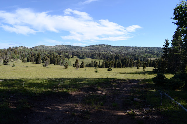
Finally getting out of Taos and expecting to land in Colorado by the end of the day, I got stalled among a bit of countryside with a new character. Okay, the plains cut deeply by the Rio Grande was also a different character, but it was uncomfortably hot too. I had looked a little at the Tony Marquez Trail in planning, but couldn't figure out where I might stay. The campgrounds are expensive in this area, but there are dispersed spots. I can check it out after all. Parking at the Continental Divide Trail crossing, which is also Tony Marquez through here, is lacking, but there is an lot big enough for a hundred cars further west where the trail hits the highway again. Of course, it is unsigned. That would be too easy. But the trail is there. Across from the parking, there is a gate in the range fence, and behind that is a sign for the trail well hidden from the road by trees. I guess we wouldn't want to advertise. Not with parking so tight.

The character of the land isn't really visible yet. Here, there is just a road lined with trees and the land itself is just a short bit of grass. Following the old road around the trees and it seems that there is someone with a key who doesn't quite respect the area enough to only use it when the area is sufficiently dry for travel, but getting past that the land slopes downward to a dry creek and upward to low hills that show a little bit of the area character. With all the rain recently, including yesterday, it is hard to see how the creek can be dry.
A fallen post beside the old road shows a CDT crest, presumably as a destination a few miles along the way. It'll be as far as I go in this direction, but since Tony Marquez seems to be more of a web of trails than a single route. As near as I can tell, all trails are Tony Trails, at least for a few miles around.


Passing along the earth dam of an unnamed tank, then upward into more trees, it starts to become clear that having a good map will be a lot of help in finding the faint road bed from time to time. The cow paths help sometimes but lead astray at others. Fortunately the GEOPDF maps the Forest Service provides for the area do seem to put the trails down right where they're supposed to be. Barriers have been tossed up at intervals along the way making it clear no one at all is supposed to be driving this old road. The uncaring one with a key doesn't care.


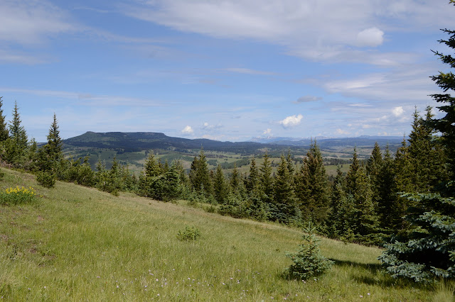
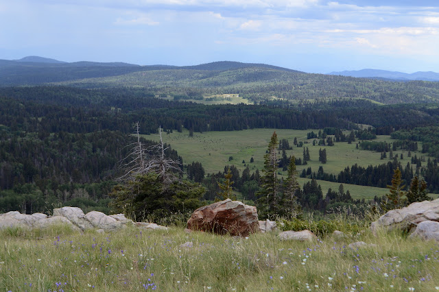
The trail climbs up a bit too steeply to a junction with itself, but there is a less steep way now and someone seems to have tried to stop the sharp erosion happening where the old road used to climb. The plastic barriers have picked up some dog-like footprints of mud. I wonder who left those. I keep going straight and expect to return along the other side after stopping at the top of Jawbone Mountain provided I can figure out which bump exactly that is. For now, it is just the hill the trail happens to climb, but it does top out to an outstanding view of distant peaks to the north still with bits of snow and the canyon to the west with its large red cliff. An excellent spot for the first of the lunch snacking.


I have to add grasshoppers to the list of animals attempting to eat my shoes while I am wearing them. The little critter just jumped over and grabbed an edge with its mandibles.

There is even a post to help direct trail users down the north side of the hill before the old road with its direct downhill route becomes a rutted mess that is hard to miss unless mistaking it for a creek. The lands just to the east are ranches and as the trail flirts with the edge of the forest, I have a chance to look for some boundary markers. One marked MP13½ is a flat off trail excursion of only a few feet, so naturally I take it.


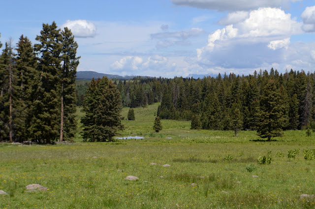
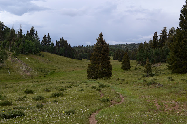
The rest of the way to meeting the CDT is across fairly flat grassy meadow interrupted by lines of trees here and there. Some places the old road is just too faint and I simply must make my own way, not that that is particularly hard. Avoiding soggy bits of meadow can be hard. In spite of that first dry creek, some of the land out here shows it was raining plenty yesterday.
I am expecting to have much easier trail when I get to the CDT and turn back toward the road. No such luck. It takes a while to figure out how exactly it heads "south" from the signed junction where everything is still trail 41, Tony Marquez, but some of it has CDT crests on it. Once I do find it, there is some greater ease as more effort has been taken to keep the route marked even when the trail is not visible. Posts and big cairns are especially prevalent in areas that are not holding the old road visible. And what exactly is the message that is meant to be sent by slapping a sticker with a flag and "don't tread on me" underneath it on posts meant to mark something that is explicitly meant to be tread on?


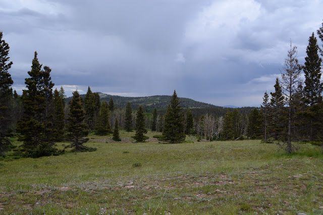
As the clouds gather, I start to feel like the weather is preparing for something to hit just as I get to the top of Jawbone Mountain. Of course it is an uncaring force of nature, but antropomorphizing is always so tempting. The timing certainly looks well done, but perhaps that is my fault since it does roughly follow some patterns.

Once the old road is more consistently among trees, it is very distinct. In fact, it looks like it would be quite easy to pick out even with a few feet of snow on the ground. I pass another junction with a piece of Tony heading off to the left, then one to the right that I have already seen the far end of. This bit of Tony looks to be the start of a good route to what the high points labeled Jawbone Mountain visually flow to by shallow saddles. Oddly, this bit is not named "Jawbone Mountain", so is it the peak? This segment was going to be my route back to complete a circle, but now I am thinking of following roads south of the highway back instead. Since I want that high point, I'll still take a little of this branch.


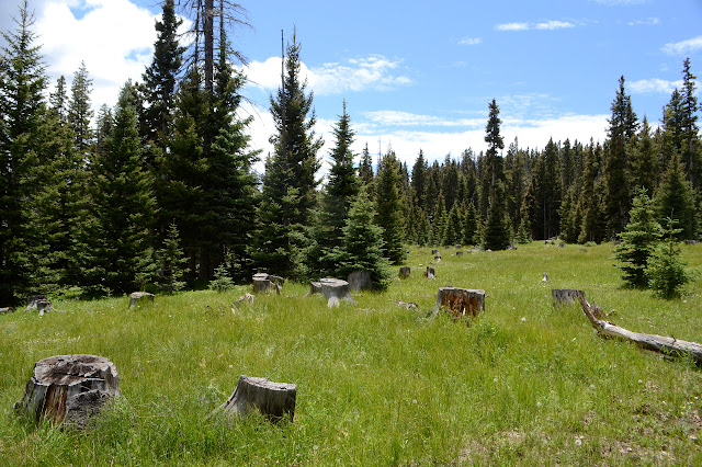
The origin of this web of road becomes clear as I follow this bit. Lots of old stumps are visible among the young trees. There are more roads than just what has been preserved by trail, and I turn down one of them to get closer to the peak. It ends near a trunk dabbed with blue paint as the land gets a little steeper, but there I find myself with elk trails to follow instead, upward to a ridge line.


I must be getting too quickly to the peak for whatever weather is planned for me to experience there because nature throws up a distraction at one saddle along the way in the form of mariposa lilies. These are white with just a touch of pink on the inside and the thinnest of blue on the outside. So delightfully delicate, they make a good distraction.


Obtaining the top, there is no special weather breaking out. It still seems to rest under the edge of the clouds that, while raining at a distance, are doing nothing around here. It is grassy with a few rocks and little trees. Beside the rock sticking up the most is a register. The notes seem to indicate they didn't come around the long way like I did although some are up for a second go. One says "first (and only) time" which just seems to lack a certain amount of appreciation. I bet this is a cute little winter climb, too.


After a bit, I head down the ridge line a little further to tag one of the bumps that is actually labeled as Jawbone Mountain. If I was paying a little more attention, it might have been the other bump, which is higher. Well, maybe it would have been both. Anyway, I am off to the westerly one and there are faint elk trails to follow down, but at the saddle between, I catch a very nice elk trail. Actually, it might be the best established trail I have been on all day. It is following around the side of the mountain in the way I expected to, so it is great. Huh. The elk seem to have gained saw technology at some point.


The trail vanishes as it reaches a saddle. It is just a short way further to the top with rocky grass on one side and trees on the other. The actual top is not too obvious and after searching through the possible locations there seems to be no register in spite of the rather good trail.


Down again is easy to the saddle and a little bit further, but then the trail encounters large fallen trees. The more recent ones have trail visible beneath, the older ones have walk arounds. Some of the newer ones are challenging to cross or circumnavigate. Eventually it seems to stop mattering because everyone using the trail starts to have different ideas on how best to get to the official trail below, so there is a little thrashing through the undergrowth before everything suddenly turns to wide, clear old road again.


Another bit of Tony breaks off to the left with a sign showing what motor vehicles are and are not allowed, but far too faded to read. It comes with a fence, so I am likely about to pass into active open range. I'm a little surprised I haven't encountered cows yet today anyway. I still don't, just a fellow walking the other way with no supplies. There's a gate with a truck parked beside it not much further, so he probably hasn't gone far. There is the same Tony Marquez information sign and place for postings that was at the other trailhead plus a sign noting the road is closed to everything motorized except snowmobiles on snow, so it's a moot point about what the other road may have once allowed. There's a few campers along the road including a Rocky Mountain Conservation Corp group. They need to learn to set their tents with nice, taught rain flies. The trail breaks off from the road and I decide to be on trail, which is where the kids are doing their work. They've got the trail doing new little wiggles back and forth across the low spot in a meadow instead of following the low spot down. It... has some shortcomings as a solution. Past their work, trail can be hard to find, but there are markers. For a change of pace, it even finds a little bit of an old mine road to follow before dumping out at the highway.

Once at the highway, I guess I could start to go cross country, but I would rather get across the wide creek feeding Hopewell Reservoir first, so there is a little bit of highway walking first. The highway has curious benchmarks that are concrete pillars with embedded metal numbers. A surveyor seems to have made use of 1055 recently. Once across the creek and highway and making my way toward the dirt roads up the hill, there is the challenge of crossing a good barbed wire fence. It takes a bit of care to slip through without shredding a bit of clothing. After that, there is only a little moisture to deal with to find the road and more dispersed camping.

The road gets rougher once I pass the entry the campers are using. It rises and falls and crosses a wide bit of grass and I realize that while the highway would have carried me high and dry, this road is going to ford whatever is there. Before the ford, the forest has closed the road to motor vehicles, not that a simple sign has stopped them all. I feel like the mess of a crossing should have, but apparently not that either. The long grass makes finding a different way that will keep my feet dry a challenge, but I very nearly manage it. Then I have a long, easy climb upward and the threat of creeks vanishes.

As I climb and gain views, it is surprising to see what might be a bearing tree marker, but on closer inspection is an open range marker. Four names are written in the corner with a date in 1965. The printed part of the marker is almost completely removed by time, so it is hard to decipher the information on it.

I tag a minor high point that is, well, right there for the tagging. Just past Thomas Tank, which turns out to be a little low as it sits right up top, I figure I want to start making my way down to the parking area. To my surprise, someone has provided me a road down so I don't have to go cross country. The gate at the bottom is much easier to slip past than some more good barbed wire fence. I am left with a quarter mile more highway walking to finish, but it probably saves me splashing through one more creek.


©2019 Valerie Norton
Written 17 Aug 2019
Liked this? Interesting? Click the three bars at the top left for the menu to read more or subscribe!


Comments