Lake Peak, Nambe Lake, and Aspen Peak
Santa Fe National Forest
Click for map.
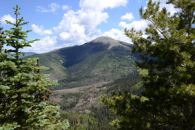
I thought I would take Timmy up Aspen Peak, which isn't much more than a mile, then I chickened out on taking him up a trail with so many dogs running on it and the trip just ballooned outward. Another visit to Lake Peak, this time via the trail along the fence and catching some bumps marked on Peakbagger, then drop down the ridge and such to Nambe Lake to take the trail back out from there, stopping by Aspen on the way. Aspen is still in the mix. One fellow said that I should come directly down Aspen to catch the lovely meadows, so that too. It's a plan, and so what if I'm sort of repeating there for a moment.

Across a bridge, Winsor trail heads left down the mountain and right into the wilderness. Both are hard to miss. My way is right and I start climbing. It is not quite so steep as I recall from coming down rather tired, but is still a solid climb. With a couple of benches for rest along the way. Not for me, that would ruin my momentum. The saddle at the top is marked by fencing and lots of signs including one on the history of the trail, but no junction signs. The trail up along the side of the fence may be too huge to miss, even in the dark, but it is unofficial.

I turn up again. The trail follows along just outside the fence and never diminishes while it does so. Various animals have probably helped it exist and grow as they wander next to the fence, but the people really need no help in keeping it established. There are backpackers and families and regular climbers and a host of others making their way as I make mine up the hill. There is even a bike tire print in the dirt, which is a bit sketchy since this route does dip into the wilderness although the top and bottom and a lot in between is not. A gate along the way leads into a meadow, but mostly it is a tree covered climb to the end of the fence.

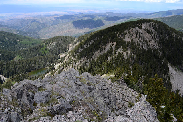
The fence ends high up on a ridge and a bit of trail follows it to the bitter end. It's no wonder as there is quite a view out there at the top of a cliff. From here, they expect the terrain to keep the cattle contained. With the ending of the fence, there is nothing to keep the trail contained. It stays pretty solid for a while, but in some spots there are so many options that the cattle paths start to compete. Where there are big rock slides, the trail gets contained again. These come with their own views.
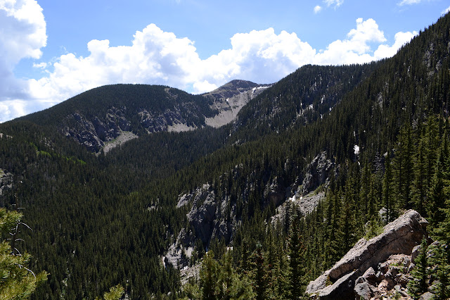

Peakbagger has an unnamed bump marked along the way at 12027 feet. Someone along the way asked me when tree line was and I said before 12k. This tree covered peak calls me a liar. I mark it done and continue on. Tree line comes soon after and with it expansive views.


The trail parallels the Skyline Trail somewhat, vanishing before it actually gets there. No wonder I didn't see it up here before. Next up for bumps is Deception Peak. Some seem to think I'm standing on it. A couple who were up here while I was on my way to Santa Fe Baldy said they'd been on it last week and indicated something northerly, maybe the bump I just tagged. Peakbagger says it's the next bump along the ridge that I missed by about 5 feet on that previous trip.

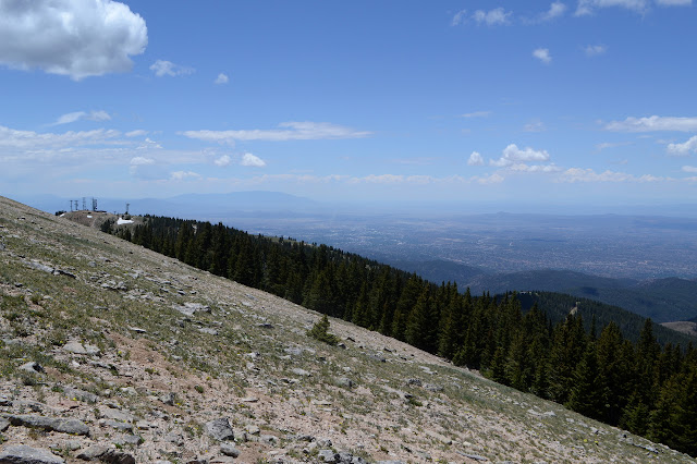
The trail is easy to Deception Peak, or at least what Peakbagger calls that. I didn't like my route away from it before, so I start climbing down. As I hit things even worse, I backtrack a bit and try again eventually making my way down to trail in a route I like even less. It would have been much easier to backtrack off Deception. At least the trail is good until I break off for Lake Peak again.


I sort of remember I should wait a couple major paths up before climbing Lake Peak, but I don't do it. I follow the crest, which is steep and loses a few feet in a couple spots before climbing again. It's not that bad, but some attention is needed here and there. The second time up is still grand.
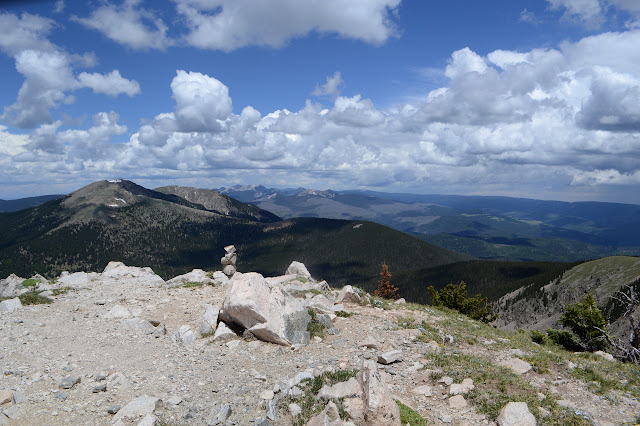
Of course the time comes to leave. The north ridge gets some travel and there is a cairn to mark the top of a thin trail. The ridge is not hard to travel, so the trail is not needed. That might be why it gradually fades away. I tend to the rocks, which is another tendency that slows down trail growth. There is snow as I hit the trees and the saddle below.

The saddle comes with a geocache and the geocache comes with repeated ravings from someone mad that there is more plastic in the wilderness and we are as lemmings following in other people's footsteps. I wouldn't care for one every tenth of a mile just because a trail passes by, but when rare in special places, the online logs often serve as a good reconnaissance source for trip planning. This one certainly does. Now, there was once I felt like a lemming. It was chugging through snow from North Lake to South Lake, powering through swollen stream and river crossings and expecting to get safely to the other side just because a whole bunch of other people seemed to be doing so. Finding geocaches that are rarely visited certainly doesn't make me feel like one. Even wandering a National Recreation Trail that gets a multitude of feet every day, even stormy days, doesn't. Good thing, because some of the trip both here and back is that. He's probably just trolling. There are lots of threats to remove the dreaded object, but the log goes right back to the first signer. I tell him it is presumptuous to think I follow the geocaches rather than going where I want to go and signing the geocaches that happen to be in my path. That should give him a little thrill when next he comes along the very same path instead of trying something new.
Now about that trying something new, I have been dreading the steep bit under the trees, but even looking at it while on the way up suspected it was the best way rather than the steep rubble beside the trees. Trails, or maybe water courses, but they look a bit like trails, do make their way down through the dirt. They tend to slide a little to the side as they go, making the route just a little less steep. Only just. Boy am I ever glad for new shoes. They stick like a treat as I make my way down to the less steep rocks below the trees. The rocks have been traveled often enough that there's a groove formed from them moving down slightly with each traveler. It seems like the clouds and their possible afternoon thunder are timing everything for when I start out on the nude rocks away from the trees, but when I get there, there is a bit of clearing instead.

All that water from melting snow must be gathering down below the rocks, because a good flow exits them as the valley turns grassy. Trail splits to pass on either side of the lake and I go left toward a big camp site. This route gives me the challenge of crossing an inlet on a suspicious set of logs. Or I could try sloshing through the soft mud which feels like it would go up over my shoes at least when I poke it with my poles. Ewww. The other side looks like it gets extremely narrow between lake and rocks for its challenge.

The clouds have taken over the whole sky again and as I settle beside the lake, they throw down a few rain drops. The few other day hikers around the lake seem to think this is a good moment to leave. For a couple fat rain drops. I take a little more time, but might be hurrying a little before pulling out the rain gear and following them down. I have stepped back in time one more step for the rain gear and this time it is a heavy duty poncho with loops for stakes that I got as a teenager. From Big 5. It got some use on the first lap of San Jacinto. I'll see how it does.

The trail down from the lake is steep. No, that's not right, there are many trails, all well worn, all steep. It is not just my general perception of downhill as steeper than uphill, either. There are some spots where the land just stops going downhill entirely and then there are meadows, but in between the creek drops just about as fast as it can and the trail tries to match it.


The trail finishes off in a sudden jaunt to the left to meet Winsor and there's a little more repeat from the last hike. The rain of caterpillars is not quite so heavy now. That probably means a proliferation of moths in a few days although some are already out. A slow rise, and I'm back around to the fence at the saddle and the wilderness boundary.

It's harder to see, but there is a trail on the wilderness side going up Aspen Peak, too. The trail does not stick next to the fence. It has been getting some deadfall on it, but someone has been cutting out the smaller of the obstacles. Big things get trail around them. It climbs up and seems to miss the peak as it grabs a viewpoint instead.

Once the view is taken in, the trail dutifully marches to the top where there is none. There are plenty of the namesake. They have leaves here. The caterpillars haven't got them all.

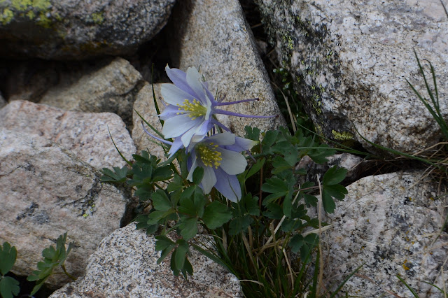
I slide over the top and start down the other side. There are only game trails, but there are a lot of them. It is easy to find the big meadow on the side, helped out by the fact that it is on the map as a white blotch in the green shading. It is full of irises. Oh, and some other flowers, too. Some sort of sunflower and a few other things. The range fence goes down the middle and the type and frequency of flowers changes at the physical boundary.


I head down some more, meeting up with the fence. I need to be on the other side, so I follow it and it keeps on not having gates until meeting up with the power lines that serve the ski resort. The service road has almost vanished, but there is a ranch gate for it. People have built fire rings on both sides in the flattened clearing under the power lines. A strange spot to pick for camp. I continue downward and it gets into steep and annoying slopes before I can cross the creek and head up Winsor back to the trailhead. I should have followed the power line road slightly upward to the other side of the trail instead. The brooding sky finally drops some rain as I make my way through the last. It is not enough to test the poncho, only enough to remind me that ponchos can be quite hot and stuffy too. Also unsuitable to scrambling around on steep slopes of soft dirt with a few trees to navigate. A dismal end to an excellent loop.
©2019 Valerie Norton
Written 21 Jul 2019
Liked this? Interesting? Click the three bars at the top left for the menu to read more or subscribe!


Comments