Lobo Peak and Flag Mountain
Carson National Forest
Click for map.
Once I determined I was going to get myself my second state high point, Lobo Peak was the next thing I decided I would do. Nearby, but gets into a completely different area and there are multiple ways up so there can be a loop. It does require a little road walking to connect whatever trails I use. The final plan is up Yerba Canyon, which is the most direct route, then down Italianos Canyon, which is a popular one. If I'm feeling good at the top, I can go on to Flag Mountain which is 3 miles of ridge trail, so a rolling 6 mile addition to a 4 mile, 4000 foot climb. Wait, that's seriously steep. That can't be right. 8200 feet to 12115 feet, anyway, and the line on the map estimating the distance doesn't quite get to 4 miles. Anyway, there's a road sign pointing out the start, lots of parking along the side of the road and even more up the short 4x4 road to the trailhead, and a little kiosk there with nearly no information. A sign beside it informs me this is special trout water: red chile water. I haven't got a license, so I expect that means I'm not fishing anyway.
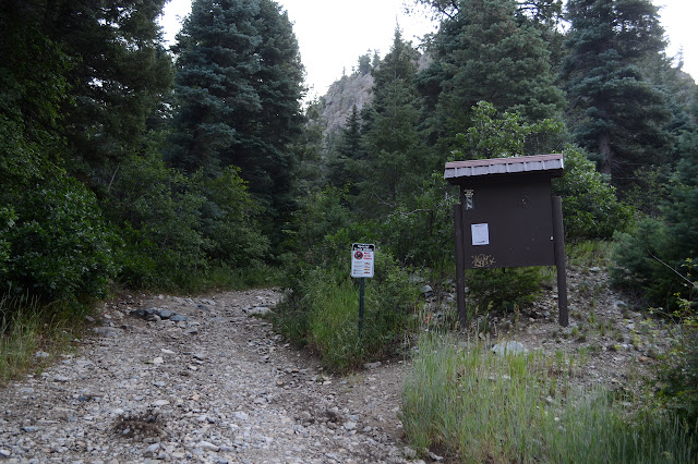
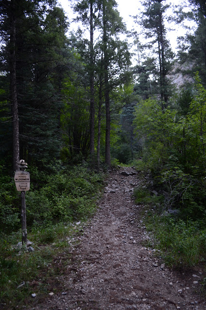
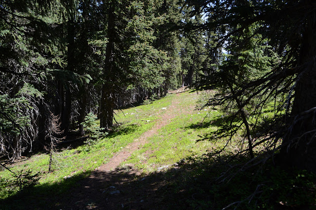
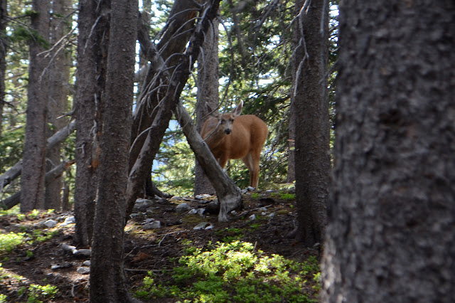
After the kiosk, the canyon narrows down quickly requiring no barriers to keep the cars to their area before the mini wilderness sign. This is not one of those glacial valleys as the rock walls raise steeply on either side. In between the walls, the trees grow tall and spindly with lots of green stuff at their feet. The trail crosses the little creek repeatedly until it starts climbing up onto the sides a little.
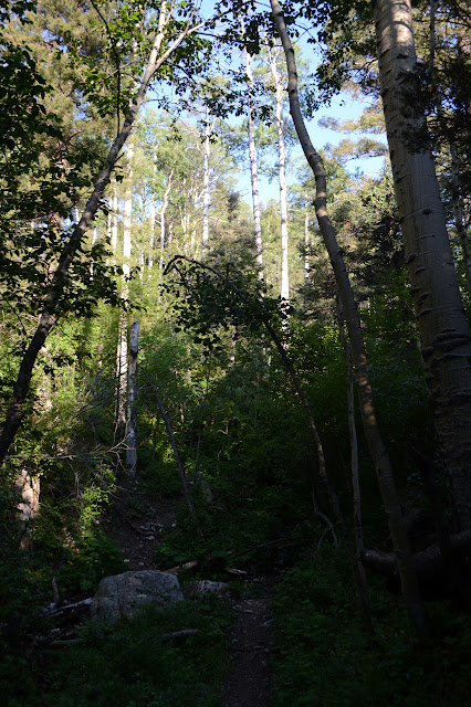


The trail does take on some rather steep bits, but overall I am coming up longer than the mileage estimate. I see hints that it used to climb in a more reasonable manner, but those parts of the trail are so long gone that the map doesn't even show them. It gets especially prevalent closer to where it tops out onto a ridge. Along the way, there are the still green, shattered remains of trees from an avalanche this winter to show that it's just steep generally and getting out will take climbing.


There are signs where the trail hits the ridge to prevent folks from accidentally taking that ridge down instead of the canyon. There doesn't look to be trail that way, but maybe that's because the signs have been working. I sense a view out there, though, and decide to walk out just as far as the shoulder to see what might be on offer.


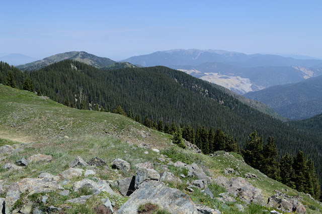
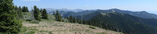
There is a view to be had down the canyon and of some interesting peaks along the ridge. The trees keep most of the view the other direction, although those slopes seem to be more open. The climb along the ridge is not so bad as getting to it. Manzanita Canyon, another option for coming up this way, is signed as I pass it. Lobo Peak Trail is too, although it is looking a little precarious on its hill side. For now, I get to turn the other way to get to the peak. Trail is supposed to pass the peak a bit below, but what I see goes up to it and stop. Worrisome for following it further.


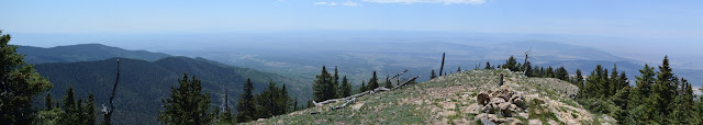
So I head up to the sign to see what I can see. There is an enigmatic monument at the top near the sign and a massive molybdenum mine along Red River that it's hard to believe I couldn't see from Gold Hill. It's so huge and obvious and I had no idea when I was on that high point.

I am not entirely feeling like going over to Flag Mountain, but I also am not feeling like not going. In the name of being here already, I might as well. It's just a bit of rolling ridge for three miles. It can't be that bad. I head over to the north peak, then start down the side toward where there should be a trail. The stuff on Lobo Peak is meadowy and good at eating trails. Just because I can't see it there doesn't mean there won't be one under the trees. There are a few false starts in finding it as something looks like it could be trail only to dissolve when on it. Each time the trail should be a little further down anyway and eventually there it is, unmistakable, definite trail.
It has blazes and cairns and cuts through the downed trees and even a few ribbons from someone who didn't want to use much or tie a lasting knot. Almost as many are on the ground as tied to branches. There is a tiny bit of snow, but not anywhere to help me lose the trail. I miss a switchback in the dirt to do that and travel gets a little harder including some scampering along a rather steep hill side until I meet it again. Nice, level trail.

There are two junctions along the way. The first, with the San Cristobal Trail, has a nice new sign on it like the other junctions have had. The second is supposed to be very near a peak that has been cleared by fire and remains unmarked. Somewhere in between all the cairns and the ribbons and even the very old blazes vanish leaving only an intermittent trail to follow. It is rougher, slower, and more difficult. This does make it easier to go ahead and tag the random peak in the middle that has been marked on Peakbagger although the trail should be going around the side. There actually are two cairns, one at the top and one along the ridge, although that is certainly not the trail.


The tufty grass makes an uneven and difficult walking surface that looks like it should be easy, so I do keep looking for trail. One bit drops off the ridge to the left and passes by a mystery corral. They took advantage of the living trees as posts for the stacked slats of small cut trees. More slats wait to slide into the gate area. It looks like a rather solid structure, but where is the water nearby? Then it's just one more hill to the top of Flag Mountain. This one had a sign too, but it is now just two weathered bits of wood indistinguishable from something natural except that they are nailed together. I was beginning to question if there ever really was a trail out this far or if someone has just marked a fuel break. The sign isn't much evidence, but taken with the way the trail wobbles off the ridge top, surely there was.
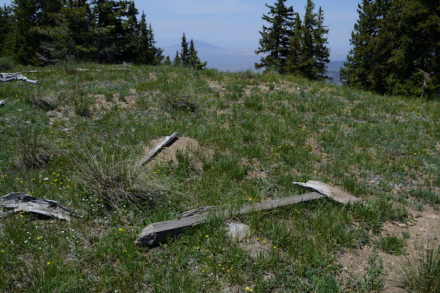
The vanished trail supposedly goes onto the next bump to the west, which is the one marked with an elevation, before ending further down the hill. I go along to find a cairn with a stick in it, but where the sign was is obviously higher. This is just a better viewpoint for the valley below. If the air wasn't a bit smoky, I could probably see the gash of the Rio Grande cutting through the plains.
Once it is time to climb again, I try a little harder to follow the trail around the peaks instead of over them since I have already tagged the central one and found it no great thing. The Forest Service maps for this area have seemed to be more exact in trail placement and there does seem to be something like trail around the side as indicated, but I end up low when following it. There is still no clue of a trail heading downward to the community below where there should be one. There is trail around the second bump as there should be, but again I end up a little low. There is a distinct smell like rot setting in. It's actually more pleasant than the sight. A huge elk lies under a tree with fuzzy antlers displaying not many points and a massive dark tongue hanging out. Its side is missing like some sort of anatomical model. All the organ pieces seem in place except one stomach hanging out. I think I better get moving before whoever it was that could bring down a full grown but fairly young elk buck notices me and thinks I'm eyeing what's left with too great interest. I'll be happy to get back to San Cristobal Trail and have trail sign and even trail tread once again.


When I get there, it is hard to see how I missed the switchback. I missed a bit of ridge with fine views for that, too. Once in the grasses and hills of the top of Lobo Peak, the trail nearly vanishes. There are some cairns and some spots that hold trail, but mostly the grass has eaten it. Oh well. I know where to find it on the way down and hit the peak again.


Now time for a new way down. I keep to the Lobo Peak Trail as it clings to the side of the ridge. Some parts are narrow. A lot of it is tree covered and that part tends to be easy. When it pops out into exposed rocks, it gets steep. One bit is a climb and another a drop. Once the drop finishes, there is a sign to continue down Italianos Canyon. That's the one for more.

There are signs of water quite high up in Italianos Canyon. I think it is in the first quarter mile, but distances can seem to shorten once getting downhill. This trail feels a lot more like it is following the route as built rather than whatever scramble became the trail this time the snows melted. There are plenty of switchback cutters trying to make it steep and ghastly, but the sensible trail walkers are winning so far. It passes through some high meadows as the waters gather. I see a few camp sites and am surprised not to see more.


Other than not being scrappy at the top, Italianos Canyon follows the same general plan as Yerba Canyon. At the top, few crossings are needed to travel the canyon, this one with more meadows. Somewhere in the middle it drops down a long set of switchbacks to be right with the creek, then it is all tight cliffs and frequent crossings in between them. I had seen a little recent trail work on Yerba, but anything over a foot was left. The big saws clearly came up this way instead.

I should have had enough light to finish off the hike. It's not that many miles. Apparently not. It is darkening as I pass through the high rock walls and dark when I get to the road. The 1.5 miles or so back are, well, tolerable. There is generally shoulder to walk on and the traffic at this hour is not bad. Houses on the other side of Rio Hondo provide some bright lighting, sometimes steadily right into my eyes. It's surprising how much has been squeezed into the space of this canyon.
©2019 Valerie Norton
Written 2 Aug 2019
Liked this? Interesting? Click the three bars at the top left for the menu to read more or subscribe!


Comments