Aubrey Hills - Cattail Cove State Park
Arizona State Trust Land
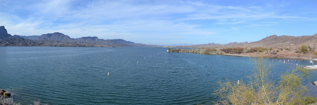
Cattail Cove State Park
Click for map.
Another day for exploring around the Aubrey Hills, but this time heading a little north to the Cattail Cove State Park. It is almost two miles up the road and, apparently since I'm just a glutton for punishment, I have decided to find a route under the power lines to get there. After all, power lines have their roads. First I have to get across the big wash I finished in yesterday. That is easy enough because there are two roads down into it on this side and one out of it on the other and although that one is washed out in one spot, it is not a sufficient blemish to keep a few people from using the road so I ought to be able to walk it. From there it is easy to find the road under the power lines and then more road climbing up into the nearby hills. Another flattened spot, but it's a nice view.

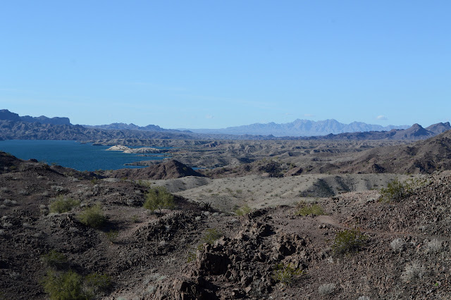
Road down from the flat at the top is a little iffy, but the ATVs have been managing, so I can too. That puts me back on power line roads. Being under the power lines and beside the highway, the Arizona Department of Transportation has given me a benchmark or two to stumble upon. Oh, and they've marked the section corner that I pass by a few feet, so I get to find that one easily too. It is another from 1915. The power line roads are discontinuous, but there is always something to follow through the steep little hills. A little over two miles later, I am looking down on the inland side of the park. Or maybe in it already, there's no sign to say when and my map shows Lake Havasu State Park occupying a chunk that doesn't quite include the shore, maybe, so it's no help.

Today is just going to be a geocaching day. I'll follow them around and see where they take me. Most of them were set by the park itself. Now that I'm here, do I hike down to the river? I guess I should. This side of the highway is free, but the lake side is $3 to hike into, more to drive. Crossing the highway is made easy because the wash has to do it too.

There is a trail with a sign on it a short way down. Destinations that sound like other trails are listed, all measured to the hundredth of a mile. Ambitious precision. Also a different way back. I just keep on plodding down the wash. (There's a geocache or two along it to sign and replace.) There is a bulldozer working on the last bit of trail into the hills beside the lake, so I have to enter into the more developed areas briefly before turning along the lake. It does take me past one more geocache than I was expecting.


So I wander along beside the lake a while, then it looks like the closest geocache is up a trail that just happens to go by another section corner. I go for that one, stopping to look for the corner. I'm feeling good about my streak of finds, but this one eludes me. It is so close it should be visible from the trail right across the small canyon. I just can't sort it. There is a set of rocks that could once have been a cairn maybe. I guess my luck ran out on that one.

So on I go to the geocache, which has a nasty habit of not getting much closer as I follow the trail to another junction. I turn to climb further up into the hills and finally, just about at the top, it has actually gotten close enough to look for. It probably was not the closest geocache after all.


And so I follow the trail around and back down to the side of the lake to get one last geocache. First to follow the trail to its end to find out what Whyte's Retreat might be.


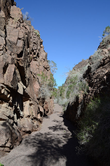
That last cache on this side of the highway was not along the trail and the junction just before the retreat is odd. One of the four trails is not listed on the sign, but it has a signboard posted next to it. Unfortunately, the sign has become a couple of black flecks of ink against white. I get the feeling there is a very long warning that is now missing. Anyway, the geocache is somewhere along that trail and I am looking for an unlisted Rieley's Run to return to the wash, so that must be what I want on two counts. I turn down it and the walls quickly close in. Not very tall, but fairly vertical. There are plenty of footprints in the dirt to mark it for something regularly traveled which gives me confidence in following it.
After a good, long while, there is actually a sign to indicate that of the two major bits of wash before me, I should head right. I suspect, based on the topo map, that the other way would work as well but in a much shorter way, but go with them. There aren't footprints leading the other way which, given the number going my way, is peculiar.

There are a few mild climbs to get up, but all easy in spite of the occasional water smoothing them down. As the wash starts to get particularly rough, there is trail up and out and into the hills. It joins other trails just before everything drops down into the original wash and there is another sign board. This one still has a bit more ink on it and words are decipherable. It is a long warning with the usual (carry water) and the specific (do not enter when storms are coming, there are dry waterfalls to climb), at least I think it does.
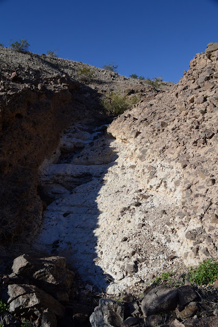
Then it is back to the inland side of the park. The caches here are a mixture of random spots and a couple to highlight features. The first highlight is a caliche falls and is just over a chunk of land from one of the random ones. Of course I go for the up and over route. It gives a nice high view point, but the transition between hills and washes in this area is a little difficult. And I wouldn't want to land above the falls, would I?


The falls are not that hard to navigate and the cache is above them anyway, so it is not so bad that I did come out above them.
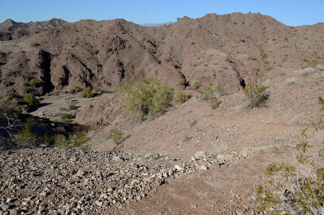
The other highlighted feature is a box canyon. I find it easy enough to climb up out of and further up along the wash, so it does not seem like much of a box, but it is certainly very boxlike. After that, I need to find my way back to camp still quite a ways distant. I figure that road I saw going north from the wash just north of camp is a good candidate. There is a low spot further up the wash that it should be coming over. If it was just one more thing off to a flattened spot and stopping, well, then I can take the low spot cross country until I am repeating the final steps of the hike yesterday. I thought the box canyon would be my way to it, but since it has no road, I follow the main wash up. It just keeps going and eventually I go for a more direct route up the canyon wall by some sketchy game trail instead of continuing on the wash. Halfway up, I finally spot what I am looking for: evidence that there really is a road coming from the south.

A huge tube packed with earth allows the road to pass over the wash. There is vehicle trail climbing up the wall that is not much better than the game trail I took and goes up the wrong one anyway. Although half the packed dirt has gone from around the tube, people are still traveling what is left of the road. I like my route better. I follow the nice game trail up the middle of the finger of land to the road and then turn away from the failing bridge toward camp. I definitely like my route better.

This time I take the wash route down around the flattened mountain. I thought the road over the mountain was bad, but this is ledges and worse. Maybe in 2005, the parking spot just up the wash from here made sense, but today if you can get there, you can easily get all the way to the parking next to the needle. Whatever, I am glad to just have to trust my two feet along the route down and back out of the wash to finish another good day of exploring.
©2019 Valerie Norton
Written 22 January 2019
Liked this? Interesting? Click the three bars at the top left for the menu to read more or subscribe!


Comments