Camp Beale Springs
Cerbat Foothills Recreation Area
Click for map.For a little bit of area history, stop by Camp Beale Springs, but pick up the free permit to enter it from the city first. It is available from the Powerhouse Visitor Center or the City Parks Department at Centennial Park and mine came with a rough map of the area. Parking is not signed, but is across from Wagon Trail Road a little before the signed parking for Camp Beale Trailhead.
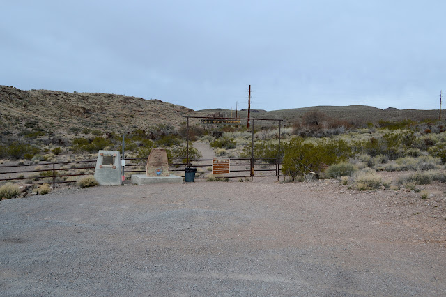
It all revolves around the spring of course. It was a stop on a toll road in 1865. It was an army outpost during the Hualapai War 1866-1870. The camp was established in 1871 as it became a "temporary reservation" for the Hualapai Indians 1871-1874. As that follows on the heals of a war is is followed on by a forced march, the wording "internment camp" on the other monument might be a little more accurate. After that, it is the water supply of the growing city below and mining and agriculture in the area. The reservoir is one of the few things remaining.


Walk through the gate and follow the path. It brings you to a bridge over the meager flow of water and then to the reservoir. Benches are provided to rest and there is enough water that birds gather. It doesn't quite have a park feel. There is a pear tree on the map and I go off trying to find that. Nothing looks quite like a pear tree. It seems a funny thing to provide as a historic reference. There is a main trail that is the usual to follow and I get back to it by a shortcut route. The places marked on the map are also marked along it with a bit more detail.

There really is nothing left of the things they are describing. There seem to be rocks around the old warehouse, but they are clearly not part of the vanished building. So it is with the rest.


Trail winds up through an old road and finishes. I loop back on the road that does not quite get back to the start but it does pass by the things that last. One spot has a bunch of nails, another is full of old cans. There should be a location for a hotel somewhere, but that one is not marked.
©2019 Valerie Norton
Written 14 February 2019
Liked this? Interesting? Click the three bars at the top left for the menu to read more or subscribe!


Comments