Black Peak -- avenged -- and the south peak
Colorado River Indian Reservation
Lake Havasu BLM
Click for map.
Back at the bottom of Black Peak and out to conquer it after my defeat a few days ago. It will be a bit of a hollow victory because I am now approaching it via a route that is much easier than the crumbling class 3 climb I aborted almost before it began previously. I'm just going to take the road up. Everyone is doing it, at least everyone who has registered their ascent on Peakbagger.

I park off the road where it is curving back to east-west next to a "no camping" sign and what is probably illegal road. Somewhere to my left should be the actual road that ultimately makes its way up to the top of the peak. I head off cross country sort of angled to eventually run into it. It is hard to miss when I come to it, although I take it for a wash as I approach. The footing on it is much worse than in the surrounding desert, so I do more following near it than on it before cutting my way up and over some low hills and down onto the spur that does the actual climbing.
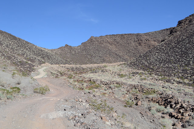
Someone once at least thought about putting in a gate to block vehicle traffic up to the top, but there is currently nothing more than two posts. Past that, the road is mostly paved in concrete. There is a slap-dashed quality to it and one bit that was driven through while soft was simply left that way. Frequent ditches have developed across the width. In spite of the paving, this is not a road you would want to drive your car up.


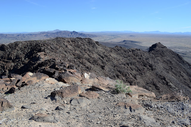
Getting up to the top is just a matter of continuing to move the feet forward. Near the top, loose pebbles on the road make for a difficult surface, but it is easy enough to simply avoid those areas. The road meets up with the power lines that came up the north side and then there isn't much climb left. I walk past all the antennas since my perspective from below put the high point east of them, but the map indicates I missed it, or at least missed the benchmark.


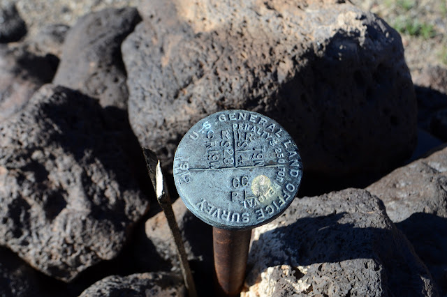
I head back looking for the benchmark not expecting much since it is in among the antennas and likely got scraped away. On the other hand, it represents a turning point for the boundary of the local indian reservation, so maybe there is something special in that place. As it happens, there is just a very well used triangulation point.

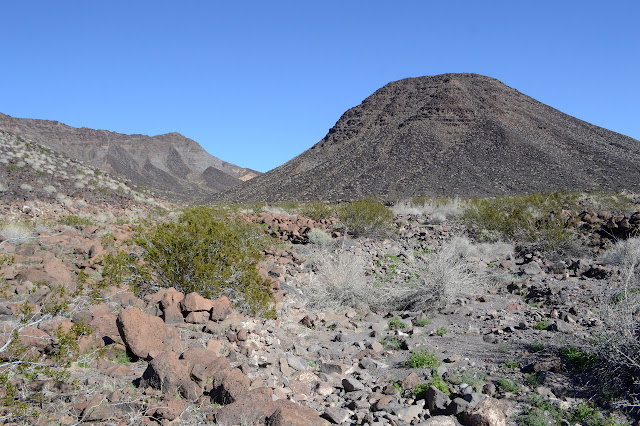
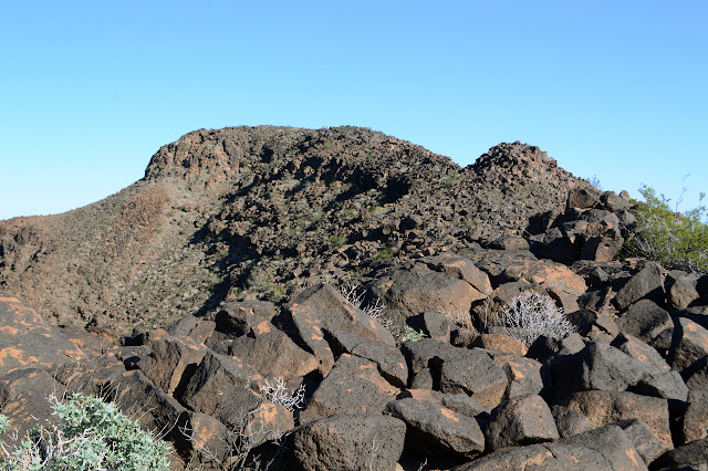
And that is it for Black Peak. Done and done. Except there is still the little matter of the peak to the south that I had also meant to go up the other day. Today I have twice as much water as I did then and I actually liked what I was seeing of the western slopes. The dark rocks look like they have been lounging in the side for a while and should stay there and although there are some slight cliffy bits toward the top, they will be easy to avoid. I set out across the washes towards it figuring the further around I can get, the better for the climb.
Out in the middle of the washes is yet another claim mound, I figure, but as I spot a second one, it seems to have a marker that is unusual for a claim. Heading over, it is actually a monument for where the section boundary meets the reservation boundary. I check the map and indeed it is marked. I must have forgotten to check for them. I look a little further and notice I actually got distracted by something marked "MP45" and "MP44" that look specific to marking the reservation boundary so would be more unique a find. Looking a little more closely at the one I'm at, I notice that it actually isn't marked according to the map. (It is the second section marker I have accidentally walked up on today. The first was while poking around the side of a road for a poorly described azimuth mark. That corner also was unmarked according to the map.) There should instead be one marking the actual section corner about 100 feet west and another about the same but southerly. I squint west and there it is. After checking it out, I check the original mound that got my attention. It has a larger, more recent marker tucked in next to it.

With that distraction over, I get back to climbing the peak. There is a fence line along the boundary that turns north and up the side to end at a big boulder. I angle my trajectory to cross above it so I do not have to navigate its barbs. One does tire of rusty barbs quickly. Really, about the time one notices the things. So I climb and continue to move a bit off to my right as I go, taking the rocks as they come. They are quite stable at first, but I have to pay a little more attention as I get higher. It is quite steep once at the level of the minor cliffs and I find myself tending to climb small water courses of brown rocks instead of the blacker ones. As long as it holds, I am happy, and they hold all the way up.

Suddenly things just seem to flatten out a bit. It is still climbing, but I no longer have to worry about rocks doing much under my feet except those few particularly slick ones that are just downright slippery. I still have a lot of mountain to hike to the high point, but it should be relatively easy. At least that's what I think until I find myself at the top of a cliff. Still, all that is needed is to give some ground and go around. I select the north side. It actually looks harder, but its promise of brief shade is too much to pass up. The rest of the ridge is easier and soon I've run out of up to go.


I spend a little time at the top, then head back the way I came. Again around the cliff to the north when it comes, but now because I know that way. When the downhill gets steep, it looks seems like it has gotten a lot steeper than when I came up and stays that way for a lot of the downhill.

I am surprised by how closely my downhill path matches my uphill path. Again, I am aiming to get past the fence without having to actually deal with it. From there, I just want to go out to the road and follow it back. As if to emphasis that there is a road out there, three old beetles come rolling along. They do not stall at the fence, so it must have a break for the road. It has gotten late, so that intriguing "MP45" stays undiscovered by me as I angle across the washes and after a very long while actually hit the road.

Again, the road is a churned up sandy thing that is difficult to walk on. Oh, and my water runs out with a mile of it to go. And I thought I had so much. I walk well off the edges happy not to be hearing any more target shooting. They had moved into the areas behind me and I heard them as I started up Black Peak, so I was a little worried. Eventually, I leave the road to drift a bit left. There is one more monument, a quarter section marker, that I should pass very close to, so I take a moment to look for it. Out in this bit of desert crossed everywhere with tire marks, someone probably slammed into it and took it out. When I get there, it stands high like it had rocks around one once like those others, but it is now bare. It has some nicks and was set in 1911. The oldest yet. Sweet. Now back to the car to get a drink.
©2019 Valerie Norton
Written 3 February 2019
Liked this? Interesting? Click the three bars at the top left for the menu to read more or subscribe!


Comments