Woods Mountains including Tortoise Shell Mountain
Mojave National Preserve
Click for map.
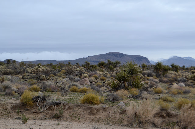
There is a closer parking spot off the road a little to the north, but that one has gotten a bit rumpled after some flooding last summer, so I decided to just start where I was. I noticed I was just east of a benchmark right out there in the middle of the sands and thought I'd have a go at finding it first, then off to the cliffs I can see out there and around to some prime spot to head for the first peak: Tortoise Shell Mountain. First to head vaguely winding between the spines to a road, and then along that road until near the benchmark.
The weatherman says the day will be cloudy in the morning and sunny in the afternoon. Certainly has the first part right. Finding the benchmark is straightforward enough although it takes a little circling. The desert floor looks like it might be a bit mobile, but it seems it has stuck around here since 1935. The sparse plants around it are probably older than they look, but out here they do seem to be smaller and simpler than in other places.

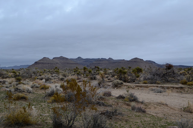
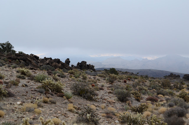
So attention back to that mountain. I make a line to the cliffs I can see and then around the edges of them. They may not be the lava I took them for at first. Most things around here seem to actually be ash and these are full of smaller rocks as ash tends to be when the rocks get kicked up with the ash. Lava can contain smaller rocks too, when the embedded rocks have a higher melting point or simply because it cooled enough before an embedded rock could fully melt. The dark color is actually desert varnish. They are very light where they have chipped, but they are sufficiently stable to have varnished to near black. The cliffs are interesting. Meanwhile the clouds play dancing games among the peaks.

I leave the cliffs and climb a hill, meaning to curve around on an easy slope right up to the top. The land has another idea. As I cross the smooth, easy slope, a gash opens up along my route. These cliffs are not quite worrying me as much as before. Sure, many of the stretches are tall and long, but many more have crumbling spots to pass through at frequent intervals. Which one is this? Glancing to my left, it looks like the second and the far cliff has another accessible spot a little downstream. I can do this.

I follow a pony trail that curves around the hill not climbing all that much until I get tired of it and decide it is the wrong one to follow. Up is the way I want to go and up is the way I do go. The hill kindly moves smoothly into more hill and a gentle walk to the top of Tortoise Shell Mountain.


There is a register at the top. It hasn't seen too much activity, but it seems steady enough. Mostly people seem to be in the area for larger things and want to do a little peak the day before. Usually larger things seem to be the New York Mountains. I would like to go, but "sketchy 3rd class summit" sounds worrisome and the road was getting a bit bad just getting to Table Top.


I took way too much time along the cliffs on the way up and it is already noon, but I figure I can get to the high point in another three hours. Taking the time to carefully select features to be landmarks for my route up and memorizing them should help. Even some possible missteps get tallied as an attempt not to do them. Then down I go aiming at a ridge with a bit of rocky to the top of it, but should have pony trails around the sides. And not the one to the right of it that looks smoother, but is out of the way.

There are no complications getting to the rocky ridge. Pony trails make their way around the side of the rocks, so there's little complication in getting past them, too. Just follow the ponies! They cross over some loose rock covered hillsides that I wouldn't have expected them to, but the rocks are pretty stable. At the far end of the ridge, I am noticing two things. My route has a bit of a wash in the middle of it that would have been got around by going to the other ridge and my sunny afternoon seems to have been fictitious. Clouds are moving in and there might not be any view at the top. For getting there, the wash really isn't all that deep, particularly compared to what I have already come down to start up for the high point.

So down a bit of steep slope and up on a cow path on the other side, initially a bit steep itself. I am now aiming at the left side of the more rectangular peak after the right hand side of the peak in front of it. Once up a little way, there are more pony trails to follow. I go for it until they seem to be going the wrong way, then wander in the direction I want until there's another that does make me happy. Before all that, though, I have to stop to watch a roadrunner dance. He stops on a rock and lifts his tail a few times, then scrambles on to a nearby high spot to lift his tail some more. He cannot possibly be unaware of me, but has no intent of running off just for my sake. After a few repeats, he is off behind some bushes and heading off.

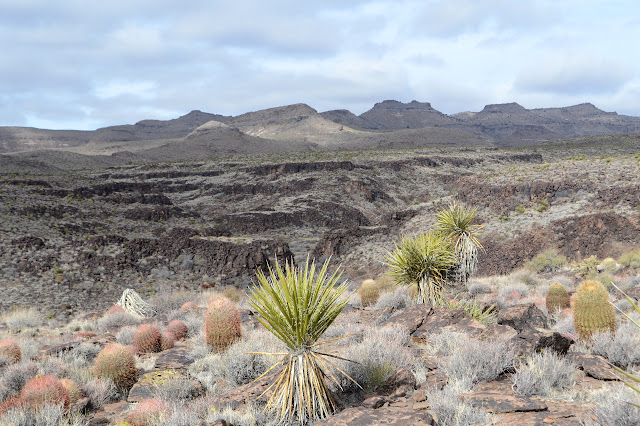
Around the first peak brings me into a beautiful canyon. The ponies cross it and then climb the far side in switchbacks, although they don't seem to agree on where those should be. I avoid the trails through cats claw and other nuisances. It requires frequent stops to admire the handiwork of wind and water on the layers of ash.


The going gets tough as I approach a small natural bridge at the edge of a cliff. The fact that there is a pony trail to follow gives me confidence that the going will not get too tough. Then the trail ends in a short, easy, class 3 climb. It looks for all the world like part of the trail. This would be more believable for a goat trail, but these trails are very distinctive. Goats and deer make very thin trails without much disturbance of the rocks around. They are more noticed by the lack of vegetation in a very thin line. Ponies kick and crush rocks until there is a comfortable wide path so can even be seen across bare ground. Also, the scat is rather distinctive with deer leaving pellets while horses drop fat processed grass bundles. There is no way of mistaking it and apparently a pony will take a short scramble when needed. So up I go with a couple of grabs.


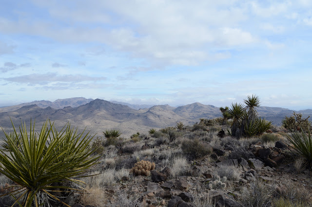
There is pony trail taking off at the top of the climb too. I am now up among unfamiliar little pines with little cones (that haven't burned in a semi-recent fire) as I attempt to stroll over to my next landmark. From here, it is mostly a navigation of the ridge with the caveat that I don't actually want to climb the peaks in between because some of them look kind of hard. Of course, there are lots of pony trails to choose from. Easy to lose, but easy to find again as they go around the sides.


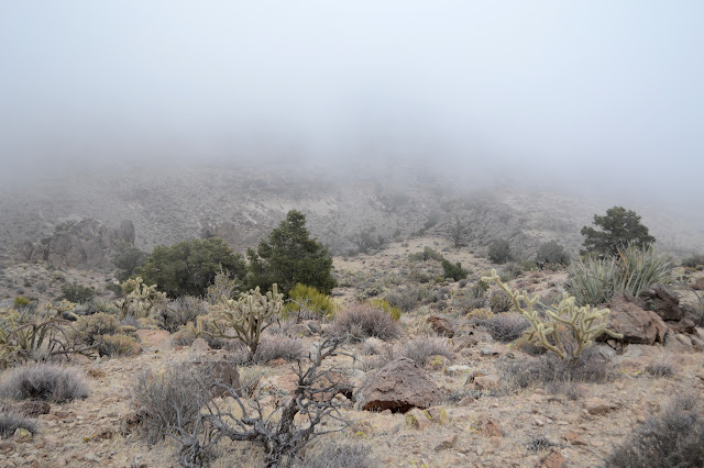
I can just see some caves in the cliffs below as I come around the peak. There must be so much of interest I am missing in the fog. Cookies will crumble in the way that they do. So it goes. One saddle beside a tortured tree seems to get a lot of traffic up and over it. That seems like it could be a reasonable way down. The high point is just a little further around the ridge line. The pony trails are thin in that way. They must not think much of the area. I follow what there is of them until they seem to be overshooting the peak, then swing back and up to the top. There is a little can to tell me I've made it and about 50 feet of visibility to admire the spine of the ridge and the north side drop off.


I got up to the high point in 3 hours which leaves... an hour to get back off of it. Someone has marked a couple points below along the ridge on PeakBagger, but they will just have to wait. That high traffic ridge looks very attractive now. Of course, since the direct route is even faster than scrambling around back the way I came, well, that's the route I want. Just got to go downhill. What could go wrong except that the high, long cliffs I almost saw through the fog are real?
It doesn't really matter if the cliffs are real or not because I let myself fall into a pony trail again as it is traveling my way, however not very fast in the downward direction. If you follow a canyon in the direction of down, you have to drop faster than it to get there. I find myself following the ridge much more than dropping to the canyon. Maybe those little peaks can get bagged too. The ridge is easy walking for a while. Then the pony trails seem to vanish. I have got out on a little finger of ridge that just drops off and to follow it again, need to get around the edge of a high peak. With steep sides. There are deer trails, but they are never as pleasant. I get moving worrying that this is about to take up half of my remaining light. There is always a safe way, but it is hard going and the chutes require some planning to get across. Eventually I am around the edge to the main ridge again. Loose the pony trails at your peril, it seems to say.

So I continue, sticking carefully to the horse trails and looking for a nice way down. As one trail turns to a cattle trail, I know there must be some way, otherwise how did the cows get up here? They are much more timid about climbs than horses, even before taking into account the class 3 scramble some seem to be willing to do. They just take me on a very nice route around the edge of the next peak, but they don't lead me down.

One of those tantalizing bumps that someone has tagged is just on the next peak along, but the cow tracks seem to vanish and I need to take advantage of the last light to make my way down to something that can be crossed safely in the dark. My preference is to go down Rustlers Canyon to the southeast because it is more direct, but I can't see any way into it at all. The other side looks like it can be done going down a rocky creek bed at first, then as it gets bad, the hill to the right is fine. The hill to the left is not, so definitely be sure to go off to the right.

So I scramble down and all the rocks hold as tested in the creek bed until it elects to get more direct in getting down, and the right side of the hill holds. Gradually, there are cow paths. I follow one across the creek bed and out over a rise to drop into the wash as the dark becomes certain. Just in time. The wash is easy enough to walk by the light of the moon, or would be if there was one instead of clouds. Even so, a light is wise to be sure it doesn't take any sudden drops. This was is wide enough that even the cats claw trying to lean in over it doesn't bother me. Travel is easy and uneventful. Here it splits and combines again, there a bulldozer dug out 5 big scoopfuls of sand. As it bends away from my camp, I just take off in roughly my direction. The distant lights of travelers on I-40, just visible in some spots over the hills, sort of help me stay in the right direct as I weave through the plants that desire to stab me. This travel is a little harder and slower, but still uneventful.
It's a good day, though too long for the hours. I do have to say, these seem like some particularly nice mountains to me. Now anyway. One fellow with an entry from 1980 says they were quite violent about 17.6 million years ago, but that seems like a long time to me.
©2019 Valerie Norton
Written 12 January 2019
Liked this? Interesting? Click the three bars at the top left for the menu to read more or subscribe!


Comments