Crossman Peak
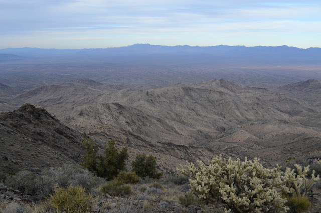
Arizona State Trust Land
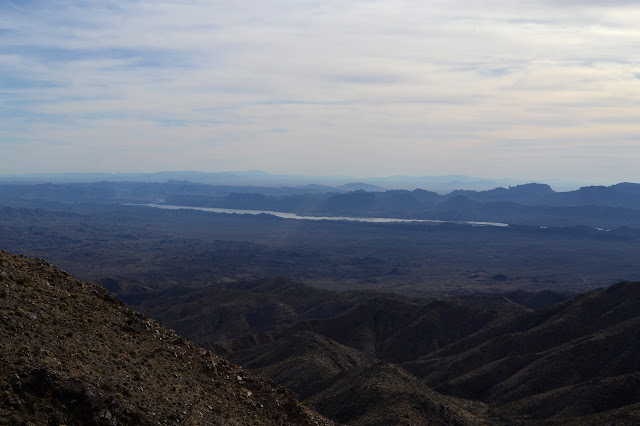
Lake Havasu BLM
Click for map.
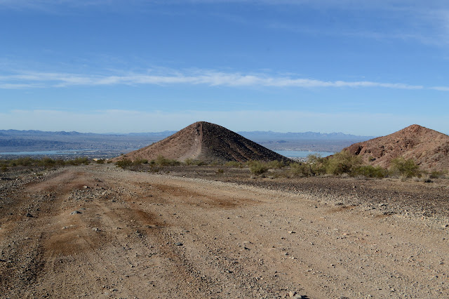
I have as a sort of goal to climb peaks listed as the USA Lower 48 Top 400 Peaks by Prominence and Crossman Peak is ranked #343 on that list. Unfortunately that rank is by height, but a bit over 3k prominence isn't too shabby. Getting there is much easier with a 4x4 or even just some high clearance, but Alltrails says I can do it in about 13 miles round trip, so I am going to go for it. The day is a little short and my start got delayed thinking I might have dropped my wallet out of a back pocket while scaling something nearby called "Little Haystack" on Lists of John, but finally located it in an unexpected pocket of luggage before having to scale the "3+" rocks again hoping to spot it. It's the little things that make a day go smoothly. Never mind, it is practically a road walk anyway and the weather will not look good on photos tomorrow, so I found my way to the end of the pavement on Bison where there is a little bit of parking and am taking to the trail. Which, as stated, is a road for a bunch of miles.

There are lots of roads to choose from, but as my destination is near a bunch of towers and you supposedly can get there from here, I figure I stick with the most main looking one and it should do the trick.

Jeep road it may be, but what people really come here with is ATVs, which the city lets them drive about to the supermarket and everything, so no one needs to bother about trailering it to the staging point. Three of them pass me before the first mile. I'm ultimately going where they can't. There's a gate.
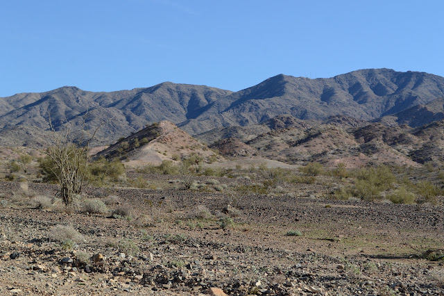

The road drops off the ridge it was traveling. There are plenty of roads staying high as I was starting to expect the main road to do, but the one dropping has definitely had work done. I follow it down into the wash below. It tries to stay high relative to the major flow of water, but it is basically in the wash. More roads go off to the side, but they have to climb over the bit of berm created from the main road.

Then it happens. There are a couple of geocaches off on another road and one road up to a defunct mine seems as good as another road up to a defunct mine when I'm looking at a map that has them coming into either side of, but well below, the peak I want to climb. And the geocacher lures me with promises of waterfalls that it is well beyond. Sure, it'll be so dry it is questionable it could be a waterfall, but it could still be fun to look at. So I go that way even though it clearly isn't the main road.


From the waterfall, roads lead up both sides to join at the top and continue along the wash. I would again take the other road, but the geocache I seem to be hunting up past the waterfall is on the one to the right and a mine is further up which I might as well see.

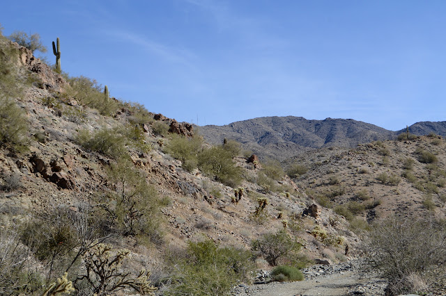
And from the mine, well, I've already gained a bit of elevation, it would be easy to climb up to the ridge there as well as anywhere else. The ridge has a road along it, according to the map. I can see some reasons not to believe in it, but there should be something travelable up there even if it isn't more than an old fuel break. I can't seem to spot any of it, though. I am now headed away from the peak as I climb and although I know I should give up all this elevation and just start up in a different place, up I go, bullheaded as usual. Hey, it turns out there's more to see of the mine up above and east of the first hole.


At the top of the ridge, there is a remnant of a bit of road. It is in support of a fence line and doesn't really go anywhere. There really is only the fence line and even that can't be bothered to go along the whole of the ridge line. As I reach a bit of rocks, it is simply tied off to one of them and I can pass freely from one side of the ridge to the other.
So I get on with traveling the ridge. I can't be too far off, I can hear the generators for the antennas spinning away. Traveling a nice, flat wash would have been much easier and then I'd be at least two humps further along once I hit the much higher ridge above that wash. The fence reappears and I have to decide which side is easier to travel. It is clearly aged but has held up well, so crossing it would be unpleasant.
There are more mines to be found. Off to my right is one with a road up to it. I can't quite seem to follow the road down to anywhere or find it further down. It might not go very far anymore. The map calls this the Jupiter Mine and there should be a spring above it somewhere. It is not so far off, it could be explored, except I would really like to get up to the peak by 3 if at all possible.

At one saddle, I think there is a fire ring, but then notice that someone has been painting the rocks silver and even left the brush. Odd thing to do, but I've seen it before to mark a surveyor's mark. There doesn't seem to be anything within this circle, though. I keep going. The bumps keep getting higher and now the seem to be crowned with more substantial rocks to make passing over them harder.


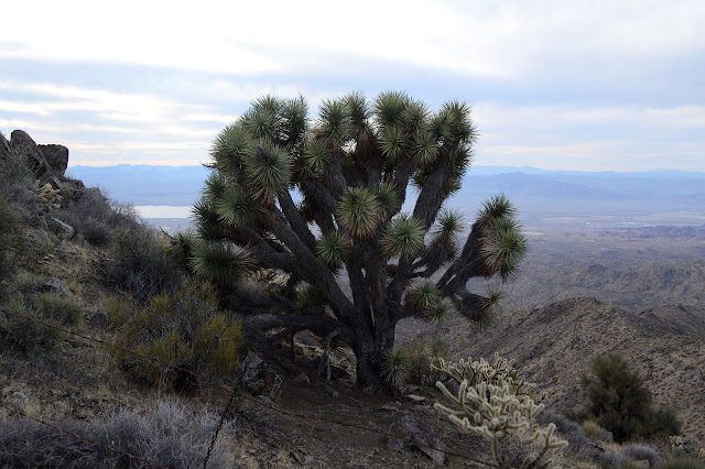
As I get to the last big saddle before the actual peak, there is a trail. It comes up from the wash below and is faint but distinct as it makes a path around the last bit of rocky outcrops. There are no ponies up here to make their fine trails, this one was done by people. They snipped the fence when they got to it even though it ends after a couple more posts. There actually are a few campfire rings and a rock wall against wind at a sleep site. I'm not sure what they might be burning, but they left the joshua tree.

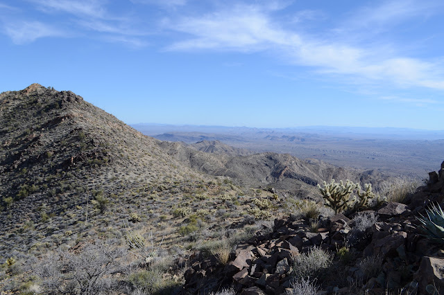
The people trail proves difficult to follow, too. They built cairns to mark it some, but when given the choice of it or a deer path going more up, I seem to go for the deer path. Both force me to make an acquaintance with cats claw. I can see the road tracing a path up the side of the mountain to the nearby towers and actually do have the resources to see that it connects up with the roads I came in along right where I started down the lesser road. I can see it well enough to know that it is a proper Jeep trail without enough room for hairpin turns, so the driver has to back his way up along 3 or 4 sections. That helps, because it is now quite a bit past 3 PM. My route stumbling into more sheer rocks than is strictly required finally brings me around to the top. There should be a benchmark there, but there seems to have been a structure since then and now there are old posts.

There is a register, although how long it will last in a reusable soda cup with the straw hole partly blocked with aluminum foil is questionable. There is no help for it from me. It is getting colder and the wind is picking up, so I try not to stay too long.


The clouds are making a bit of a false sunset, but it will be quite late when I get back. If I had more time, I might try to follow that trail that came up at the last big saddle on down and see where it goes. Since I don't, I want to get to easy navigation as quickly as I can, so follow that more distinct path down to the generators and antennas. More fence trimming has occurred along it. It is still quite incomplete even without taking into account the help it has been given. Whatever its purpose was must have been largely symbolic. The trail delivers me to the antennas with a little bit of a rock scramble here and there and the road delivers me down past the defunct mine it once served (or some approximation of it) and into the washes below.


I am down in the wash before it gets dark, but not to where I have been before. I would have felt better if I was. Just past the gate is a guy showing off his new four seat ATV to a friend, so if I really wanted to I could probably get a ride. The canyon, what I can see of it, is full of rocky loveliness as it takes me where I expect it to. The walking is easy enough to do by the light of the 4 day old moon. The walk back is a lot quieter than the walk in, but I am not quite the last one out.
©2019 Valerie Norton
Written 14 January 2019
Written 14 January 2019
Liked this? Interesting? Click the three bars at the top left for the menu to read more or subscribe!


Comments