Abajo Peak
Manti-La Sal National Forest
Click for map.
I decided next up would be Abajo Peak, the high point of the Abajo Mountains. It was an easy choice. I'd almost tried going for it with my previous loop, but didn't want a 20 mile day. I figured it would add about 6 miles to that loop that turned out to be quite a bit longer than expected. I've got another cobbled together route for this one. I mean, I could just drive up it (depending on the quality of the road), but who wants to do that? Instead, I've traced out some ridges for a cross country route up and then trail and road to come back down. The road, 4WD on my map, actually looks in good shape and is marked by a horizontal number. I think I could drive it until the trail portion and make a much shorter day of it, but then there goes my cross country challenge. I'm kind of set on the ridges now, besides I sort of expect there to maybe be trail that way. Surely the locals like the idea of going up the local high point, but not just in a truck. Oh, and I thought I might actually put on my orange cap today.

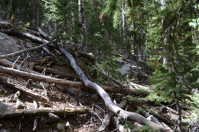
My original plan was to actually go up about a mile where there is a ridge line that, for not real reason, I expect there could very well be trail, but I am quickly distracted from that by an unexpected bit of road that could be going up to a fuel break. It is good enough that I could have driven it as far as it is still used, but then it quits at a camp site. I should have known. Old road continues on, maybe going to the campground that is a quarter mile or so down the pavement. There is a little bit of something like a fuel break going up from it, but it must just be people playing with their ATVs because it doesn't go more than 100 feet. From there, there are trails, but they are from cows and more interested in going along the slope than up it. I am on my own to get up this slope and sometimes the forest is quite thick, either with shrubs or fallen trees. Or both.


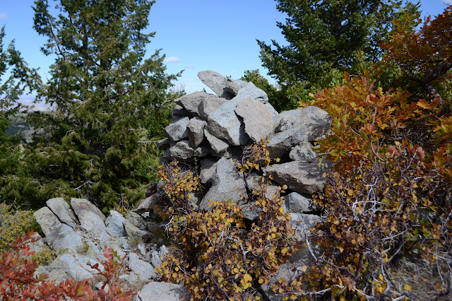
It takes a lot of work and a lot of time to get that first mile or so to a minor peak marked with an "x" and an elevation, AKA a recoverable survey point. I'm surprised to find there is a cairn built at the spot. That's more than there usually is.

Or maybe I am misinterpreting the cairn, because there is soon a second on a tiny rise of the land and this one even has some debris of the sort surveyors seem to leave about the place.
The climb of the ridge relents for a small saddle which seems to have some nearly unused road up it to give the local cows a pink salt lick. I always wonder what heavy metals are making it that way when I see funny colored salt. Now I'm wondering if the beef from these cows gets marketed as somehow better because they got funky salt. There are a few cow trails again sort of going my way as I climb again, but again they vanish when I need them most. This time it is a dark bit of forest as the slope gets steep and large, jutting rock outcrops start popping up among a larger than normal amount of fallen trees.
And then suddenly there is a trail with the logs cut through. Well, the older ones anyway. Should I estimate its age by the faded Dr. Pepper can beside the cut? The trail is thin, but I can mostly follow it and there are more cut logs frequently to help. It is a lot steeper than would be officially built and one switchback is either a junction or missed quite a lot. Since I do catch it, I'm able to follow it past a prospect, game camera with a fat antenna on it, and then some more surveyed points with no monuments except that someone built cairns. That's three possible culprits for this trail. I expect the prospector came through first, but it does visit the surveyed points very closely. Anyway, I don't have to fight (much) of the forest any more to follow the ridge.
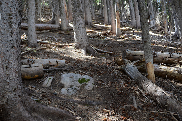


There isn't much climb left until I reach a power line noted on the map, but it is still nice to have the trail which just keeps on going in nearly good repair. Meadows with their competing cow paths and a spot with heaving fallen trees both present a challenge, but I seem to be able to pick the right trail or find the new trail emerging after the old path has become obscured.
Nothing is left of the telephone line except some cut telephone poles still offering the smell of creosote to the world. There is still something like a road and since there are still antennas, I expect there is a buried cable. Sometimes a not so buried cable. And there are footprints. Someone has traveled here recently. Maybe whoever left the truck at the top.
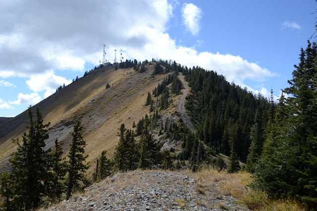


Then it's a little bit of good road to the top among the air conditioners and warning signs of high radiation and, on one particular building, threats that loss of life could result from tampering. That one belongs to the FAA. I don't hold much hope of actually finding the benchmark up here, but almost against the side of one building is reference 3 from 1963 and a little further off the side of a propane tank is reference 2 from 1936. They point out into the middle of the gravel where the station is long gone, as is any replacement.

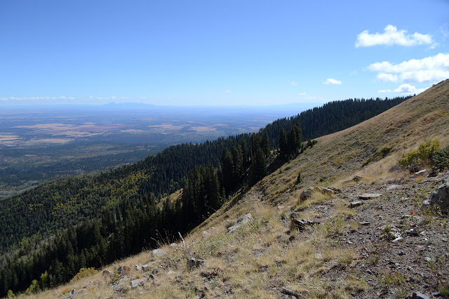
Past all that noise is the new view. I found the bear's ears!


The route down along road and trail (which turns out to just be smaller road) is longer, but it'll be a lot quicker and easier than the way up. The road looks good enough to drive in my small car right now. I expect it has just had recent maintenance and is not usually looking this good. It takes me down the other side of the mountain and then the "trail" takes me across that side through an old mining claim with survey markers from 1987 at its corners. They hill is terraced and the ATVs that take this have been taking the "wrong" one and then climbing directly up a minor ridge to get to the "correct" one. With all the loose rock, I wonder how they make it up.


When the trail hits the trees it gets even crazier. It twists all about as if just hoping to find a way and as it doesn't match what's on the map, I start to wonder if a thin motorcycle trail off the side was the trail and this is just a bunch of ATVs that didn't want to be left out. A pair of hunters coming up the trail pause to talk to me. They use library whispers, which I just can't quite get used to out in the open. Their musket loaders seem to be modern marvels around a clunky ancient base, but I guess they can have everything except riffling and breach loading. Maybe riffling is allowed? They comment that they're amazingly accurate these days. Besides them, I did heard an unconvincing elk call while I broke twigs in a dark bit of forest. I gave a shout out of, "Oh, really," to the caller and it wasn't repeated. Their ATVs are parked at the road.

The road pops out at the divide between Monticello Municipal Watershed and Blanding Culinary Watershed (er, what?) which demands people "do not pollute water" and "no camping". Well, the Blanding side says "please". When the cattle guards are there to keep the cows out rather than in, I'll believe they mean it. This is the road I am parked along and up here it still looks good enough for the little car to drive. I briefly ponder going ahead and taking this Scenic Backway which is going my way when I leave the area, but everything recommends high clearance. I turn down for some very smooth sailing to the bottom although everything traveling it is, indeed, high clearance.

Weirdly, there actually is a trail climbing up about the place I had originally picked to start up the other ridge about a mile up the road. I have no idea how good it is or how far it goes, but it certainly gets away from the graded road. A little further down is a road that seems to go a bit long for a camp site, but that doesn't mean it's not. There are quite a few camp sites along this road, some on very long roads, but none up at the saddle where the sign says no. I actually walk a little of the last half mile or so along a road paralleling the main road with a few camp sites along it. I follow it at the hint of a geocacher, but the geocache itself turns out to be in an occupied area. Well, probably not occupied right at this moment. It's obviously a hunter camp and there are three deer grazing in the grass less than 100 feet off. It is quite a funny sight to see.

*photo album*
©2019 Valerie Norton
Written 22 Oct 2019
Liked this? Interesting? Click the three bars at the top left for the menu to read more or subscribe!


Comments