Sliderock Mountain
San Juan National Forest
Click for map.
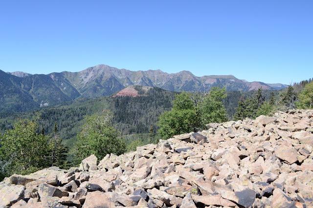
Out for more exploring, I went to drive out to Cemetery Flats and see what happened. Unfortunately, the road was a bit too rough by Rands Point, which is to say I'd already driven over something I probably shouldn't have and decided to park before I did it again. There's plenty of parking there although at the moment it is take up by a bunch of hunters studying the far side of the canyon for elk. I haven't seen any since the bunch on Endlich Mesa, but hunters sure are easy to spot. Well, these aren't trying. It's quite some view from Rands Point.


I wonder if I want to go up Cape Horn on the way to Cemetery Flats, but decide to just walk the road. Another hunter, bow in hand, is sidestepping his way down a steep bit. They really are much easier to spot. There have been some deer on this road, so there is something for them if they've got the right tags. At the next saddle, the old road went left and the current one goes right, so I follow the old road up to Cemetery Flats. People have kept it open as a nice camp site, but only for the tougher vehicles. I look around for signs of a grave to give it its name, but I'm not sure where exactly that sort of thing might be. None of the maps I have indicate where and the long grass and tall asters would easily hide such.
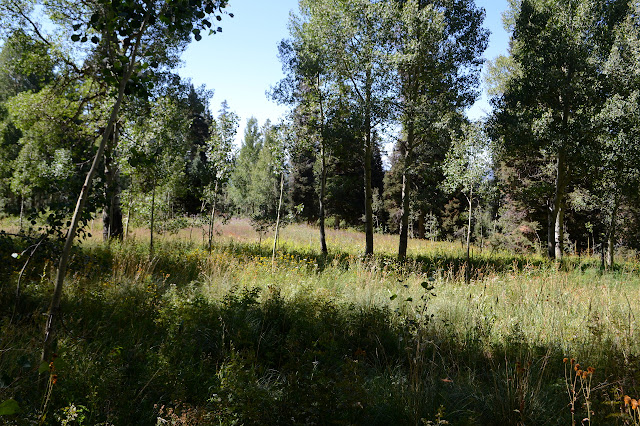

The old road continues, so I go with it. ATVs have been pushing their way past a barrier, but they stop at the tree fall. I have no difficulty with the trees, so follow it to the next saddle where the new road was cut into the old one leaving it inaccessible even to the ATVs. The saddle has a grand view and, of course, another camp site.

Sliderock has a benchmark on it, or so the map says, out in the middle of a large bald patch. I might as well go for it. If it is just as nothing as the one on Barnes Mountain, at least I get lots more view. There is a very distinct trail with cut logs out the back of the impacted camping area, so maybe I even have trail. Trouble is, after climbing a little way, it pushes around to the side opposite the road and starts traveling in a level way along it. As it takes this turn, a pair of aspens have taken on some carvings like "NF 01" and "no luck 14". A hunter trail rather than a peakbagger trail, then. Maybe.

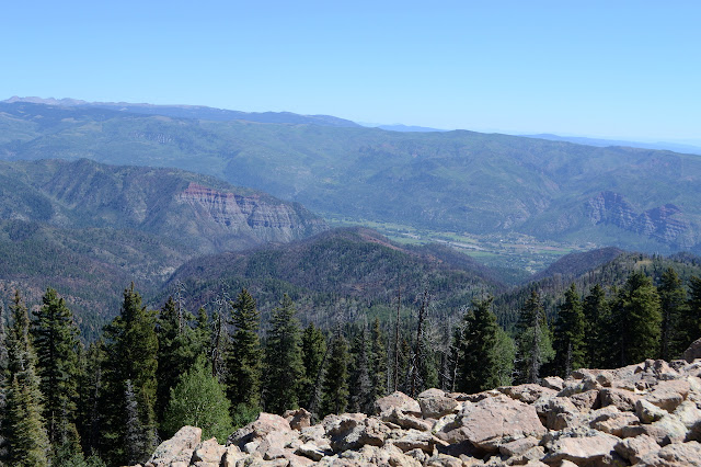
So I turn back and start up the steep hill. There aren't even animal trails to help me most of the way and the bushes seem determined to push anything coming up the hill back down. I avoid those. A section of southeast slope seems devoid of them, so as long as it doesn't get too steep, I have a path. Above, there really is a vast area of cleared area because it is too rocky even for trees to take hold.
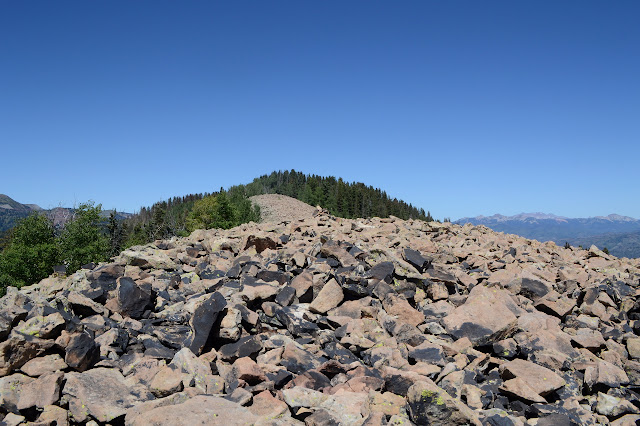
The view gets better with every step toward the indicated spot for the benchmark. This one is there, although it is just a metal stake with a triangle and USGS in the top. Toward the other end of the clearing is a piece of wood, honed and resolutely placed vertically like some much older mark.

At the top of the bald spot is a long pink ribbon labeled "escape route". That makes no sense to me. Someone thought this would be fun ribbon to use? There is more, and more cut trail, so I might as well explore further. Someone has certainly made it easy.

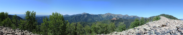
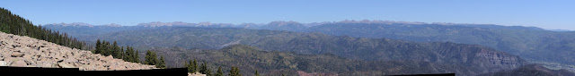
The trail breaks for a meadow, but the high point should be up ahead so I climb up through it to find more trail at the top. It goes right over the high point, which contains a register with quite a lot of folks who were working the 416 Fire.
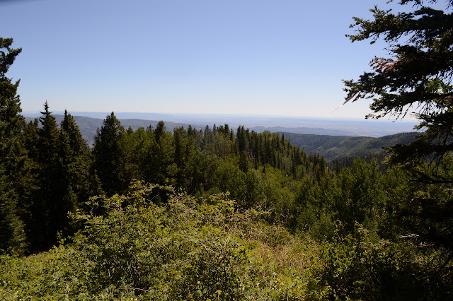
The ribbons continue down the other side. Okay, onward through the trees. They let out at a massive fire break where the far side trees have burned and suddenly it makes sense. It's a proper escape route.

There is trail going down the hill, so I follow it. I expect that trail around the side of the mountain should connect up with this. Unfortunately, I don't know how far down it will intersect. The trail going down devolves into a thin dry creek. I probably won't be able to notice the when it does. The fire jumped the break and there is evidence of fight. Maybe I could follow down near the break where I would be more likely to see the trail? Not that I know it actually comes this far. Maybe I should go back the way I came.

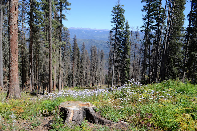
Getting back down the hill is much easier. Those bushes pushing down are no resistance when going down. Back at the cut trail, I decide to test out the cut trail that now I suspect will really get to the top of the mountain even though I would never have stayed with it long enough to find out. Just to be complete for all 15 of my readers. There are a couple trees down on it, but it was presumably cleared just 3 years ago. It's a nice and easy route all the way to the fire break. Someone even cut a single blaze for it once.


A meadow offers the greatest potential for the trail to vanish, but it doesn't. It must be getting used for something. I was right, I would not have recognized it while coming down the fire break. A jumble of logs make it hard to see although the route itself is clear.

So back I go. The carvings on the alder indicate this trail is a bit older than the fire. Besides the "no luck 14" carving I first say, there is a 1982 and a couple 1935. I don't think the trees they are on are that old, though. Anyone can put anything on a tree if they've made up their mind to hurt it like that.

Then it is back along the road. Lots of berries line it. Looks like it wasn't a very good year for them.


©2019 Valerie Norton
Written 21 Sep 2019
Liked this? Interesting? Click the three bars at the top left for the menu to read more or subscribe!


Comments