Parrott Peak and Madden Peak
San Juan National Forest
Click for map.
No difficulty in getting to the hike I have planned for today. It starts off right across the road from Miners Cabin Campground where I'm staying. (Which is free and has a bathroom. No tables. For that, you've got to pay at Snowslide.) My plan is basically to go up an old mining road to Lucky Discovery Mine, then make my way up to Parrott Peak. From there, continue on up the ridge to Gibbs Peak, which looks to be about where the ridge starts getting rather complicated. There is a prospect high on it that once had a bit of road that connects to Allard Mine, which still has a bit of road down Bedrock Creek about a mile up the main road. It has quite a nice waterfall right at the bottom and enough red rocks to suspect it is actually Redrock Creek. I'm not tied to this plan, though. Judging by the amount of ridge line I managed on Lewis Mountain, I will not make it anywhere near Gibbs. My main goal is Madden Peak and the benchmark up on top with a distant hope for a county line marker since it sits on a county line. There could be a forest marker too. Although now it is all San Juan, the monument description says the other side used to be Montezuma National Forest.

There is a road with no markings right where USGS puts the road up to the mine, but a little further along is a road signed as "Madden Trail" which just seems like a sensible place to start if you are going up Madden Peak. It is immediately apparent that this is not the same road. It goes up and sort of parallels the main road in the opposite direction. At its first turn is a trail with a very old cut log not too far from it. I stare at it feeling exactly the same thing as when I stared at the trail up Sliderock Mountain that would have given me an easier time of getting to the top had I given it a chance. A little more quietly is a voice of experience with such things saying, "Oh, yeah. Peakbagger trail." With these two notions suggesting I should go for it and I'm clearly already on a different route than I started out for, I go for it. It does take a few minutes of staring, but I resolve to really give it a chance. So long as it doesn't drop down to the creek below. I'm not trying to get to Madden Creek. I want the peak.

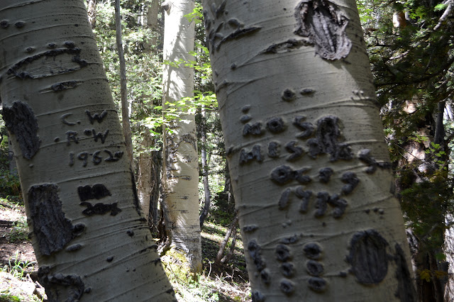
The trail looks to have light but long and constant use. It is enough to make it distinct from the cattle trails that come and go. It seems distinctly human in ways besides the fact that every 6th aspen tree seems to have some carving on it. I know I'm not the only human that can resist this urge to mark aspen trees. Some high up symbols reoccur and I note that one matches brands I have seen on the cattle. But this trail looks like it's had McLeod work on it in the last few years.


The sign tacked onto a bearing tree gives one possible explanation for the trail, at least at first and up to about here. It has a distance with no units. I have seen some of these quite far off, but usually they are close to their subject, so I glance around. There it is. A survey crew came up on this trail, either building it or using something existing, and placed a marker here. The marker, presumably placed vertical has slumped with the hillside and now sits horizontally. If that was the last of it, the trail would have vanished from this hillside, but it is in good repair. It marks the corner of a property marked on my map which I have just finished edging along. There is much more to this trail than that. I turn to follow the much more.

It starts to drift downward and keeps wrapping around the mountain where I would have turned and climbed (I suspect) were I going up the mountain. Maybe I've done all that climbing as extra work. But how important is it to "get to where I'm going"? This time, I'm going to stick with it. It finds a bit of road to follow briefly. The road splits and I study it for a while to see which way I "should" go. Trails do both, but the main one... continues straight. Not that it sticks with the road much longer and instead takes a steep climb up the hill. Then, for a stroke of luck, there is an actual hiker coming down the trail. That should be someone who knows. I pull in a bit of courage to properly talk to someone and add "Where am I going?" to my hello. This will continue on to Gibbs Peak. He insists it is a bear trail. I insist it has some distinct hallmarks of a people trail. I'm not sure of all the clues I am picking up on, because there is something about the tread, but the way when it passes pine trees closely, all the branches on the trail side have been broken or cut to head height is a dead giveaway. As to other routes, he mostly says, "Yeah, you can do that." He hasn't done the road to Gibbs, but he shared the peak with someone who came that way. He keeps insisting that you never see anyone on this trail in rather stark denial of the evidence in front of his eyes.

He leaves me with some things to think about. Shall I continue up to Gibbs? (It's 4.8 miles bottom to top by this fellow's GPS.) It is the taller peak and therefore a better prize by some standards. There is trail all the way up and here I am standing on it. It does sound like it gets a little scrambly at the top. There is still a way to return to my original route, more or less. The old road also goes out to a mine that is about 600 feet away, so if I go check that out, I should be able to follow road over to Lucky Discovery. Well, I do want that benchmark and to at least glance around for other, unadvertised, marks. And if I go up to the mine, then I can check it out. So up to the mine it is.

I have to invent my own way up to the mine where there is a choice of roads. The one leading down probably connects with the road sections below. I go with the other, which is easy enough to follow. There are trees down across it, but my travel is not blocked by them. It has been purposely blocked to vehicles where it reaches current road next to a big bowl of land. The bowl is somehow not filled with water although I see no drain. Instead it has that thing so rare in Colorado: big trees!

The current road comes in as mapped and heads off again in a new direction. I try it a little, but it turns determinedly downhill. I think maybe not. Back to the plan heading to Lucky Discovery Mine. The road is distinctly different where it is mapped and where it is not. Actual building went into the mine road, but the new one may not even have seen a bulldozer. It is just pushed through where there is space. By the numbers at the junction, I am coming back along Madden Trail and Lucky Discovery is up a spur. Maybe I should have kept with it. It wasn't inspiring confidence. This way is much nicer although there is a spur of clueless people trying to get to the mine from below and another legal spur heading down the mountain, I know not how far. Someone has knocked down the sign for it even though it is granting them permission to go. Then it stops on top of a huge pile of tailings. I have arrived at the mine.
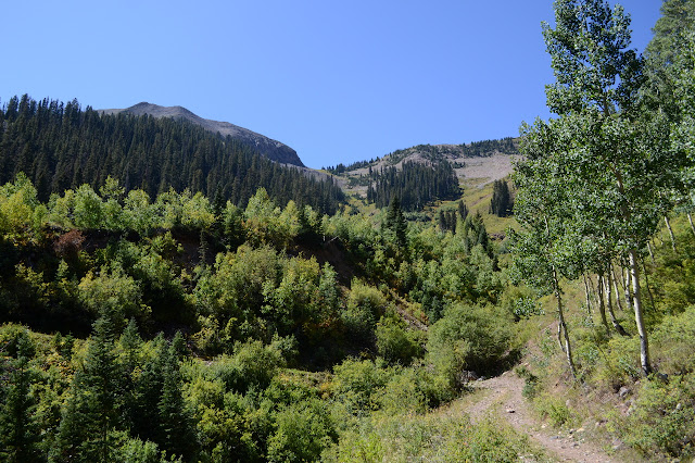


Road actually continues past the tailings, but it is a lot rougher and crossed with trees and rock fall. Some goes down to the tailings I saw on the left earlier. Some climb. I climb, and when it splits again, I climb again. It doesn't go far before ending in an obvious prospect. So these roads represent further exploration of the claim. Well, I knew road would run out. Then I want to go up, and if up is too steep, I want to shift to the left. That appears to be less steep and will meet with the ridge line sooner. The ridge looks like a good way upward. The only problem with this plan is that if it is too steep to go directly up, it is probably far too steep to slide to the left. Should I climb along the avalanche chute or the forest? The edge between seems the least full of downed trees or low brush, so I go for that. I almost go for an animal trail that seems to be climbing a couple times and then there is something much better. Prospector trail.
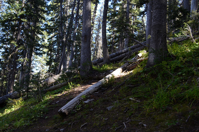
The trail looks unused in recent years, but the old tread is still solid. Blazes and downed trees were cut, but there have been a few additions. Unlike the animal trails, it has a distinct climb to it. It brings me to the ridge and then seems to vanish. The ridge is exactly what I expected, forest coming up one side and meadow on the other.


As I hike the ridge, there is some evidence of a trail after all and maybe even some sparse modern use. Then there is a prospect. Only reasonable when following a prospector trail. I think there's more trail down in the meadow coming up from Snowslide.

The trail up from Snowslide heads up to the other ridge, which turns out to contain some sort of building. Based on various things sticking up, my guess is another weather station, but this one gets manned. There is another prospect, always another prospect, before everything gets rocky and steeper. The final approach to the peak is an easy walk across the rocks.


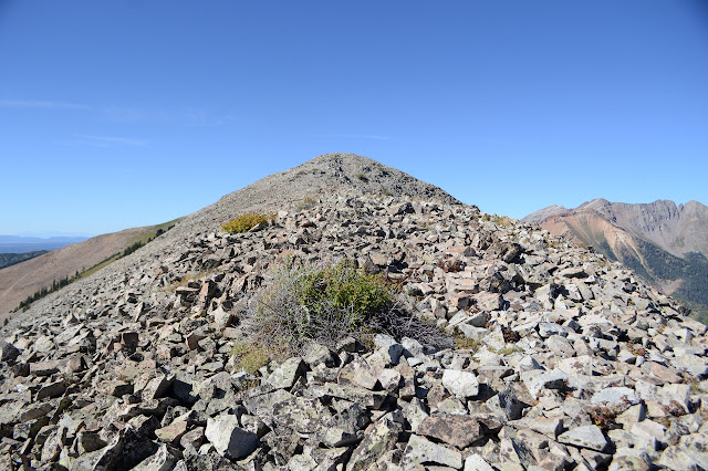
Then I'm at the top and can take in the view all around including the ridge line ahead. It's not bad. I can see all the way down to the river on both sides and a long way up.


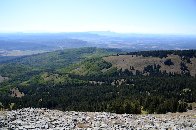
I remember that rather abrupt down turn the ridge line had on it when I was looking up before, so continuing along it has me a little worried. There does seem to be more trail that way. Then, of course, another prospect. It's a little harder to be sure among the rocks, but the hole seems odd. Below it, there is a trail that has probably had some work go into it. It winds through the steep rocks on the back side all the way down to the saddle sorting out any troubles navigating that slope might have had. I think I see more trail crossing the hill side below Madden. Going up Madden is just a long walk. It has more flowers than I was expecting so late in the season.


There is a lot of top to Madden Peak. There is a register tucked into a large cairn at one end of it and the benchmark on the map at the other and, to my sense, the high point in between. Unless that cairn was placed as a marker, there are no county or forest markers up here. The reference marks seem to have a funny history. The original placement looks like they weren't that far apart, but then someone reset reference 1 somewhere significantly different. Or so they say. I can find reference 1 and an old setting a few feet from it, but no sign of the reset. And there's just a bit more view.

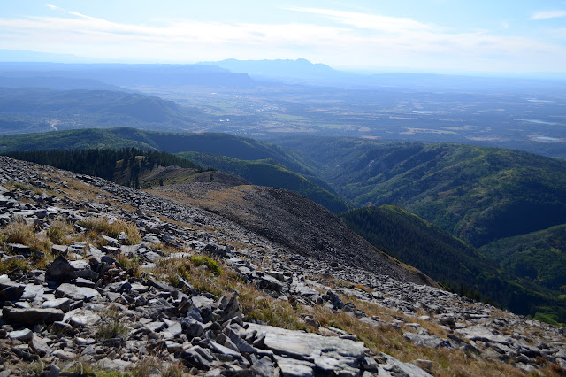
Considering there was pretty good trail and then nearly a stone walkway to go from Parrott to Madden, my time up was awful. I haven't got anything like the time needed to continue all the way to Gibbs and even Star could leave me up here at dark. I can still go down the other side... or not. There are more prospects and even a claim marker on the north side of Madden, but the trails I see are going west. The slope I can see on Star is really quite steep and there was that trail on the other side. And I could enjoy the wildflowers once more. I turn back and climb over Madden again to the south side.


Just getting to the saddle again doesn't get me onto the trail. As I start down, there is a somewhat more scrambly trail instead. Memory says a little higher on the north side, so I try that and find something that has not been used in a long time. For reason? The place is too full of hikers for it not to be. I try it anyway, slowly realizing that it is most likely to fail where it is most needed. It gets thinner and thinner before getting into an outright slide area. Climbing out into the slide is not just hard, it lacks any insight in where the trail might have got to.
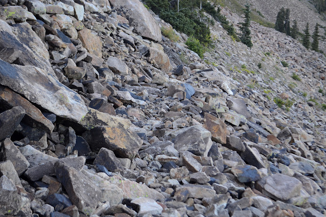

I start back up watching for maybe a missed switchback. I can't see one, but I do see something I'm comfortable with taking, so down into the rocks. An LED flashlight in the form of a lizard suggests someone else has passed this way. Cute, but maybe not something to leave on the mountain side. Another section of trail looks more promising, but runs out at a claim marker.
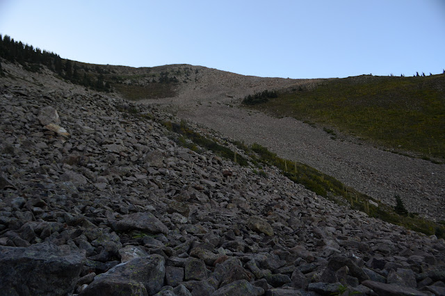

Spotting tailings looks promising. Those will probably have a road to them. I make my way to them and across to the road. It is real. It is also cut by some massive slides and then just sort of fades, at least as far as I can tell without first navigating the slides. I circle back to find a little road, but it doesn't go anywhere. Whatever. Down. Except it seems to be getting steeper and the footing worse. A thin creek has washed away all the loose stuff. It is a gamble, but I take it. There is not enough water to wet my feet. The sides are generally too steep to get out if there is a drop off. The deer show me the way when I might want to get out after all. Deer are good like that. On it goes. This, "Ooh, there's a trail there," is not working out as expected. Mine gets brushy, so I cross over to another that is better in every way as the land relaxes its slope.

Suddenly there is a massive buck thundering along the hill away from me. Flattened weeds imply I may have disturbed where it was trying to bed down for the night. I usually get rather worried about animals that haul off like that, but I heard a musket shot in this valley on the way up. I'm sure that deer would have made whoever that was really happy. Maybe not enough "points" on its rack.

A road comes in from my left, maybe from those tailings after all, probably from something out north. It has use trail along it, so I'll have an easy way the rest of the way down. At first I think it'll tuck into the system I started up, but it drops down before the end of the road instead.
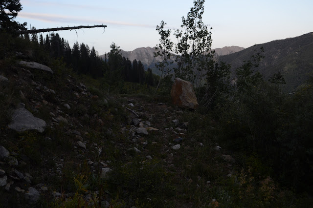
Even easier once back on the active road. I just hike it as it comes, taking the way down at the junction rather than retracing my steps. As the sky darkens, I watch the alders as they pass and the spaces between them. The road gets rougher as it goes, often with erosion problems leaving it a slanted mess than can be hard to walk. I pass an active mine. Maybe that's the reason for it to go a different route than on the map? It's not too late as I cross the road and cut down the hill to camp.
©2019 Valerie Norton
Written 13 Oct 2019
Liked this? Interesting? Click the three bars at the top left for the menu to read more or subscribe!


Comments