Newspaper Rock and Indian Point
Newspaper Rock State Historic Monument
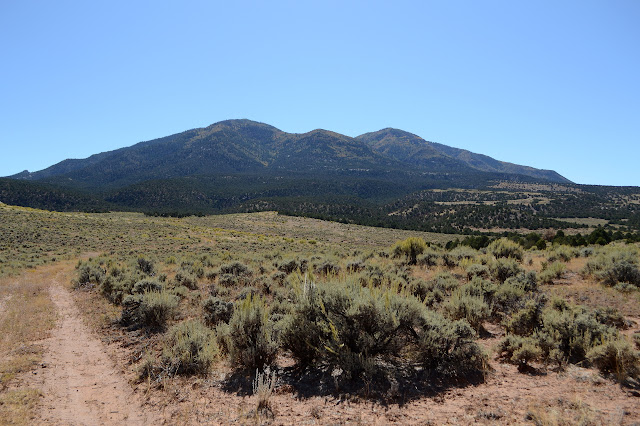
Indian Creek SRMA, BLM
Click for map.
I have been to Newspaper Rock before, but it was a rather long time ago. It was probably about the time my dad got his 4x4 pickup truck and decided the family vacation would include Canyonlands where he could take this shinny new truck over Elephant Hill and up (likely down) the Silver Staircase and out on the Island in the Sky to see the confluence. I recall that last one not having such a bad road in and there's a paved option of sorts. I also remember one road in The Maze where a little white Corolla came up out of a canyon and we got to the top and my dad hit the brakes and perched there for a bit before deciding it probably wasn't deadly and putting it in 4-low as though that would save us if it was. Then again, I seem to remember him doing something similar in the Bronco with its push button 2WD-4WH-4WL changing and feeling like a button with a light was not so settling as a proper stick. There were multiple trips to Canyonlands. At least one of them included a stop at Newspaper Rock. Still, it's just down the hill (and free to stop at) and I might not remember it in all its glorious detail. And I found a little hike to do with it. Anyway, most my pictures went missing at some point in his basement, so there are no little squares of rock art or of the brown Green River mixing with the clear Colorado. I'll probably not fix that second any time soon, but I can have a look at some rock art again. The parking and other improvements all have a distinctly BLM flavor even though this is apparently a state owned area. The kiosk is full of BLM publications and refers people to call the local BLM office if they have questions. I give the map a good glare, wondering where else I should be pausing before walking past to the trails forming behind it by people who can't seem to read because I've just committed the same sin.


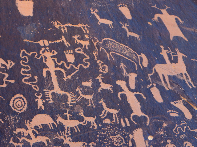
My eclectic map suggests the rock itself is on the other side. So does the kiosk, in really big letters with three even bigger arrows since symbols sometimes help when dealing with the illiterate. Following the sidewalk to a much more developed looking trail gets me, in very short order, to a large rock surface with dark desert varnish and a whole lot of petroglyphs that have darkened again to varying amounts. It's quite busy, but not in the way I was thinking so not the one I was thinking it might be.


So that's the sightseeing for the day. Next I want to climb the nearby high point marked with a benchmark right at the top. It looks a bit like I could circle around to the right to find a suitable slope to head up, but I've got a rather long route around the other side to check out instead. A road passes up a canyon and a smaller one goes around the back along the higher mesa. The road is down the paved road a little way just past a cattle guard beside a very large cottonwood. The canyon has quite a lot of bullet holes high on the walls on the way.


I have my eyes open for any sort of signs along the way because there seemed to be a "for sale" sign a short way up the road on the other side of Indian Creek. There must be some section of private property with a right of way for the road because I do eventually pass signs declaring that behind them is public land. It comes just before the road turns from the larger canyon of Indian Creek to a small tributary to climb to the top of the mesa.

I quite like the blind arches the rocks are showing around Indian Creek as I climb. Their curves are delightful. The tributary canyon seems plainer in comparison, but still has something to offer.


Then up on the mesa where BLM has left an information sign that looks like some conference poster about how they are restoring the watershed by thinning and chipping the pinon and juniper that have encroached upon the other communities over the last century, doubling their area. They've checked it out with historic photographs. Of course, there's no one here now to defend this poster, so I can't ask how much ground the pinon and juniper lost when the ranchers came in and likely started burning them well over a century ago. Not that that was probably what really lost out. I have heard tales of sweeping grasses that covered much of the land and made it look like prime grazing area. Unfortunately, the grasses had a delicate foothold and a couple years of cattle trampling and ripping them left them unable to hold the soil they depended on in place, so the soil went and the grass went. The area here were getting reseeded with sagebrush and such and given a couple seasons rest without cattle, but the grasses will need far more than that.

The smaller road I am looking for is indeed small. The tracks are fading from the land which doesn't let such things go quickly. Still, I know I have found them because they go past the corral that they're supposed to go past. The fencing on it is double the normal height. That might even be tall enough to corral deer. A second part has been left at the more normal height. Indian Point still rises above it all just ahead.


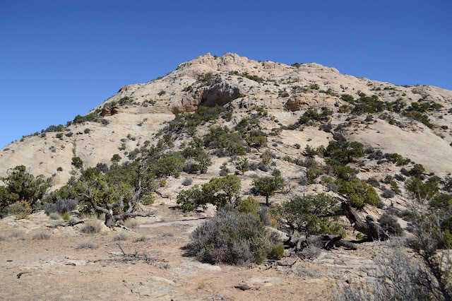
Getting close to the little peak, it is tempting to shortcut toward it, but there is no reward for that here. Little canyons cut around the sides so that only the one long rib is connected with the top of the mesa. Anyway, there's quite a lot of biological soils and they're pretty near impossible to avoid while the rocky rib has, well, rock to walk along.

Some have left cairns as suggestions of how they think I should find my way up. I must agree with them because I pass a couple while not trying to follow them. They vanish in the second half of the climb, so maybe I go "wrong" afterward. It seems quite alright to me. First hang a strong right, then clamber a bit left until there's no more up.


The benchmarks I am looking for seem to be a pair of reference marks set in 1953 that triangulate to a spot that looks smoothed by many a trouser rub as people scooched themselves down from the very top. It isn't that it's scary to stand at the top, just that it is tempting to sit there and then just shuffle off when done. I sort of expect a triangle or circle with a dot and "BM" next to it carved into the sandstone, but if so it has been rubbed away.

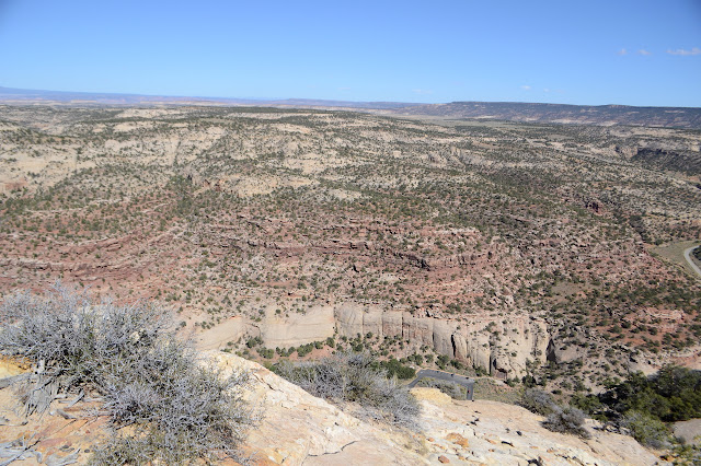
I'm very near to where I started, and yet the perspective is entirely different. This was one of the prominent white domes in the foreground when I was looking down from the Harts Draw-Canyonlands Overlook.


I find my way over to the lower peak on the south side of Indian Point before retreating the way I came up. Pondering the canyon starting to split the point away from the mesa on the north side, I think I might go down that way. The trouble is, there seems to be a ledge that circles it just high enough to prevent me and further down a second is visible. I suppose I will just take the long way back, too. It probably isn't all that long in time. Just a couple miles and all of it easy walking.


This time I notice the survey marker of sorts next to the "corral". It gives a clue about the structure: it might be project #272, Shay Mesa deer exclusion. It's to keep the deer out. The lower one just keeps cows out. The marker is dated 1958, so it's been going for a while. I also notice the ruts in the sandstone in a spot of road that the cars have been avoiding. It suggests a bit of history might go with this road. Mining? I had thought I might hike it up to the top of Shay Mountain (about 7 miles and 3800 feet) and I notice some mines are down the other side. Then back at the start, there is a "for sale" sign after all, but on the ground and partly covered. I am having difficulty matching their line drawing with the map of the 80 acres, but I think it might be for the NW¼SW¼ and SW¼NW¼ of section 21 T23S R22E. That's code for the bit I just walked through on the road.


I poke around to the other side of the creek where Lower Indian Creek Trail should start. It certainly looks like road here and there is another "for sale" sign, this one still up. A pretty little canyon, if anyone is looking. Does have a couple public roads running through it, but also water.
©2019 Valerie Norton
Written 26 Oct 2019
Liked this? Interesting? Click the three bars at the top left for the menu to read more or subscribe!


Comments