Highline Colorado Trail, Grindstone, Bear Creek, Sharkstooth loop
San Juan National Forest
Click for map.
I really want to go on the high trail, so I decided to just drive up as far as I could and thumb it and let the chips fall where they may. The chips are definitely going to fall. I have a 20 mile loop planned, which is getting a late start. I will definitely be getting back out after dark and almost certainly not be able to get a ride down. (That's nearly 6 miles.) Up is easy. Everyone is only going about 5 MPH so they don't see much problem with stopping a moment. Unfortunately, I decided to just park where I parked before and then was insufficiently clear, saying "the top" when I meant to say "the observation point", so I missed out on the first ride when they thought I wanted to go up 124A. They don't know I've already been. I would have arrived 30 minutes earlier and 2 miles fresher. Instead, I found a ride up with a wedding party that decided a bit of steep and wet wasn't something they wanted to risk, so they stopped a little over a mile short. (This is an improved dirt road?) But still cool to find someone was going up the mountain to get married today. There's also people out with their paints. I tried to hide my jealousy, but it's my own fault mine have stayed tight in their box.

The Kennebec Observation Site has parking and interpretive signs and one more trail than I expected. None of the signs say where the third trail goes. The markers for who is allowed to use it and the Highline must be switched because it says bikes allowed on its way into the Hermosa Creek Wilderness (only marked by a very small sign off trail) and Highline says no bikes although if follows the edge. A sign below says the bathroom is locked, but it seems to be removed now.


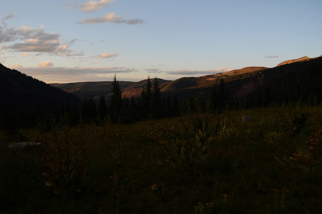
I better get started. There needs to be a lot of hurry for today. Maybe I can get to the pass along Sharkstooth Trail for sunset if I keep more conscious of moving than usual. I still want to take enough time to really see all the bits before that. It's not like I'm here just to move my feet around. The pretty has already started. I'm trying to ignore all the clouds. My two day old weather report gives a 20% chance of thunder and showers in the morning, clearing to slightly cloudy in the afternoon. I am having the idea that since it is already mid-morning, it should already be a little clear.

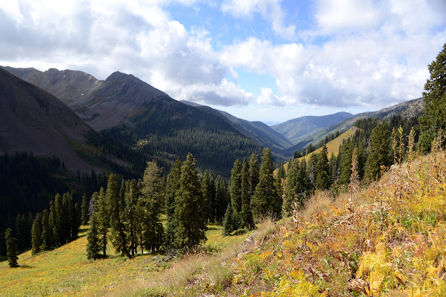
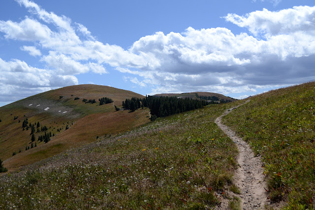
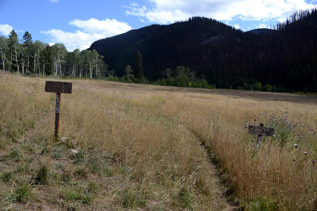
The junction is not only well marked, but has a listing for "entire loop", which seems to bode well for finding trail the whole way around. I sort of really want there to be trail today. It does say the loop is 17 miles and my estimate, which I consider a lower limit, is 18. Maybe there's some other loop I didn't notice. The arrow is going my way, so I go right and climb above the lake to the high ridge line walk that is Highline.


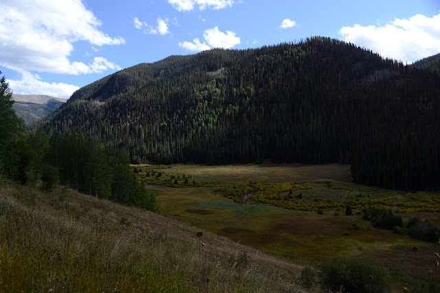
At the top, Bear Creek and its surroundings are laid out below. One of those out there is the Montezuma County high point and the area prize. If looking for the hardest peak to climb instead of the highest, the area prize is probably still one of those. There seems to be yet another weather station up on the peak to the southwest.


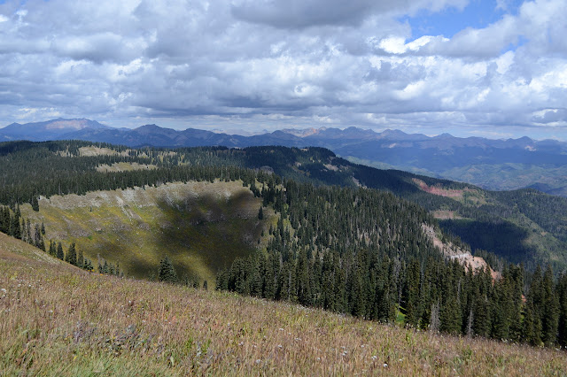
Bear Creek is just part of the view from Highline. I take off on the undulating and generally downhill trek dancing between it and Hermosa Creek. Trail has been here a long time. It was once a major Ute trail and now is marked as Indian Trail Ridge. If only the extra 6 miles at the end weren't hanging over my head and I could tag the high points. They aren't all that much higher, but my tendency to stay a while and enjoy the full turn is contradictory to my unfortunate need to rush or I will have to "enjoy" bits of the trail for the only time in the dark.
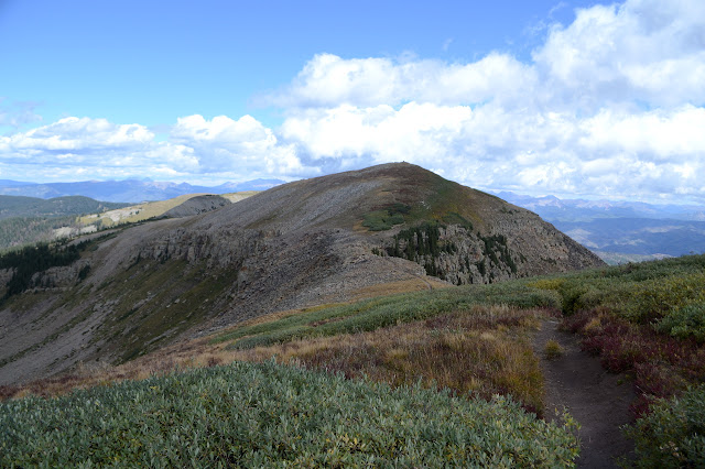

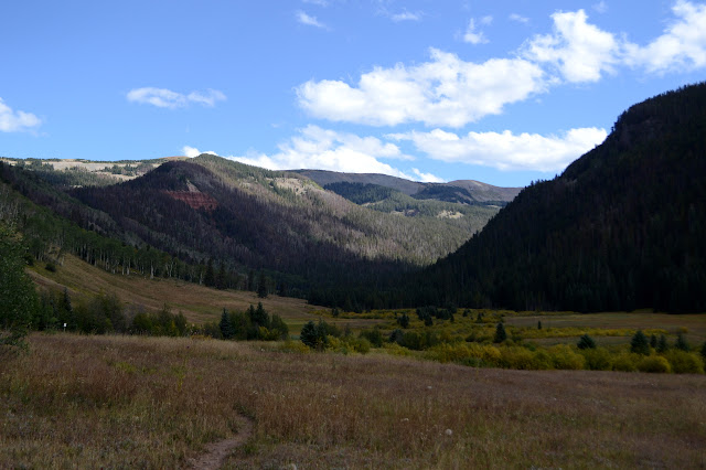
I dwell a bit more on the far ridge to my left than my right. It is closer, sharper, more attracting of attention. Very slowly, there is a gnawing sensation that I'm not giving Hermosa it's due simply because it is sitting back quietly. A symptom of rushing. Across the way, a lovely valley stretches between the higher peaks and Sharkstooth where Sharkstooth Trail enters the valley above where I will catch it. I don't know this yet and knowing it would make me feel more grounded about the route. I don't have time to pick this sort of thing out from the map. Another symptom of rushing.

My junction comes as the trail drops into some trees. It even does dropping into trees elegantly! When I first looked around at the trails of the area, I noticed Neglected Trail along the Cape of Good Hope up ahead and "had" to go there. I just couldn't sort out a reasonable day trip. Or an unreasonable one, as this may turn out to be. On the way up, I assured myself that I could just go out and back and maybe even take in more Highline that way. I even assured my fellow visitors that I could do something more fitting to the time I had and skip looping around. Somehow there is no thought of it now. Of course I would continue around my loop and see those more neglected trails even if they aren't named so. If I want to hike the Colorado Trail, then that is a completely different goal from today. I passed three people on their way to soon finish that. I am having a massive single day explore and that happens next in the valley below.
So I turn down Grindstone Trail with hardly a thought to the rest of Highline except a little that what I had was too short. Also, little thought to the fact that I would drop to about 3000 feet below the pass I need to finish the loop. Some, but only a little. Greater thought is put to the possibility of taking Grindstone Loop when it comes up because it appears a little more interesting on the map. It also appears to be more than a mile longer, so the rush says "no". I am surprised to see that motorcycles are allowed. Or not. Actually, the signs keep fighting it out. The motorcycles see the uncertainty and roll with it. The current Motor Vehicles Use Map is the ultimate authority no matter what the signs say.


One of the three bicycles traveling the Highline, the only person going my way, assured me that I wouldn't see anyone once I left the Colorado Trail. Not quite true. I spot a bow hunter stalking along about 50 feet above Grindstone. Still only seen a couple deer since they started, but quite a lot of hunters.


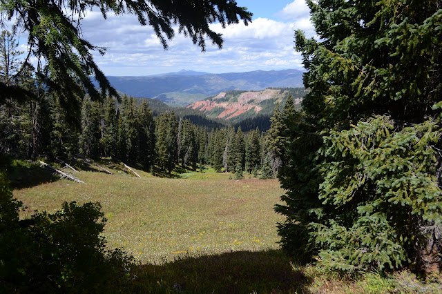
The big meadow had some evidence of fire around it, but nothing that affected the trail too much. One small switchback had gone missing right at the start. I enter a section of badly burned alders and things are a bit different. There are a couple spots where the trail is not immediately clear and suddenly I know just how much I did not want to have even the slightest bit of route finding. It's a physical blow and I take a step back before settling down to just deal with it. After all, I can deal with it. I have proven it over and over. This one isn't even very hard. I just really didn't want to have to do any.
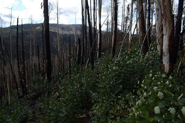
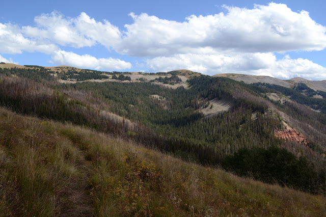
Anyway, I can see trail far below. I have an ultimate aim. Luckily I don't know about the cliffs between me and it. Once the trail gets off a short ridge and starts switchbacking down the slope, it becomes quite distinct although still surrounded by burn. There's only one tree down among a few still bright cuts.
The "no" contingent of the battling signs raises it a level and cites criminal code. A sign closer to the trail may have been unequivocal too, but all that is between the screws to hold it on is a sticker saying it was vandalized and they regret the inconvenience but a new one is on order. A short way further is the split of the trail with a claim of "yes", but "no" for motorcycles on Bear Creek. That one will stay consistent, not that there aren't hints that motorcycles go there plenty.

So I turn and start up the canyon. It should be a long, easy climb at first. Actually, it's probably not too bad anywhere. It is still going to be 3000 feet. One unit of climb, since that is what all the trails behind Santa Barbara go up, give or take. The dried thistles in the grass are sharp as I pass, but they don't feel better for going slower, so they don't slow me down.

The trail follows along the slope on the far left side of valley where it starts to get a little steeper. This keeps my feet out of some rather soggy patches just below the trail and above the creek. Somehow there are little streams coming in even though I wasn't passing any as I walked above and these are feeding the soggy patches.

It is the hottest part of the day as I walk through the lowest point of the hike without any shade. If it hadn't been downright chilly above, the walk through the meadow would be unpleasantly hot. I watch the cliffs a little, glad the trail stayed true after all and I didn't have to meet one by finding myself standing at its top. The warm day becomes cool and moist as I plunge into forest. The creek here rattles along in a small canyon below the wide valley instead of meandering and bulging as it did before.


It's barely necessary, but the crossing is bridged. Notches are all that remains of handrails there were once along its side. Maybe it does get a bit bigger and violent. This puts me across from Magnetic Gulch as I get there. It has caught my eye and I wonder what gains it its name. The only thing I see is that it comes down beside a huge red face and red is often from iron and iron is associated with magnetism. But I expect something else would have gain it its name. There's lots of red around. Just I wouldn't be able to see anything from here.


The trail is getting steeper and I am trying not to slow my pace as it climbs one last 200 foot chunk up to the junction with Sharkstooth.


The junction looks to have once been the end of a road. Mining seems more than likely. I'm suddenly on National Recreation Trail and somehow have been on National Recreation Trail. Fancy. So that'll be well maintained, right? I shall see. I would really hate to have to turn around and go back the other way. I did throw in a Costco down blanket when I started so I can, if needed, spend a miserable but survivable night on the mountain. The nights down by the river have been around 40°F, so up here is likely to be around freezing.

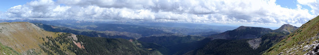
I have nothing to fear. The trail is there and solid. It's the only one I've been on today with blazes, or at least the only one I noticed them. Trail follows along the tops of big ledges that are little cirques. I keep expecting to see ponds in them. The sun is setting a half hour before I get to the pass and my legs are telling me this is about all they've got. That half hour if I'd been clearer. Coulda shoulda woulda. Anyway, they were pretty unclear on where they were going, just poking around and stopping sometimes to extrude cameras out windows. They might not have given me a ride.

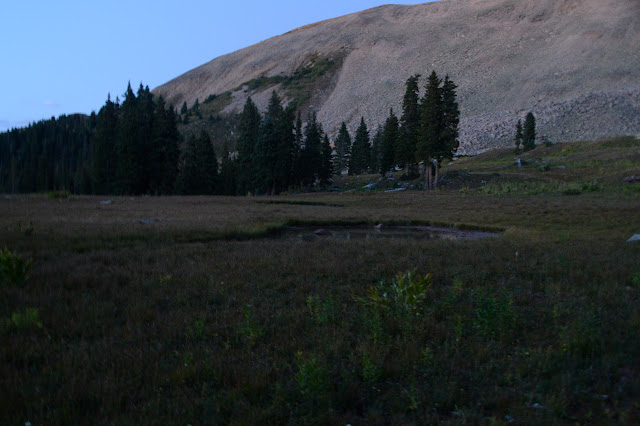
I smell smoke and see camp sites near a high stream, but never can pinpoint a campfire. Maybe its a smoldering lightning strike or just old ash. My water is just about over, so I grab a quart at the last water, but I'll wait until it is dark anyway to filter it. The last cirque finally rewards my expectations for ponds.

There is one last sign before the pass: "Warning unstable rock". Just what I needed in the dark. The trail itself seems to have been scraped down to some surface, more likely some gravel and dirt added until there is a surface other than rocks, but the rocks around it look like they could see their way down onto it. Some have already done so. Nothing I can do about that, day or night. Some folks have decided to use a slide or two as trail. I go for the long, easy grade switchbacks instead. Much nicer in the night.
It is dark at the top. Warmer than I thought it would be and only a small breeze to cool me off. I sit with the stars instead of the sunset to snack and filter and get out a light. I can go uphill steadily in dying light, but I need to see well for downhill. The landscape below is dark. Surely there should be a lake visible down there? I can't see it. I can see more of the Bear Creek side, but I'm probably filling in more than I know from what I was seeing earlier. It's the new view I really want to see and can't.
I must be out of practice with night hiking, no longer doing it every Wednesday, but I feel steady enough coming down off the pass by flashlight. It's a long stretch down and around to get to the lake. It was probably not visible from above. Once it is visible, it is too rippled in the wind for a reflection, but the milky way is a vertical arch above it. There is always trail around the edge of a lake and I'd seen it from above, so I'm not too surprised to find the trail gradually getting harder and then checking only to find I missed where it turned away to catch the junction. I have less regret to not be able to see much once back to where I've been before. I undoubtedly would have seen something new. For now, it is just the lights playing on the road as someone actually tries to come up that road in the dark.
There are a couple cars in the lot. The guy who just came up isn't going to be going down again any time soon. While emotionally let down, I'm intellectually relieved. I'm not sure I'd really want a ride with someone foolish enough to go down that road at night. Up is bad enough. He called it harrowing. So down on foot as expected. My feet don't hurt until after the first two miles of road walking. Maybe some of my foot pain has been squeezed toes. I know tension makes them hurt more from the pounding. Interpreting one rise in the road as a tank trap in my limited light, I get off into a camping area. It looks like a nice one, well off the road, but just means I have to walk a little further. The walk becomes familiar with passing the road to Columbus Mine. I am back to the car exactly at midnight feeling like my legs will probably fall off at the hip. But I got to see the Highline.
©2019 Valerie Norton
Written 1 Oct 2019
Liked this? Interesting? Click the three bars at the top left for the menu to read more or subscribe!


Comments