Robertson Pasture, Twin Peaks, and Spring Creek Trail
Manti-La Sal National Forest
Click for map.
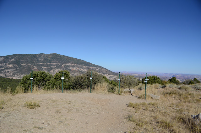
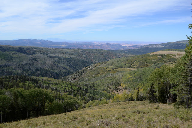
The roads seem to be increasingly dominated by rough things, at least on the map, so I wasn't sure what I could do. I plotted out a loop of 4WD road and (motorcycle) trail and a little bit of paving from an easily accessible overlook for a get-to-know-the-area exercise and figured I should have more ideas later. The easily accessible overlook is the Harts Draw-Canyonlands Overlook, or so it says on the map. It lacks any road signs to point it out, but once there has a nice set of sighting tubes to point out the landscape. That can't be bad. It includes Canyonlands!

So on to the first little bit of paving before turning onto the first bit of 4WD road. There's plenty of shoulder and the cows have pounded a path on one side to make travel on that shoulder easy. There are a few discrepancies between what I see on the ground and the Forest Service quad as I get to that first turn. Spring Lake is actually signed as Foy Lake and I've never seen such a nice 4WD road. The paving is old, but quite complete. It is marked with an "easiest" level ATV trail sign, too. I have about a mile more of paving than I thought. The cows have walked the side of this one, too, but sometimes beneath low branches.

Foy Lake is a big tank with earthen dam on two sides and quite full of water. Shay Ridge (ATV) Trail heads off next to a bathroom and a map marking area OHV trails and about four dispersed camping areas, this being one of them. The second bit is good for me to know since I'm looking for a better campsite.

The paving quits just past the lake and as I keep left, the road doesn't last much longer. Through a ranch gate is a large area occupied by some well spaced massive RVs and a skinny little pair of ruts ending at the trailhead for Robertson Pasture Trail. Hikers, equestrian riders, mountain bikes, and motorcycles all get to use it until Oct. 1 when the wheeled ones have to quit until May 15. Is winter really coming so soon here?


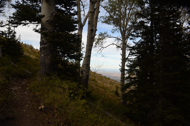
There is chaparral here similar to that which I know from southern California, but it is the high mountain sort getting taken over by trees which are a mix of aspens and deciduous oaks and less familiar pines where I would see live oaks and ponderosa. Still, it is feeling more like a desert and so it is nice to see the little creeks with a little bit of water as I go climbing the easy way up toward the pasture.

The pasture is indeed pasture. Cows have been here changing the landscape. They do more than just crop the grass down like living lawn mowers. In some places it looks as though ditches have been dug to try to keep the aspens out of the meadows, so the cows might be getting help with halting natural changes.


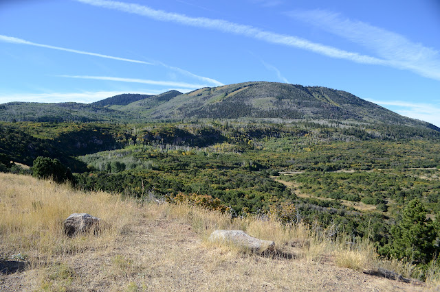
The pasture is prettier than I expected and the canyon views are quite exquisite. I had tried to turn a trail called "Red Ledges" into part of my route, but it was getting too long with that. I'm not seeing much in the way of ledges, perhaps a bit red, in that canyon. Maybe you have to take the trail to see them.


Not seeing the red ledges makes it easier to skip the trail as I come to the junction down a wooded canyon. It looks a little rough, but gets more use than the further bit of Robertson Pasture I start up along instead. There are more trees along the way now and even more as the trail makes an unexpected turn and seems to be going around the mountain instead of up and over a higher pass. As it gets further and further from the grassy hill side the map says it is climbing, I get to wondering if it is even the same trail. It sure doesn't feel like what I signed up for. Perhaps what I wanted has been abandoned. I think about backtracking to a split I noticed in passing where some long unused trail was climbing a grassy hill side. The trail finally breaks out of the trees into a grand view before turning back.
Since the trail has turned back, it must mean to be climbing. I am still not entirely certain that it is. It is all long rolling dips between climbs that feel like flat. It is two steps forward and one step back with the forward progress being questionable the whole way. The next few switchbacks are shorter to help give me better assurances that I am indeed going up and might still be getting the climb I signed up for. Above me is a mountain biker running back to get his camera on a tripod after getting a shot of himself riding down the hill. I would be embarrassed that the trees witnessed it if I were to try that. Maybe it's just that it's so much not a part of being here, now and when I see the results I tend to feel like reality is being tampered with. Staged reality. But he does happen to be a Forest Service employee and, more importantly, worked on the reroute a few years back, so he can assure me that it is really going to get where I want to be. I can't help pointing out that it has already added more than a mile to the route to get up what is really not a very big climb. He says it's much more fun for mountain bikers and motorcycles this way. I'll give him mountain bikes. They like this sort of interminable shallow climb that makes stock grade look strenuous. But I've seen a few motorcycles pointing themselves up hills they weren't sure their bikes would hold onto just because it would be fun. I think they're all for a slope. Since he should know the right person to contact, I tell him he's in charge of reporting the downed tree he's about to encounter. The forest is a bit thick through here and there have been a lot of trees that needed to be cleared, some quite recently. Anyway, onward and upward and finally to the saddle at the top.

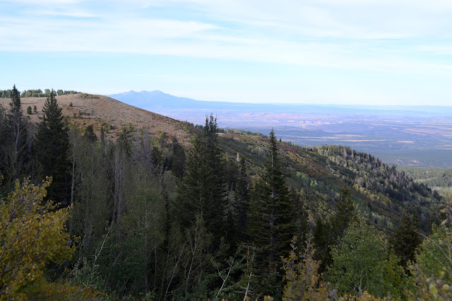
The saddle is my best launch point to grab a peak, which is why the prospect of missing it was really annoying me. To my left, North Peak. To my right, Twin Peaks. The closer of the Twin Peaks is higher and has a benchmark on it, so that is the one I'm feeling most like going after. Right means going into more forest. I quickly find a trail going my way. I actually had expected some little bit of trail, but this is cut through the downed trees and has had a motorcycle or two on it. Not recently and there are a few trees that will need to be cut before the next illegal rider comes up. It makes for an easy walking trail, first up to a gravel covered shoulder suitable for landing a helicopter, then through more trees up to the open peak.

It is surprising to see insulators for a telephone line on the way up. The higher peak is quite close, so I wouldn't expect a fire lookout to be up this one. The top has benchmarks and an old fence and no signs of other construction. If there was a lookout, it has been completely removed including the footings. It might explain where the second reference has got to. I can only find the station and reference #1. There could be only one, but usually singles don't get numbers. I walk around a bit and take in the view. Abajo seems more like a taller peak from here than from below.


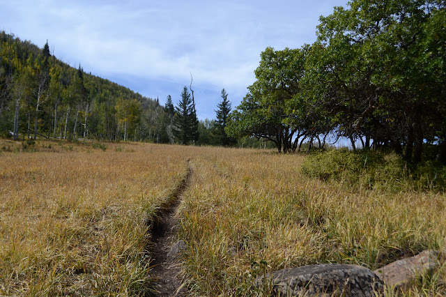
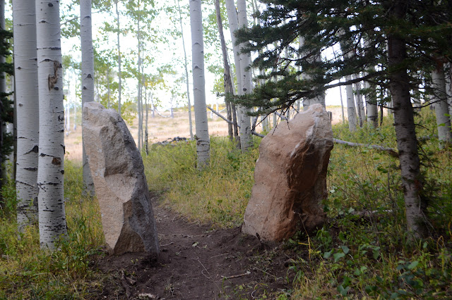
Someone has found a salsa jar from the "salsa twins" to hold pages for a peak register. Themed. Cute. I head back down to the saddle and then continue on over it toward the road below. It is another 4WD but looks nice enough for me to drive. It's never a good idea to judge these things from a distance, though. Just before getting there, I turn along Spring Creek Trail, which stays high of the creek and gets higher as it rolls along.


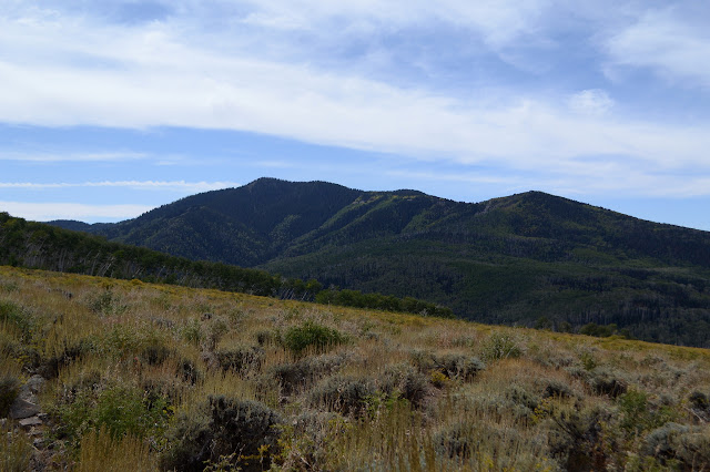
I know I don't really have time to go for it, but when I hit the minor saddle with Prairie Dog Knoll, I turn to stand on it, too. There is nothing to it except that someone actually named it and that name actually got on the map. It's still and extra quarter mile each way as the shadows get long. Admittedly, those long shadows are really picking out the texture of the canyons below.

Someone has stacked up a massive cairn at the top of the knoll. That probably doubles its prominence from what it was originally. It is certainly a good spot to look out on the plain and the patchwork farming and what looks a little like wispy smoke. Drift smoke. Below me is a popular dispersed camping area for the big rigs and I can see a bunch scattered like tiny houses.

But I can't spend too much time at the cairn, so I scamper back over the mildly rocky terrain back to the trail as quickly as feels safe. Heading down again, there are only some tiny reroutes. I was promised that I could get back to going straight up and down hills again, which seems to be almost true, but I do like to make some compensation for drainage. At one point I eye a deep gully to the side and wonder if that was the original trail. A deer shoots past, almost safe for the evening. Somewhere below there is talking as someone packs up for the day. Close one, deer.
The trail ends in a proper 4WD road. Well, you'd at least want high clearance. A little sign says there's an overlook 2 miles back and a road sign advertises Prairie Dog Knoll 1.5 miles back. I'm not sure what the overlook is. Maybe it is the knoll and the half mile is rounding error. I'm more interested in finding out what "The Racetrack" is somewhere down this road.

The Racetrack seems to be a long downhill of open space pointed at those canyons below. They're really pretty as the light changes colors and I'm spending too much time looking at them instead of the ground as I walk this rough road hoping not to trip or roll a rock underfoot. My luck holds, perhaps because there is a bit of ATV traffic as hunters make their way to their temporary homes for the night. It does tend to bring my attention a little back to the road.

The Racetrack has a reservoir too, which would be pretty but it is somewhat occupied by cows and smells of something dank and oxygenless. The road travels along the earthen dam which is showing some weak spots.


It is only a short way more down to the paved road below and another short way along the road back to the overlook. It is getting a little too dark to enjoy it now. I wouldn't mind watching the sun come up on it again, but I think it would be better to pack up and get this one spot I picked out in the morning by Foy Lake which is sheltered from all directions that there is likely to be a generator heard and a pleasant quarter mile walk to the toilet. The day proved to be something like 17 miles, a little longer than my original 13 mile estimate, but that was without the peaks and reroute.
©2019 Valerie Norton
Written 20 Oct 2019
Liked this? Interesting? Click the three bars at the top left for the menu to read more or subscribe!


Comments