Copperas Peak
Gila National Forest
Click for map.
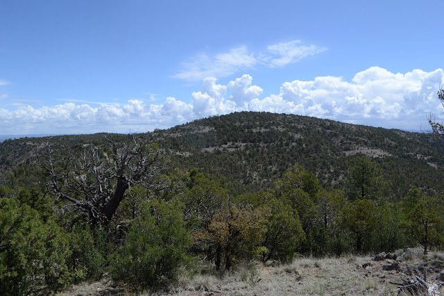
It thundered yesterday and was thick, blowing mists this morning and looks to be recycling the water back up into the sky still full of energy and to do it again. I have a long hike planned and would rather do it when the views stay intact and it doesn't start on another session of clashing. Now that it is clear, today looks like it has just enough time for me to pop up little Copperas Peak before it all breaks again. The signs at the wilderness lookout are all about fire. Somewhere out there, a fire burned, but it looks like the dead trees we are supposed to note have already fallen. Maybe I'm just not looking closely enough since I don't really care to see more burn scar. One sign shows what it thinks the area behind it should look like if fire is returned to the system and if it's not. The area behind it looks a bit like if it's not. Then there is one sign on geology. It is all about the period of high volcanism about 30 million years ago. According to it, the rocks I stand on are "altered and mineralized andesitic lava and rhyolite intrusive rocks", far below the rocks are "less altered", and right up on the very top there is a layer of "unaltered decitic lava". The diagram has plenty of other intriguing details that are left to the reader to find explanations for elsewhere. The "roadside geology" along the bottom seems a bit clearer, but I suspect it means there should be a distinct difference in the rocks and maybe the plants as I arrive at the top.


There seem to be a lot of fences in the Gila Forest. I am faced with one that might be along the wilderness boundary, so the game is which side do I want? The boundary goes right across the peak itself. This one seems to have a built in space between fencing going to the cattle guard at the entry to the overlook and another fence circling the overlook. It seems to say, "Trail!" although I don't expect anything but a very disused road that flirts too closely with the wilderness to really be here even if it is on the map. Stepping through the hole is essentially choosing the right, wilderness side of the fence. It has a good trail for a bit, but the other side looks stronger. I'm not too worried, none of these fences seems to be in very good repair and it will likely be easy to cross frequently.

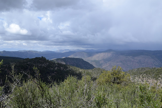
Sure enough, I can cross the fence easily in about 200 feet where the barbed wire is all laying on the ground. The fence and trail beside it actually go down the hill a bit, so I let them get on with it and turn for the easy navigation of find uphill, go that way. The rain shadow to the northwest seems to be growing and getting closer as I go, giving me a deadline although it is difficult to determine.
There are some steep spots, but I just slide sideways and up and pick up a bit of trail. It is probably animal trail and vanishes soon enough when things get less steep. It does seem to get rockier with little ledges popping up as the peak draws near. The fence is back and following east of the long, narrow top, so I cross it where a big rock gives me a leg up over the barbs as they dip.


One outcrop looks very like it could be the high point even while standing on it, but the map says a little further south to a benchmark. I humor it especially since I'll want to find the benchmark anyway. The next bump is decorated with prayer flags. They are strung along through a couple trees then out to the wires left by the surveyors.


So it is time to stop and really look out. The land does not look quite so much like old and well eroded mountains from here as it did from the Pinos Altos Range. Of course, the actual view has changed quite a bit from that far south.

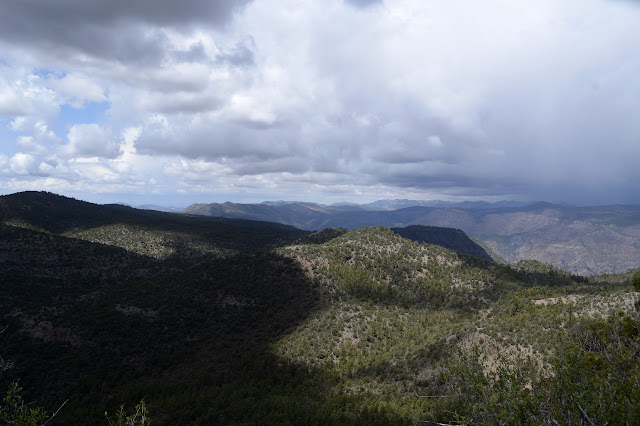
So after a while of watching the rain shadow swell and listening to the infrequent thunder get a little more threatening, it is probably time to reverse my flow and move toward shelter. I move north and off the mountain. I am not trying to retrace my path, but I find myself using the same rock to cross the dipping fence and plodding along the same animal trail around and below a short rock line, hitting all the same spots. When I finally do something different and don't cross the fence again near the lookout, it leaves me walking around the other and over the cattle guard. Guess I did well for my way up.

A couple drops hit me as I finish and I expect that I have done so just in time, but the rain never really materializes all day. There are some teasing spatters, but nothing sufficient to get anything wet.
©2019 Valerie Norton
Written 23 May 2019
Liked this? Interesting? Click the three bars at the top left for the menu to read more or subscribe!


Comments