North Mesa from Middle Fork to East Fork Gila River
Gila National Forest
Click for map.
I find myself in a state of waiting for a few more days and wanted another hike. I have gone into areas southeast as well as I can, northwest, and southwest leaving the northwest left to explore. I noted that if I head up the Middle Fork, there is quickly a trail heading out east over the North Mesa with a couple of possible routes to where the East Fork Gila River is not a collection of private property. It looks a little long, but measures about 18.7 miles. Probably will be 20 again if I go for a little bump labeled "Whiterocks" and a benchmark or two, so I tried for an early start. It's early enough at just after 8AM, especially for splashing through the river. Early enough starts are getting really easy with the lengthening days.

So down into the river canyon I go on some old road that vanishes in the bottom. The first crossing comes quickly although there is trail off to the side from people trying to avoid it. Of course it is unavoidable, so my attempt down that trail just served to strengthen the wrong turn before just plunging into the water. Campers are still sleeping a fair distance from a hanging bag that looks more like a bear advertisement than a bear hang. Easy grabbing distance from the ground for me and I can't reach as high as a bear. Maybe it's only against rodents. The next crossing is deep in shade still and feels quite cold. Someone has splashed up the bank ahead of me and one set of footprints seems distinctly newer than the rest.

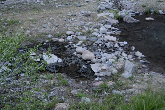
Steam alerts me that I have arrived at the hot springs that are the first destination on the sign at the trailhead. It is a little more than the half mile stated. There are lots of hot springs around here, but none noted on my maps. I expect some of the mystery trails that zip up the canyon side a short way get to more. If they are real trails. The map in this area has some curiosities that make me suspicious that it is a little wild.


Just past the hot spring, the wilderness starts. In four more crossings, quite a bit short of where that wild map says to start climbing, there is a sign pointing out my first destination, Whiterocks. I'm not exactly sorry to have fewer river crossings than advertised although it is a pretty canyon. Hopefully I can see it from above instead. I turn away from the popular trail and the fresh footprints and even most the stale footprints and start to climb. One bit of wildness is manifest as real in the form of one of the extra trails that probably goes to an old tank. Except... who would go to a tank with the river so close at hand? The trail is well beaten, but only from the upper end. Anyone from the other direction would likely shortcut the sharp corner at least a little. Folks who don't want to descend all the way down for water, I suppose. The sign just says trail and points away from it.


If there is trail down where the map shows, I think I will take it on the way back, but I don't see any. The next junction is the one at the top where my planned loop splits. The trail to the right, my return, looks more heavily traveled which bodes well for finding trail on the way back. For now, I go left where the only prints are from a bear. Although less used, it is not difficult to follow. A section corner just off the side along the way gets a little attention, but I can't find it. Maybe it was a cairn and became the two nearby cairns marking the trail when some trail maintainer decided it should stop confusing people.


The trail passes through the corner of some fenced off sections. There was some on the way up, too. Whiterocks turns into White Rocks Tanks (the signs are undecided about the spacing) as I get to the next junction. The tanks are a pair of dry spots that look like they get marshy and a corral. Just about everyone goes north here, so I turn on a very grassy but clear enough trail. It needs some feet, but I turn off it soon to start to climb a bump labeled "Whiterocks" on the map. It soon becomes clear that the bump is just a bump and the white rocks are off on the other side, near the edge of the next mesa.


All those people who go to Whiterocks probably never even see them. Well, there might be a good view of them on the trail up to Jordan Mesa. I finish climbing. It has some views in between the trees after all.


I'm not sure I actually want to climb the Whiterocks, but I'll walk around them to find the benchmark just north. They do look wild.
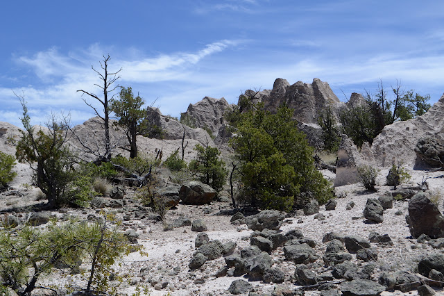
Except for the juniper, one might take it for an alien landscape. They are strange from afar and even stranger up close. This benchmark is easier to find than the section corner, in fact there are little metal tags attached to a couple trees to help point the way to the disk on the ground. The tags seem to be sketch work, but the one for the reference mark never seems to have resolved into a permanent disk.

From the benchmark, climbing to the high point of Whiterocks looks rather easy. It is only about 40 feet up, if that, along a smoothed ditch. The rocks are more solid than they look at first, but I still expect the high point I tagged will vanish for another in 10 years' time. Of course, it might just be shorter.
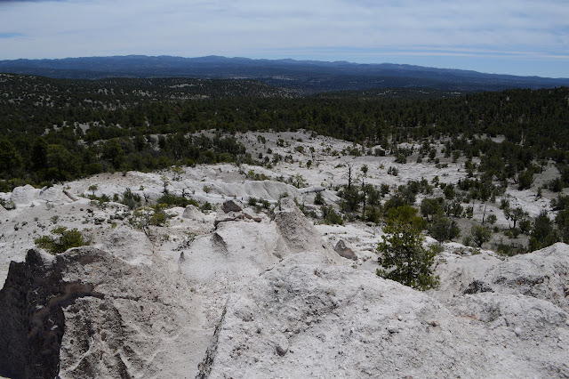

I head down again to find the trail. Getting across the shapes of the rocks at the edge on the east is a little more difficult than navigating the west was. The trail is easy to find and made easier through some large cairns. It continues to have frequent cairns as it winds through the grasses of a bit of the mesa that is not quite so flat. There are views of Whiterocks behind me, looking again like some elaborate sand castle.

I find myself trying to figure out what to expect of the bit of East Fork I'll be in. From here, it looks like a bit of a ditch if I am looking out to the correct thing. There is another benchmark nearby, so I poke around just long enough to locate it. It is a relative of the other, marked "WF5" with a multiply struck thing after the 5 and dated "19 9". Guess they had a little trouble with this one. After the distraction, it is back to descending and wondering what the river will be like until the trail suddenly gets a bit like slickrock.


The trail gets a little steep in spots as it climbs down into the canyon to the junction beside the river below. Some of it looks like trail and some of it requires spotting where the rocks are generally smaller and lighter from many footfalls. It gets to be a bit more like trail again after the rim. I must manage it correctly because I find myself beside a sign at the bottom.


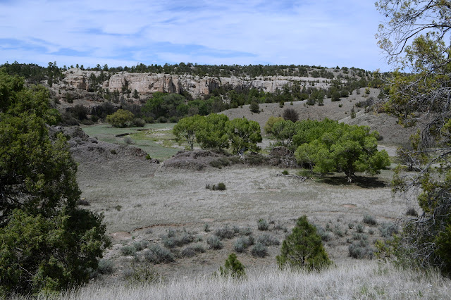
The sign says it is half a mile to the road. It is a little late and time to be turning back, but this second leg is shorter than the first and there is a whole cemetery up there by the road. I decide to go for it. One extra crossing (plus back) and a little bit of hill to get out the other side of the canyon for some historic interest.

The cemetery is a little fenced area just inside the wilderness boundary. The only marking still legible is the wooden "cemetery" sign fallen to the side of the entrance. It has 5 or 6 graves and only one looks as though it might have had marks. It is for remembrance by those people who already know who is buried here. The road ends a few feet along at a ranch that simply says "keep out". Faint trail continues on up an over a hill which should get to a larger parking area than the slim space here between road and wilderness. Nothing calls me further, so I head back.

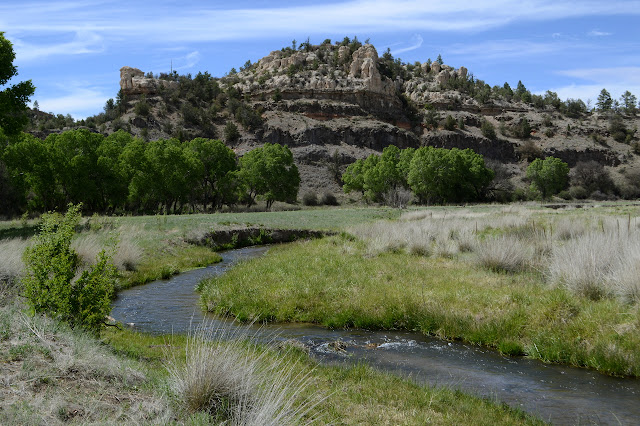
It is quite lovely in the canyon. There are some rather surprisingly large specimens of cottonwood up here as there are below. As I go, I have to admit the water is not just tolerable but quite warm. I don't think it was quite so warm on the upper crossing. It is having a lazy, shallow flow with dark rocks beneath and a bright sun above. Some shadows now, but there has been a lot of sun. It could be warmed nicely by the sun through here. I last went for a swim in a natural body of water on a hike with Ruth, who I haven't seen in years, but this one is quite tempting.

I grab a bit of water on the second to last crossing. I expected to have a source and will run out if I don't. Just before the last crossing, there is a sign as if there is a junction. There is supposed to be no junction, but the trail certainly makes a T and trail, blocked with sticks, very distinctly continues. I am tempted to continue down just a little way to a spot that says "Montoya homestead (site)" on the map except I feel like I have already used up all my excursions time and usually when it says "site" there is nothing left to see. Maybe little bits of metal scattered about. Since I am not going there, it is time to quit the river and start up Adobe Canyon to North Mesa again.

Finding my way up Adobe Canyon is difficult. Trails seem to come out of it and go downstream instead of across. It's weird that both parts seem well traveled but they don't quite meet. Maybe I should take a hint and poke just a little way that way, but the time creeps onward. There are scattered metal bits here, pieces that could almost as easily come from a camp as a home. Once the trail is actually in the canyon it is hard to follow because it tends to be a little too close to the dry creek. It stays right in the bottom until a short section where there is actually water, then drops back down. A spring is marked at the point where the trail finally leaves the canyon although there is none to be seen. There is an old bit of pipe coming from up a side canyon, suggesting it might actually be that way but was once accessible here. Not a concern since I got water at the river.

There must have been some industry in the canyon once for there are other metal bits. I climb upward, bumping into Don't Panic, who I met yesterday. He's already done Continental Divide Trail and Grand Enchantment Trail and is doing something I didn't catch that is the same as the GET through here. Maybe Mogollon Rim? That seems a worthy bit of geography. Anyway, it's by the same folks as GET and he's hiking it. In his underwear. (He's not the first through hiker I've bumped into twice. The pair that were lounging at the hot spring while I hiked the Gila below where the forks meet were on the Middle Fork as I came down it backpacking and the second was quite obviously surprised that I had gotten so far ahead of him on the river and was then chugging along the other way.)

Back on the top of North Mesa, I am feeling rather happy about having taken this hike. Happier than the last one for sure. The mesa seems to be at just the right height compared to the mountains around it to have a continuous border of lovely peaks. And the East Fork was a delight. And the Middle Fork up ahead probably won't be that bad as it gets late and I have 6 crossings to go. Back in the moment, North Tank is the only one by the trail to have water and I note a wildlife camera aimed at the remaining puddle. I wonder what they get besides hiker butts.


Then I get back to the sign post and everything is familiar again, although now in a very different light. Down I go.

I'm careful going down. My shoes are getting worn again and all too ready to slip, but I get down into the canyon again. Don't Panic said the water in this one was also really warm. I don't agree, until the last two crossings. That one that was the coldest in the morning is the warmest now. Then it's up and out and on my way.
©2019 Valerie Norton
Written 12 Jun 2019
Written 12 Jun 2019
Liked this? Interesting? Click the three bars at the top left for the menu to read more or subscribe!


Comments