Little Creek and EE Canyon
Gila National Forest
Click for map.
I decided to go on the EE Canyon Loop, except that's not long enough and there are a pair of trails along Little Creek and the ridge north of it (Ring Canyon Trail, but not named for that part) that have a few connecting trails to make a number of possible loop lengths. I settled on a connector only shown on OpenStreetMap, but it has been good to me so far and the Forest Service is definitely missing a number of trails on their maps.
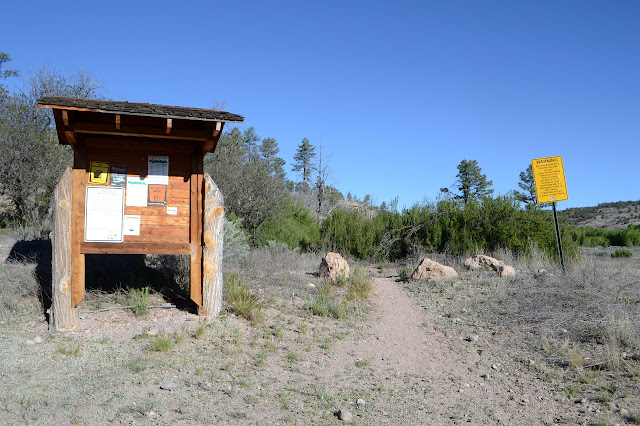
The trail at Woody's Corral is easy to find at the west end and from there, I just climb up. There is soon a sign pointing out destinations. I'm on Granny Mountain Trail, although it is first "Miller Springs" until it reaches those on the map. There is no junction here, but one arrow points off in another direction and as I look that way, there is a trail down in the sage on the river flood plain heading off to Gila Cliff Dwellings National Monument. That's the stock bypass and my way back so I don't have to take the road. For now, the way is up the hill until I can start peeking into some canyons from the top. There is actually a little one of surprising interest off to the side as I climb, but then there are some big ones each with its own character.


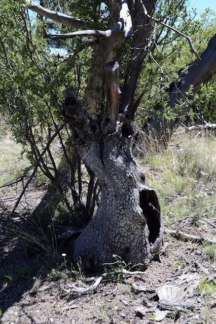
There is a junction and a choice. My first initial plan in this was to continue along the higher trail and get a tiny connector between double loops, but that just doesn't speak to me now. It is probably a little shorter, but I am standing in the middle of a burn that happened to spare the junction sign and somehow wanting the creeks instead. It is not much different either way. The trail down to Little Creek is along a burned and gutted gully. There are a few wild flowers, a few patches of grass down in the bottom of the gully, and a lot of charred trees. One big one fallen shows its roots. For some trees they say as much as you see above, there is below. Not so for pines, which have a shallow root system that may spread as far a the branches above. And then there is Little Creek.


Water! Quite a bit of it, in fact. Little Creek doesn't seem so little at all. The sign for the junction is almost lost in the growth beside the creek even though it is right next to the trail. One destination is Granite Peak, and my brain shouts, "I want to go!" Luckily, it is the way I am going. Unluckily, it is 11 miles off after already doing more than 4. The peak itself is actually only another 5 miles away, but the trail circles around to the far side before ascending. Now, if I were going from here, I think I would start up Bloodgood Canyon just short of the next junction and then pop out on one of the later tributaries to the south to gain the ridge line that is not too steep up to the top... Actually, it does look like a good plan, especially since some of the local geology that they think is cool enough to call out on the sign at the end of the road is named for Bloodgood Canyon. And they saw fit to put a benchmark on the peak. Too bad that with my starting point and the cross country, it really is just a little bit too long for the day. All this is worked through at the delightful large camp built up on the far side of the creek along with my first foray into the lunch collection. Then onward along Little Creek and toward Granite Peak, but not to there.


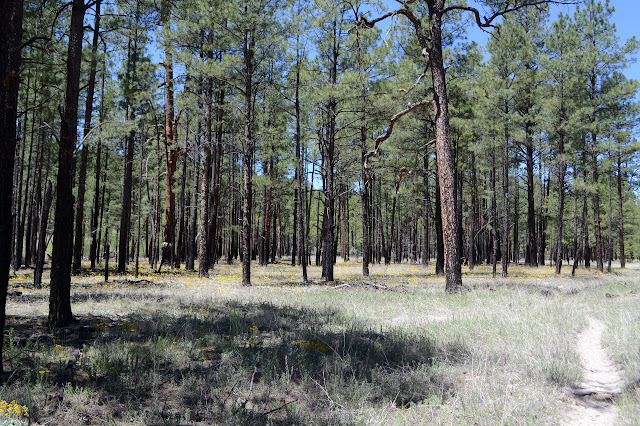
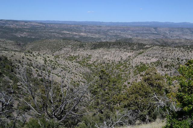
The water has vanished underground by the time I get to the next junction. Had I not gone the slightly longer way, I would never have known there was water up here. Maybe it will show itself some more. The junction is marked by a new sign on an old post. Someone has decided a little finish will make them last longer. The corral that is supposed to be here is long gone. From here, the trail climbs imperceptibly through wide meadows with wild flowers. Way off on my left, soft hills eventually rise. On my right, it looks more like a jumble pushed by a bulldozer to get all this flat area, except that it is quite high and would be quite an extravagance of earth moving in pursuit of nothing and far from anything. It seems absurd to think this is all flood plain of a comparatively little Little Creek. The happenstance of the mesa formation that the creek takes advantage of, I suppose.


The water does return again, generally as the canyon becomes narrow for a short way and the trail is forced to climb perceptibly. The map shows a spring that I cannot find and above that the creek becomes seasonal. The dry sections look the same, but there are no wet sections any longer after the somewhere spring. My trail to connect to Ring Canyon Trail above is soon after, but I can see no sign of it whatsoever. Maybe it was that mystery trail I saw splitting off earlier? If so, it is extremely misplaced. I have been making good time in this flat terrain, so I can probably go on to the next connector and still be back by dark. It should add very roughly 5 miles and make it a 20 mile day. Hopefully that one does exist. And if I may be so bold, ow.

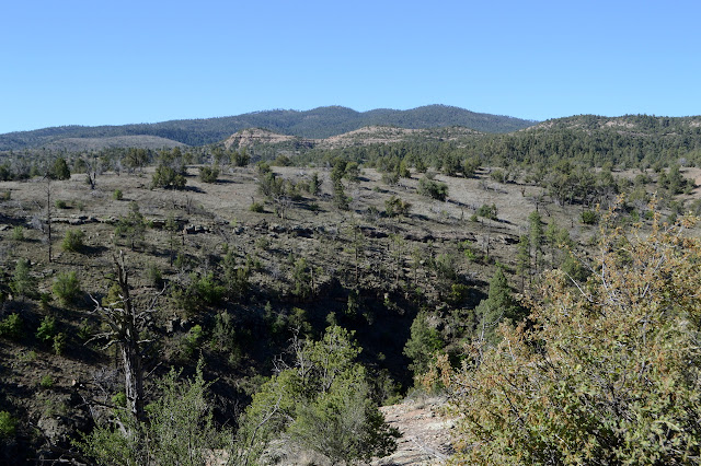
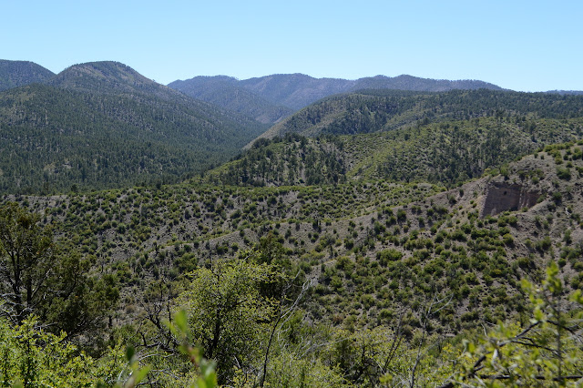
I start to question if I am really still following the main flow of Little Creek as the hills get low, not that it matters. The trees are obviously burned and seem to be missing a lot of their neighbors, especially on the south facing hills. It looks a bit ravaged.

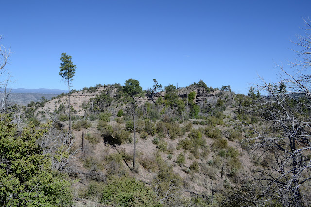
Right where it ought to be, there is a junction. It even has a sign. Still 6.5 miles to Granite Peak from here. Not today. I follow the arrow for White Creek, but I won't be going all the way there, either. The trail climbs up a tiny canyon that looks like it has seen a lot of extra erosion lately. There are plenty of standing dead and one, right above the trail, is hanging dead in standing dead, the bottom of it too far up in the air for me to reach. On the far side, I can see it is caught in a fork in the other trunk, but it is still worrisome to go under. When the map says it climbs out of the canyon for the ridge, it sticks to the canyon and stays there to the top.

The top has signs of differing ages. I am expecting a T intersection, but there is a crossing of trails. The signs show only those destinations I expect. What is the extra trail? There is one more sign at a distance, so I wander over to see it. "Trail not maintained and dangerous." This is the other side of Ring Canyon I am expecting and I can't imagine how it could be dangerous except in the sense that a weakened burned tree might fall just like on the other trails. It seems to follow the top of easy ridge line. The arrow that should be for it points down the mystery trail, so that must be a reroute. Both look to be getting some use, but the horses are definitely going along the reroute. Not my problem as I am going back the other way, looking to see what views the high trail will give me. There are so many miles of trail out here that can't be got to on a day hike.


I can find no sign of my expected connector trail at the top or anything in the area visible in between. I expect I could do the cross country. Anyway, onward and downward. The ridge rolls enough to get a bit of up, too, but it is all gentle. I see no trails at all even as I think I should be getting to the EE Canyon Trail. It seems I have to go all the way around the upper section of the canyon, much further than indicated on the map.

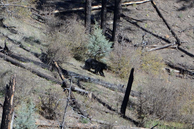

There is a bear wandering downward where the first trail junction "should" be and a steep game trail where the second "should" be. I keep on and quite a bit after expected, there are signs for each, as well as the well worn trail to follow. The bear did look to be having a comfortable walk where he chose to go, but I would not have had the same on the game trail. The canyon is completely burned out at the top with standing dead everywhere. A spur of trail, but no sign, make it easier to find EE Spring. It is piped and filling some sort of halved container. As the canyon narrows, there is vegetation that survived the fire.


The canyon ends with a pair of big rocks guarding the mouth, then the trail climbs up to meet the one I started on for my backpacking. This time I can notice that the Forest Service has a grave marked rather than a ruined cabin. It is on the other side of the trail and even has a spur I hadn't noticed going to it. The Grudgings cabin may be gone, but William Grudgings is still here with a stone to immortalize both him and his killer in 1893.

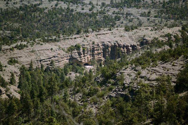
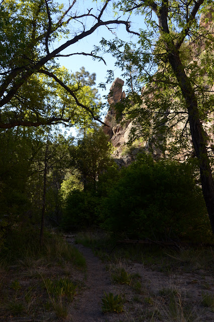
The next junction, I turn for the only trail I haven't get walked, the connector to the end of the road. I hadn't expected any more river crossings on it, but there are a couple and a mud puddle. Also a few people just hanging out in odd places by the river. The monument is closed now. I check the sign again and there is Bloodgood Canyon rhyolite tuft mentioned in columnar jointed form and as spires, so it gets two out of three call outs along the bottom of the sign. The other mention is for natural caves.

The stock bypass starts just before the trail gets back to the road and is signed. It has plenty of footprints along it as well as hoof prints. I get another river crossing, but that was to be expected as I was on the wrong side of the river to get to the corral. There is also another muddy spot, which I can just barely find a way around. The trail is a very fine soft dirt that puffs in great plumes with each step, so I essentially end up muddy anyway. If I had wanted to do the loop in the other direction, I'd have found it just a bit to the right of the slightly more obvious trail upward.
©2019 Valerie Norton
Written 10 Jun 2019
Liked this? Interesting? Click the three bars at the top left for the menu to read more or subscribe!


Comments