Tadpole Ridge
Gila National Forest

Click for map.
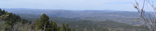
According to the one guy with a geocache along it, "This trail is quite likely the premier trail in the Pinos Altos for high country views." Unlike for Signal Peak, the Forest Service has gone ahead and put a sign out so people know there is a trail as they drive by, even if it is only a hieroglyphic of two hikers and a trail number. Parking is a little forced, but there is quite a lot just up the road and off onto the road to the lookout on Signal Peak. There also looks to be a bit of a shortcut to a higher point on it a little further up the road. No warnings about burned stuff getting ready to lob its weakened self at unwary hikers, so that's nice. The trees do look charred. It might have been an oversight.

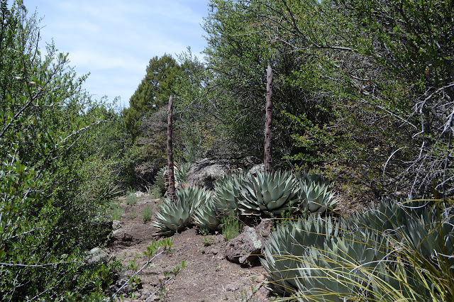
The trail first bit of trail isn't so hot. It winds in the trees near the highway, nearly touching it at one point, then climbs to a spot that was once a road junction where my suspected shortcut comes up. A great big cairn with a stick pointing out over the other former road makes me think it might be a well used shortcut. The trail turns to climb, leaving both roads for a new, winding path without quite so much water erosion as it starts to roughly follow the ridge line that is the general route.

There is a rocky outcrop like a granite dome off to the left and then some cliffs that are probably Scott Peak. I wonder why someone bothered to name this bit that is not the high point. Since it is named, I've given a slight bit of thought to climbing it. Most of that thought is that it would be shorter from the other side, so I'll see what that holds first. If I don't like that, I can always come up from this side on the way back. Although this will be a long hike so that seems unlikely.
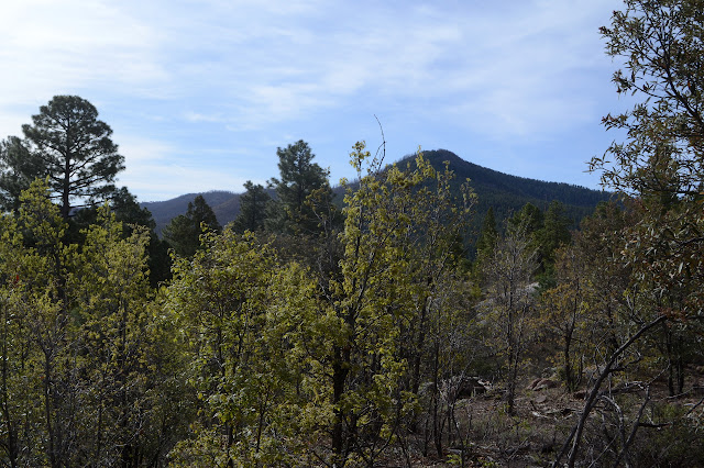

It looks like there has been a burn below the peak, but not over that much area. As it creeps around, the trail does not seem to hug the peak quite as closely as shown on my maps. There doesn't seem to be a use trail up it anywhere. The far side is still cliffy and the area is guarded by head high roses. At least I think they are roses. They have no leaves on to hide their vicious thorns behind. I think they were all over the other sides, too. The trail climbs further, looping north around a couple higher and unnamed peaks. There are some breaks in the trees to look out now and then. It nearly touches the saddles to get slight views to the south.
There seems to be a fence running along the south side. It is very incomplete, but distinctly has a gate down from one saddle and even a trail through it. The maps offer no hints and I have a full day, so that will just have to be missed. Maybe it drops down to T X Mountain.

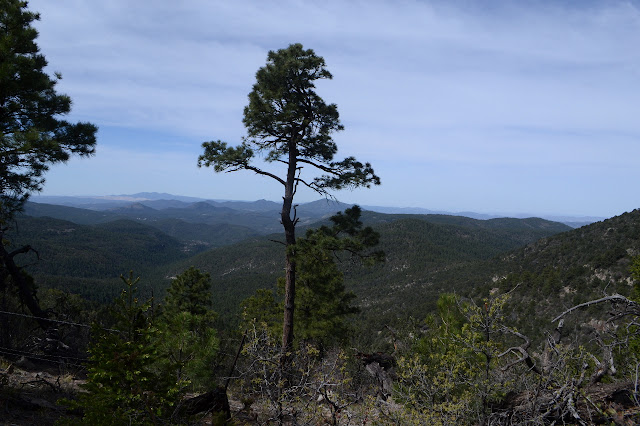
I wonder if the trail will go more around the high point than indicated too. Of course I have to tag the high point if I'm passing by. The area along the ridge is wide and flat through here and just about anywhere is a potential camp site. The trail does stay to the top and someone seems to have been rolling rocks into it. One of them is quite large, but I can see where it used to be before it was sitting in the middle of the trail. As upward seems to finish, there should be a top. It is quite indistinct and no one has built a cairn or left a register to render their opinion on the matter. The tree covered summit is mostly without views, so tagging is all I do. Down in the next saddle is an actual camp site that looks like it might have been the one the fellow testing his new backpack used. Certainly enough fresh footprints all over it. Then it's more steeply down the north side and on to those undulations ahead.


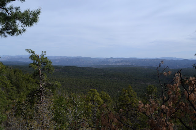
A ridge stretches out to the south from Tadpole. Passing it changes the view on that side a bit and shows another burn scar. This one has had some time to recover, but not a lot of trees have come back.


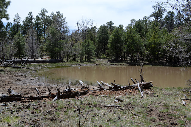
I keep on to a little pool of water marked on the map as "Tadpole Lake". It's not very big and more like a mud hole as I get there. It reminds me of the ponds formed by an earthen dam by a spring. If someone did that here, then they made sure to make it look like a bunch of tiny hills. I see no signs of tadpoles, but there are interesting impressions left in the mud around it.
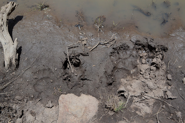
Bear prints are always fun to find. Poking around a little more, there are some through the pine needles in the forest, too. These are deep, poking through more than an inch worth of pine duff and a bit of the soil beneath. They are many steps from a single bear walking precisely the same way each of many times going from the water hole. Besides that, there is a large area of irises that are only leaves as yet. Just a bit too early. I thought about continuing on to the end, but have decided against coming back up the 1000 foot drop over 2 miles or the longer road hike back. So, it is time to return.

Apparently I came through a gate on the way. I didn't notice it crumpled up to one side. None of the fence for it to latch into is there, so I guess it's not needed even though there are clearly cows about. Well, the fence is far from complete too.


There is supposed to be a trail heading off the ridge at a tiny saddle near the top, at least according to OpenStreetMap. I pause and look carefully around for it. Although there are blazes sometimes, there are certainly none around here. There is no trail going down, either. Maybe it is a the other I saw, very misplaced at a small saddle instead of the much larger one just east of it. In that case, that trail through the gate should go out over A Four Mountain.

The unnamed peak west of Scott might have a use trail up it from the saddle on its west or it might have a sort of bathroom trail for the sometimes used camp site in the saddle. This site does not look nearly as popular as the on west of the high point. As expected, I do not quite feel like going up it or the other.

I do feel like going on a short monument search for a pair of closing corners, though. One is a little way along the road the trail abandoned to start upwards and, besides being on the wrong side of it, is easy to find. The other is up the hill from the highway. Both were set in 1913. They were poking around here early. The shortcut along the other road is not very steep, but rocky and turning into a wash. The horses appear to be using it. It is easy to find across from the road signed for Meadow Creek where there is ample parking. I may as well have used that. Since I didn't, the trail along a dry creek back to my parking is a nice find since it means I don't have to take the highway for the half mile or so.
©2019 Valerie Norton
Written 13 May 2019
Liked this? Interesting? Click the three bars at the top left for the menu to read more or subscribe!


Comments