SA Canyon
Gila National Forest
Click for map.
If one travels all the way to the far end of Grapevine Campground (one of numerous free campgrounds in the area) without crossing the East Fork Gila River, there is a dreary looking little dry canyon that some local geocacher assures me will be a short hike to something great. Well, maybe not too dreary, but compared to the leafy green of Grapevine and the sedate but strong river flowing past, it doesn't seem to hold up. Numerous people logging it seem to agree, but for some reason the logs just stopped totally after the 7 finds in 2015. There does seem to be a very distinct trail into the canyon. It is decorated with toilet paper shoved under rocks, which seems like a very compounded error to me. They camped too far away from the toilets for them to walk all the way over there? Surely they knew how far they could walk. They can't use pits because it disturbs their delicate noses too much, so they wanted to spread it around more? So they found a water course (which they should have been moving away from) and deposited their toilet paper (which should have been packed out) under a rock so the evidence of their misdeeds could last as long as possible. Not such a good start.

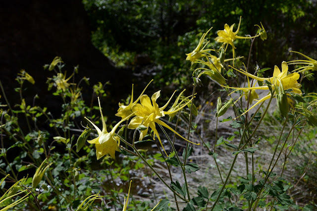
The distinct trail continues past the rocked toilet paper. Those that left it are probably not responsible for the path. SA Canyon is little, which makes me wonder how little Little SA Canyon just to the east might be. Up on the right, the canyon wall seems to be compromised by some digging matching where a prospect is marked on the map. A couple more turns and the canyon is not quite so dry as it looked to the accompaniment of quite a burst of yellow columbines.


The water increases a little as I go, but not enough to get my shoes wet. It vanishes in a rock fall area with seepage from the walls below it. The previous logs speak of an obstacle and a plank that used to be available to get past it. Maybe this is the obstacle? Whatever, the cache is on the far side and it isn't much of an obstacle, so up and over I go.
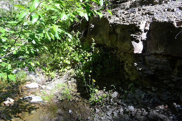

There is water behind the rock slide too, so the seep was not the source. Just a little bit further is a pretty little waterfall with a deep pool at its bottom. Unfortunately for me and my dry shoes, I have not quite got to the geocache. So then, this is the obstacle. Now the plank to get past it makes more sense. The fact that no one has logged it in 3.5 years although many logged it about 4 years ago still doesn't. The last log does say the plank is gone, but that shouldn't have worried any potential finders since they still got there.

The morning was a crisp 40°F as I started, so I am not too eager to step in the water. It has definitely been warming and... well... how bad could it be? The water really isn't that cold at all. It comes up past my knees. The waterfall shows signs that it gets climbed in the form of missing moss. I step carefully as I go. There is plenty of water to dunk my electronics if I should slip although it will catch me nicely. There is a second cascade behind it.

This one does not show quite so much evidence of climbing, at least to my eye. I still have a little way to go, so up I go again. The canyon opens out at the top and my journey is finished. The geocache sits right where it should be and the last signature really was in 2015. The stop must just be down to the luck of the draw. I add my name and tuck it back inside and look a little further up the canyon. There is still some path, but it is much reduced from when the trail started. I expect the canyon could be followed all the way up to trail #709 as it comes down from near Military Road. I have a second little adventure planned for later.

I turn back and downclimb the cascades even more carefully. The last big step to get to the pool worries me, but there is no reason. Balance is not challenged by a small flow in a big pool and the logs at the bottom do not roll too badly. It is dry and warm enough that my shoes are only damp as I finish.
©2019 Valerie Norton
Written 23 May 2019
Liked this? Interesting? Click the three bars at the top left for the menu to read more or subscribe!


Comments