grave on East Fork Gila River
Gila National Forest
Click for map.
There is quite a lot of private property along the East Fork of the Gila River with a road running through it all and trail #708 at the end of it going out to another clump of private property and some more trails that failed to get on the Forest Service map even though I know they exist. Well, the other end of the one that climbs up to Military Road by Thirtytwo Tank certainly exists and looks used. My guess would be I can walk that road, but the ranger I asked wouldn't say for certain then indicated he'd been around long enough that he should know. Sounds like, "Yes, but the landowners would rather it not be so and I have to deal with them more." The river is clearly navigable, so that definitely exists as a right of way. If I wanted to do a big loop including the area (which is very possible to do), I would pursue it more. Instead, I will just get a taste of the area by searching for a grave that is west of the private property. I will just have to leave the road earlier to do it.

So I start off along the road for the short section before it hits private property. The campground ends at the ford where a sign notes "no camping". People have made sites past it anyway and these have additional "no camping" signs on them. Another ford takes me to the locked vehicle gate and hiker gate without any locks at all. I still suspect there is a right of way on the road. Of course, the signs don't bother to mention it.

I check where I am on the map and to my surprise, standing in front of the gate is actually already on the marked property. Also, I seem to be on what looks like a spur road on the map while the main road crosses the river again. The remains of that road appear to have trees crossing them, so it must be out of date. I cross over near the old ford and continue, staying west of the fence. It seems to replicate the boundaries on the map, but it doesn't last long. I just keep west of what was once there. There is a single post left in the rocky transition from common river flood plain to the hills around it and I seem to be drifting a little far east as the river drifts east, so chug up the hill west a bit and try again. There is one last fence post up on the hill, then nothing.


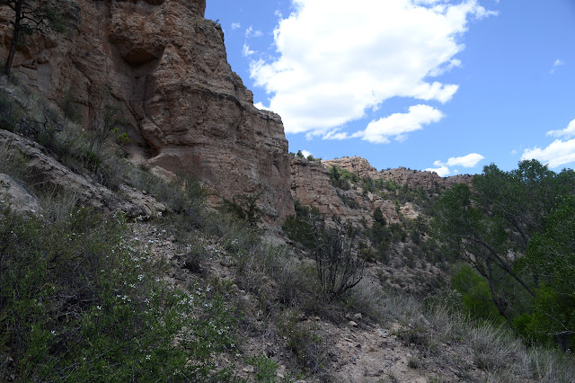
I had taken the three pieces of private property area to be three ranches, two about 160 acres and the last about 120 acres, but this first piece is actually a number of smaller parcels. That certainly helps explain the amount of traffic that comes through the campground. As I start to get up close and personal with the vertical buttes on the other side of the hills, I'm not sure where I can start dropping back down. The river curves back to the west, so somewhere there I can. On the other hand, there's a nice wide animal trail that follows along high on the hill which definitely stays west of it all. I go with that, although I start to worry as it becomes clear there's a cliff below me and a very steep slope to get to the top of the cliff below me that I might have made the wrong choice. Still, it is a very wide and well used animal trail.


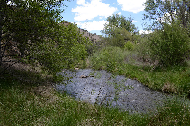
I see a spot I might be able to scramble down, but the trail goes on a little further before taking a different scramble down. I am now beside the river where it has a bend west of the private property. I head north a little further and cross the river when I'm pushed to. I'm practically at the grave, so cross back soon after. Except something's wrong. I am almost certain I can hear music coming out of a bad car stereo.

Sure enough, above me is a bit of private property someone neglected to mark while they were marking the rest. They are out working on some fencing and listening to the radio. I am practically standing on top of where the grave is indicated, but there is nothing there and I don't really feel comfortable looking around. I can't quite help but notice the tree, though. It must be at least 8 feet across. It would have been large when the area was first being homesteaded. It would be a great place to look. New fence misses it, but old fence encompasses it. Off limits. So that's that. I turn back and cross the river. A dog starts barking as I splash.

Someone must have come over because she calls from across the river. I see no reason not to go back a little and talk to her. She says the whole canyon is private property in that typical way folks have of oversimplifying. I did stay west of all indications, then west of where there should have been indications. I'm also standing close enough to the river now that, well, you can't do anything about that right of way. Navigable rivers are special. But that's not what I say. I just stick with the staying west of the property part and ask her about the grave. I was looking for the grave, crossed the river, found unexpected private property and turned back. She does know about it and points at the tree. Really, The Tree. It was under that tree until a large flood washed it away. This was another reason I felt it would be useless to look. It does look like the sort of place that would be prone to flooding and getting washed away. However, everything else of the ranch seems to be at the same level, so I go with saying that that must have been a rather scary thing. And also that that is an amazing tree because it is. It is easy to see why they chose there. I add that I'll return to returning back the way I came now. Staying west. And that is exactly what I do.

Well, that's almost what I do. I almost try getting by without the high animal trail. I'm not even certain I'll find it from this side, but I seem to walk right to it, so up into its mildly scary heights and across to the easy hills. Once on the easy hills, I see no reason to go back down to the road. I can just drop down onto the campground from them. Well, there is a bit of a climb if I get too far downriver along the campground, but it is an easily slope down to the road right before the ford to the campground and I catch that slope to finish the hike across the ford.
©2019 Valerie Norton
Written 23 May 2019
Liked this? Interesting? Click the three bars at the top left for the menu to read more or subscribe!


Comments
I passed by a couple other graves on my other hikes in the Gila plus visited a whole cemetery in the post linked in the comment above. Yes, there are many spots to visit.