Signal Peak
Gila National Forest

Click for map.
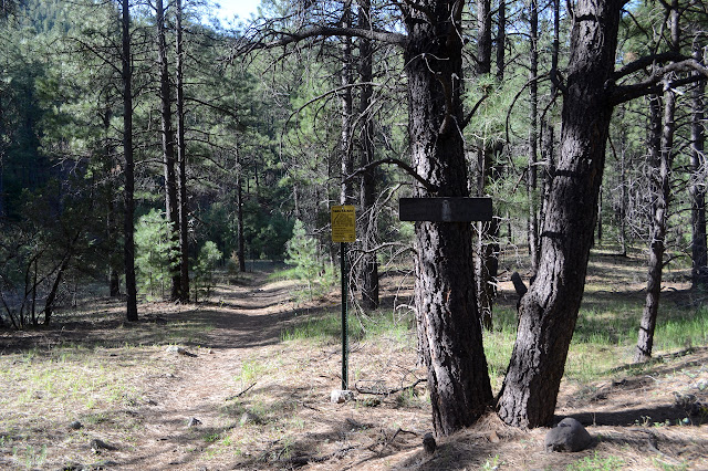
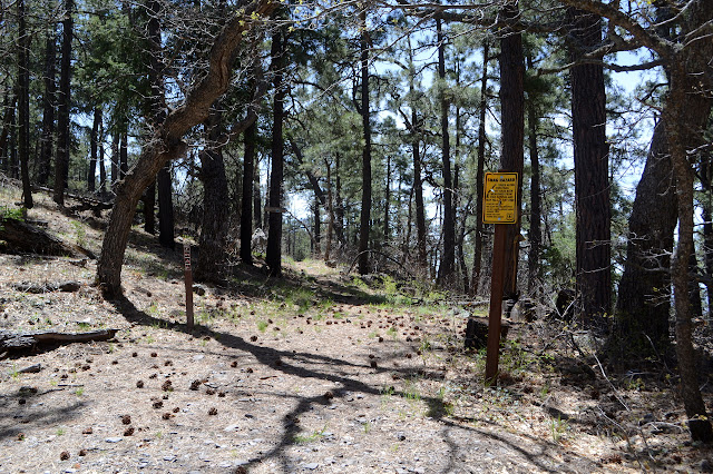
Signal Peak is a 2.5 mile hike with a fire lookout at the top and Black Peak is about 1.75 miles more and just a little bit higher. There isn't any parking at the trailhead, but there is a little maybe 60 feet up the road for Tadpole Ridge and there is a lot a little further up the road and slightly down a good dirt road. If one wants to, that dirt road will also get up to the lookout eventually, but that doesn't seem like a desirable route to me. Besides the sign telling me where I am and that it is 2.5 miles to the lookout, there is a bright sign warning that the trees along the trail have been weakened by fire and could snap at any time with the implication that that might involve hurling large portions of themselves at me. There are also those lovely little "area closed behind sign" signs that require very close inspection to notice that hikers and horses are allowed in. It doesn't say bikes, but this is not wilderness so that is presumably an oversight. Someone has been riding it anyway.
The trail crosses a meadow and starts up. The tiny stream was flowing just a little bit uphill of here, but must be underground now. There isn't even wet dirt to note it here. The route up often seems to be on old logging roads and except for a short burst of steep between a pair of rock outcrops, tends to to keep a steady and comfortable climbing pace. The trees tend not to be very big, although I expect that if a major chunk of one came at me I'd think differently about their size. There have been some recent falls, but it seems the hot shots have been out getting their exercise. Someone has been out with a chainsaw anyway.


After an initial climb on the north side, the trail gets up onto the ridge then keeps to the south side for a while and all that while it just keeps on a constant climb. The south offers a little more views than the north did.

As the trail gets higher, it seems to leave the old bits of road behind. For a bit, it is on a narrow, steep hillside still on its constant climb. Eventually things start to feel a little airy and more breezes seem to be blowing and there is one last rocky bit to the top.


There is supposed to be a benchmark, so I embark on looking for it. The station is easy as it is directly below the lookout. The references are out in the weeds. Well, one is. The other has coordinates near the picnic table but there is nothing there. There is nothing where I might expect it either. Oh, well, the station is the main bit.

The sign on the gate to the lookout steps indicates it would be illegal to climb them during fire season. Is that now? Probably not since it isn't occupied. This one is not quite so tempting as the 99 foot one was. Anyway, I still have the slightly higher peak to get to. I head down the road, then manage to catch a little bit of trail that shortcuts the road before getting to the main ridge walk just past an open gate and a pickup truck with a driver who seems strangely concerned with it. Oh, and finally spot the unmistakable doings of fire. The road appears come come up largely through a forest so devastated by fire that it is at first hard to even find a little bit of green. There are some clumps, but they probably aren't even 2% of what was there once.


Since I am starting from road again, there is another sign to warn of the dangers of the trees and a more permanent sign to say how far to the Continental Divide Trail. Black Peak is on the Continental Divide which turns off along a different ridge about halfway between here and there. I'll probably turn off to go up the peak just before getting to the trail roughly following it. For now, I get to get into the burn a little.

Happily, the trail finds some green forest to hang out in as it climbs back upward to Black Peak. A great big cairn by the trail and a second a little further up the hill mark a use trail to the top. Surprisingly, this peak also has buildings. There does seem to have once been a road to serve them. It takes a while to even notice it and it is now getting reclaimed by something with great spines that I'm pretty sure will be a wild rose once it leafs out and blooms. There's also a current that is a candidate for thing with spikes. Oh, and there is another 1936 benchmark although the map forgot to mention it. The single reference (numbered 2) I can find points at the building, but an elevation marker is not far from it. Maybe the map didn't mention it because it disagrees with the elevation.


That mine I've been noticing seems even closer up here, but I am looking at it out over where I was hiking before. All perception of course. I head back since the view isn't all that good. Got to get the bit of climb through the burn done before it gets too hot. Not that it likely will.


Walking back up in the burn is not so uncomfortable after all. It really is a gentle roll between the two peaks. I could think about heading down via the road, but not so much. It seems rather long and a lot burned. Still, there's plenty of time when down again to wander around just a little bit more to find just a few more benchmarks.

©2019 Valerie Norton
Written 11 May 2019
Liked this? Interesting? Click the three bars at the top left for the menu to read more or subscribe!


Comments