Ukonom: Onemile Lake and McCash Loop
Klamath National Forest
DAY 1 | DAY 2 | DAY 3 | DAY 4
Orange line marks the day. Click for map.
My awareness of the day crystallized as a horrible creaking noise came from the poorly looking tree hanging over my camp site. I jumped as far as I could back and curled in the tiny foot of my tent, I heard another noise, an unusual clacking from a raven in a neighboring tree. It was similar, but not quite a creaking. They do make such fascinating noises. I'm pretty sure it had a little bit of a laugh in that second sound. I got myself up and fed and packed and off on the trail. The bears are quite courteous when using the trail. They leave their scat on the side instead of right in the middle. I've never seen that before.

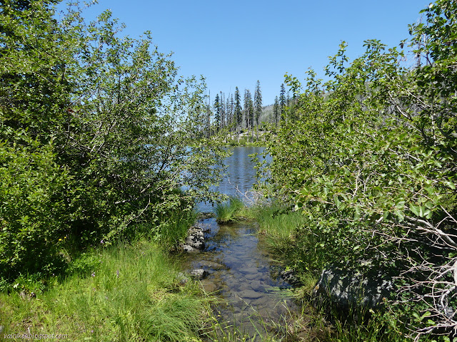
I came upon a pair of tents halfway along the lake. The occupants, who had run out of light, had some warnings about the trail up ahead. Not so bad as the trail to Secret Lake which no longer exists, but not good at all. Hey, they made it, so I figure I can probably manage eventually. I wasn't too worried about it taking a while. It really wasn't going to take all of two days to get back to the trailhead anyway. I could tell them that the trail exists all the way on the other side although sometimes it takes a little looking. They were also aiming to go down to Green Granite Lake, so I didn't know about that because I got a little lazy about the spurs. I almost managed to lose the trail in the next 20 feet, but I soon became very happy that I'd done the rest of the trail around the lake.

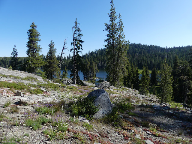

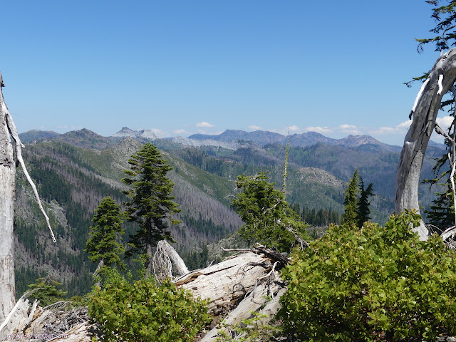
The trail climbs up among the rocks to ever better views of Ukonom Lake. Odd islands and shallows and that rocky point where the other camp site is all become visible and all seemed to be settled in their best light.


Then the trail leaves the lake for a fire devastated area and as it wraps around the ridge line, it pretty much disappears. I found the footsteps of the two I met earlier coming up steeply from below. I could see where one or the other had searched and discarded routes. I was sure it couldn't be proper to be coming up that steeply, so added my own search and discard prints as I ultimately followed them right down. I found a couple cairns and segments of shaggy trail, but I'm not sure what I followed some of the time. Clearly, there were just enough clues because I pretty much stuck to it.


Then I got to the bear tunnel. Actually, I'm not sure it was really tall enough for a bear to comfortably walk through, but there was certainly good tread at the bottom of it. I swam through the bushes kept from interlacing into each other by the previous swimmers. It was hard work.


After about a quarter mile, it ended at a stream and I stopped to grab water. Hard trail can make one quite thirsty. I needn't have worried. As I moved on, I found the brush had been cut back on the rest of the trail. The exposed tread didn't seem to be holding up as well. Still, the going was easier.

I was going well until I got to the stock camp for Onemile Lake at which point I couldn't figure out the way out. The camp had clearly been used for stock recently, but I wasn't finding a stock ready trail out the other side. I headed back though the nearby meadow to a crossing trail I had dismissed as a game trail. It did have footprints on it. It could have been a reroute to avoid the meadow? That certainly happens sometimes. I walked up it and quickly decided it was definitely a game trail. Down the other side seemed really unlikely and just got into the sort of numerous trails that cattle will create. I headed back to the camp and ignored the logged out trees to finally find what I was looking for.


While poking around, I found a bear skull left in the camp. Hopefully that hasn't got the same effect a dismembered bear paw can have on stock. Still, interesting to see. Once I'd found the trail out the other side, it was easy going again. I followed the trail to Secret Lake as far as the outflow of the larger lake/inflow of the smaller lake. There were two more camp sites along the way, one surrounded by blackened former trees and one hanging with huge and green trees.
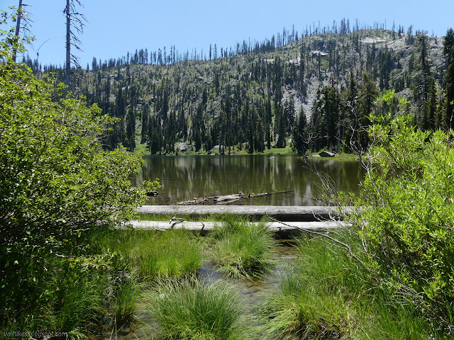


I looked a little further around the lake and found another camp and the overall inflow. I stopped there for some more water because there's a lot of dry ahead. I didn't notice the shortcut trail and climbed back up to the ridge on the proper trail. I was on to repeating bits of trail, but there are certainly worse bits of trail to repeat.


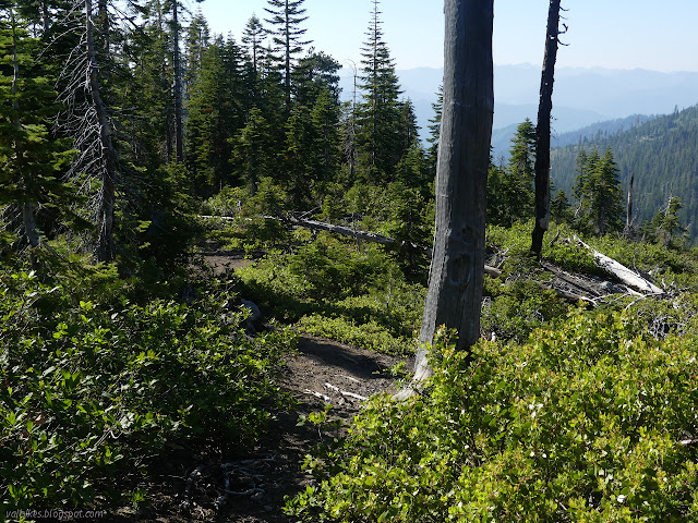
On the way out, I missed the junction I wanted to take. It is a short trail that connects to the McCash Loop at its north end. I got to where it should be and saw why I missed it. The most obvious thing remaining are bolts a bit over head high on a tree. The tread is just a hint. Looking at the terrain on the map and the actual in front of me, I couldn't see not just taking it as a cross country route. There were plenty of feet on the loop at the signed junction, so I wasn't worried about finding it.

The route up and over was, indeed, easy. I saw a couple footprints as I did it and found a few pieces of trail. I did not find the loop. Those footprints must have been hopeful people who turned back. They certainly weren't up on the ridge. I kept on going anyway, finding more pieces of trail, some distinct enough to say this is it even as it gets overgrown, old cut logs, burned cut logs, the odd blaze. It is still there, in a faint form. Besides, what is a McCash Loop without looking down on the McCash Lakes? Or, indeed, a loop? Weirdly, I also found two fire rings.

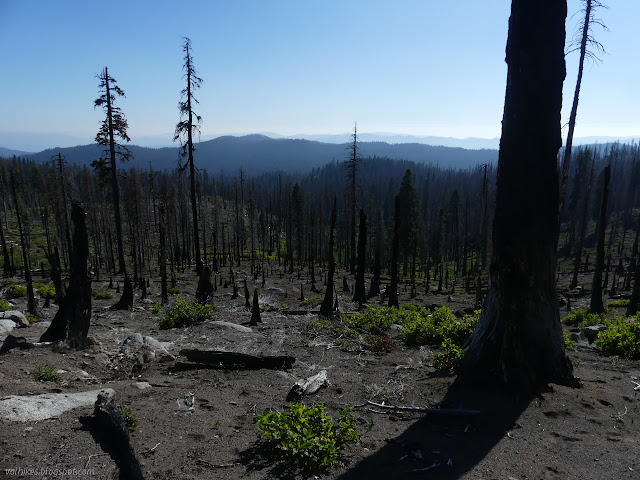
My hope for camping was up by some springs in the top of Long Meadow. As I started down, I started to have a game trail which gradually turned into a people trail. The first spring was dry, but the second was putting out plenty of water. Of course, the area was surrounded by burn. Big trees, half of them dead. I could see a possible camp, then decided to investigate potential flat areas lower down. The water sank in, but then came back, so the source was fine. I couldn't find anything I liked better than by the high spring and ended up heading back.


The water coming out of that spring was oh so very very cold. A raven came by to knock a small, dead branch off a tree. Maybe it was the one from the morning, out to see how far I'll jump this time.
Continue to the next day ⇒
©2020 Valerie Norton
Written 16 Jul 2020
Liked this? Interesting? Click the three bars at the top left for the menu to read more or subscribe!


Comments