Salmon Mountain: Red Cap Lake
Klamath National Forest
Shasta-Trinity National Forest
Six Rivers National Forest
DAY 1 | DAY 2 | DAY 3 | DAY 4
Red line for day 4. Click for map.
(Day 4 of
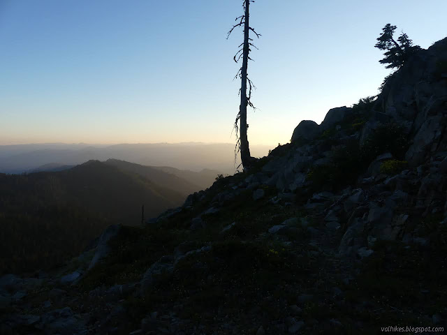

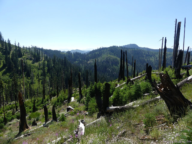
Light was just getting to the iffy camp sites on the west side as I headed down the good trail. Not worried about time, I cleared the trail a bit as I went. There were a couple big things I could get, even. And if not me, then who? There actually were some day hikers with binoculars coming up. The first fellow who said he used to drive up to Red Cap Lake and such when he was a young hunter, "If you can believe." Ha! I could. The surveyors on Salmon Mountain wrote that the Forest Service had pushed a bulldozer all over the place, but then dug out the beginning to stop the hunters from driving in anymore. He chuckled at that. They'd just been glad to be able to, but didn't feel entitled to it. The pair up after him were controlling a pair of dogs as I passed. Don't dogs make bird watching hard? Maybe I'm misinterpreting the binoculars. There are other things to see.


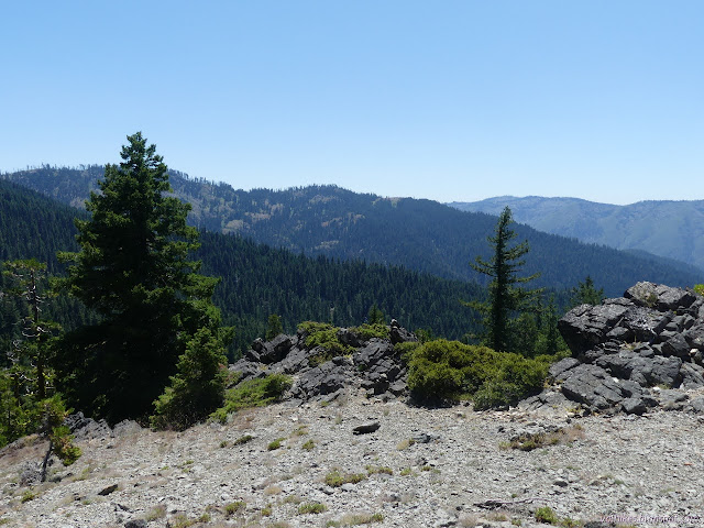
Back at Salmon Summit, I turned for the second least used trail expecting it to be the difficult section for the day, but not too bad. It was a bit overgrown with very clear trail along the old bulldozer track. It did look like someone might have driven it once or twice. It certainly isn't getting any driving now. It has some erosion issues and then some heavy overgrowth, but hikers have simply found a higher route around it all.


The map would have me believe the trail avoids all the water, but I found bits of Eightmile Creek even before wandering incorrectly below the trail. I suspect the bears like getting closer to the water in the more reliable places.


I probably was supposed to follow the water up through the lilies to find the rest of the trail. I turned left and found a different trail. Admittedly, there was a clamber through a tree with well spaced branches on the way. After the other occasional clambers, it didn't exactly feel off. From there, I was following bear trails which kept wandering into the willows only to end at the creek. The actual trail on the old bulldozer track goes above the willows. I eventually climbed up high enough to find it again.
I got back on track just before the signed junction with Devils Backbone. It is a wide road heading south. I turned north, the direction pointed for Red Cap Lake. The trail down to the lake was twice as far along as the map told me, but was obvious enough and progressed downward in switchbacks instead of practically falling down the steep slope, so I forgive it for being wrong. I kept hearing about a steep trail out of Red Lake, but this is quite reasonable.


I lost the trail at a big meadow. I expect it crosses, but I couldn't find anything of trail on the far side and ended up following various bear trails down the hill rather steeply. The switchbacks were nice while they lasted and I'm sure glad I didn't try to find my way out instead. I never figured out what of the random trails around the lake and camps is supposed to connect to what I came down. The lake turned out to be a bit more interesting than the previews had indicated. I was back in day hiker range and was a little surprised that there were none to share the lake with.


The trail out the other side to return to the trailhead from Red Cap Lake wasn't immediately obvious, but it would be the only one that gets very far. I saw lots of evidence of somewhat recent trail work as I climbed up to the Salmon Summit Trail.
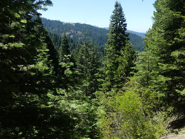
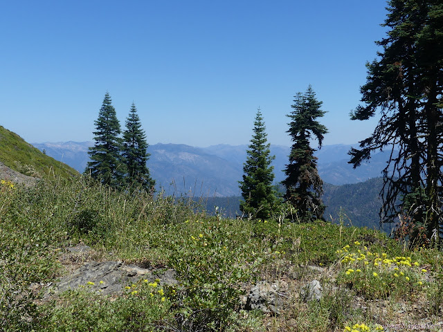
Once back to the main trail, I kept thinking about and deciding not to go after one of the few peaks along the way. Whitneys Peak would have been a particularly easy one to grab, but it was just hot. Hot hot hot. The air was really seeming clearer than that first day, too. I even saw a probable Mount Shasta poking up in the distance. An excellent day to grab a peak. I kept to the shade of the trees as much as I could. I did start down an old bit of trail that would travel closer to Indian Rocks, but decided to give it up, too.
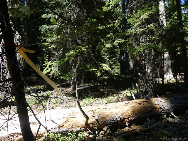
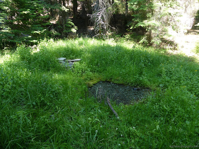
There were day hikers for Red Cap Lake and Salmon Mountain. I found a pair of locals from Orleans who mentioned the trail isn't even on Alltrails. (I probably won't fix that, but I made sure it got marked on OpenStreetMap where it was also missing.) There were another few singles and a massive group camping right at the trailhead where a bunch of bicyclists were about to start for the mountain. On the way, I missed the higher sign for Orleans Mountain, but I found the one near where it is marked on the map including some ribbons. I noticed a second trail and followed it to find a spring and Whitneys Camp. The spring is above the trail, but the flow isn't even apparent at the trail.
So I returned with about a third of my food. I checked out what I might get to from the area and decided against that, too. Nothing really was nearby. I headed down, managing to only meet one car coming up. That's not so bad considering it was Saturday.
©2020 Valerie Norton
Written 1 Aug 2020
Liked this? Interesting? Click the three bars at the top left for the menu to read more or subscribe!


Comments
Red Fire on Six Rivers National Forest
Salmon Fire on Shasta-Trinity National Forest
The Salmon Fire officially started midway through Monday, July 27, but the information on the Red Fire indicates the lightning that started them off actually came through on Sunday, July 26. Either way, that's when I would have been hiking the area had I stayed in two more days with my two more days of food expecting to leave on the 27th. I think the Red Fire was too far down the drainage to be an obstacle at the time, but the Salmon Fire is larger and far up the Eightmile drainage and does look to be at least licking at the trail.
They have now been combined into the "Red Salmon Complex" for the purposes of fighting them, but they are still separate fires. (For now. Burning in wilderness at low intensity, so they may let it burn a while. These are lightning fires, so rather hard to see as anything other than part of the ecology.) Current information can be found here.
I'm coming up empty for trail maintenance groups. There's Trinity Trail Alliance, but their current projects seem less than inspiring to me. There's Bigfoot Trail Alliance, but this isn't Bigfoot Trail area. I've had my Volunteer Wilderness Ranger training via Los Padres Forest Association so I believe I could even lead a group cutting brush. I haven't got sawyer training, just lent my hand to a saw a few times. That Salmon Summit Trail looks to me like something that would be popular with trail runners and seems especially attractive as part of huge loop possibilities with PCT if it were clear. Horses can't get far out there currently.