Frazier Mountain on snowhoes
Los Padres National Forest
Click for map.
Frazier Mountain is the second mountain on the Hundred Peaks Section's list of peaks that I have been up, but only in a car. Since I don't feel like counting drive-ups, I need a plan to hike it. I've had one to go in from the east side at the edge of Hungry Valley, but with all the snow on the ground, a 20 mile hike is probably too much for the short days. From the north, I can get up and down by two routes in 7 or 7.5 miles. That's still almost 15 miles and the trip up Tecuya showed the snow can start very early, and that was the south side of the mountain. How long can one go on snowshoes in a day? They certainly aren't as fast nor as easy walking as hiking on dirt. Hopefully I'll have the good sense to quit if it gets to be too much, not that I have a good record of that. With the memory of the frigid wind at the top of Tecuya, I have my puffy mittens and a few other things to be sure I'm warm enough.
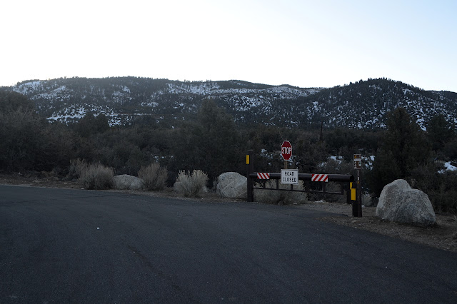
My plan is to go up the West Frazier Mine Road and some others that wander over to the fire lookout at the very top, then come down Frazier Mountain Road. Both are closed for the season at this start point, so there should be no traffic. The big snow was right around Christmas and there is still some snow around the lot. People have been coming out for snow play and what is left is full of footprints while some slopes have become crushed down to ice. The snow on the road has been pressed down into a hard ice too, so I have to be careful when I encounter it. Mostly I have dirt to walk on and a few mud puddles to avoid.
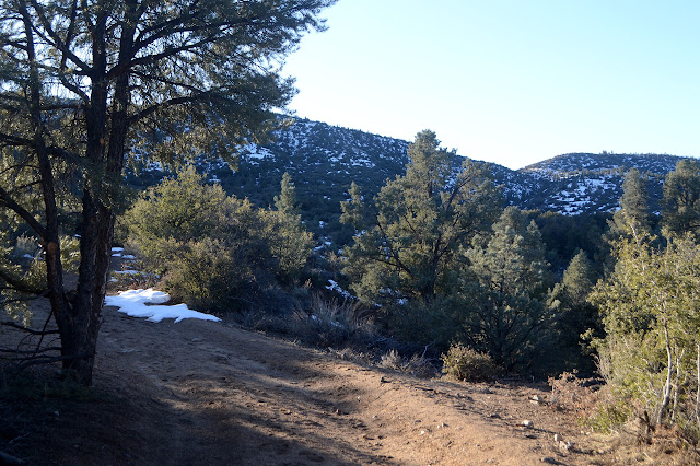
The road at first seems to just wander up and down in an overall level way across the side of the mountains. It is getting to the old road that comes off Lockwood Valley Road a bit to the west. That section is now blocked off and unmarked. There's still a few certain they want to take it, so it is still visible on this side. There's a bit more climbing once the road meets the old route. There's only a few footprints through the snow sections now. After a mile, it's down to one and 1.5 miles leaves none but the animals.


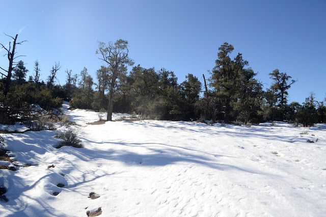
At first, I just trudge through the snow. The sections aren't long nor deep and the footing is secure enough. I did neglect to bring my gaiters. I meant to have the nice, long ones on. I'm going to regret this eventually. The snow is deep enough to get into the tops of my shoes. Right around 3 miles in, I think I'm ready to try it with the snowshoes instead. It looks like it is getting pretty determined to be covered in snow.
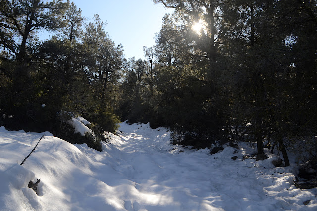

It doesn't last, of course. Around the next corner, there is dirt. The snowshoes come off to go back on to come back off to go back on... This spotty snow is quite annoying. Eventually the spots are short and I just step carefully through the 20 feet or so of dirt before the next section of snow.
The junction is under snow, but the signs are clear. Actually, there's still not enough snow to make the roads difficult to make out. Now it really gets to climbing with a couple segments that look like they've been redone because they were a little too steep.


It all levels off again for a bunch of miles of gentle climbing. The wind hasn't been bad, but now I want my windbreaker. I can hear more wind high in the trees. The snow is still not so deep that I can't see where the road is. In fact, the trees have managed to clear a space around themselves. Still, a space in the snow under a sheltering ledge of a rock shows the ground is two feet below there.

The junctions are no problem with the incomplete visibility of the road as they are well signed. Some signs are a little harder to find than others, but every route has one. Once I'm close, it's easier to see because someone was up here. Skis or a snowmobile, I couldn't say. It's very old track. I think it's snowmobile, but expect it shouldn't be. Whatever, there are two and they stay so perfectly distanced so much of the time that sometimes I think it must have been some four wheeled vehicle. Also, the track is now a hard, icy ledge in the middle of the snow that makes unpleasant tilted footing.


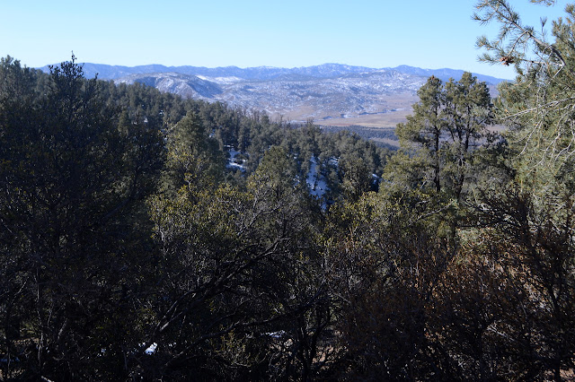
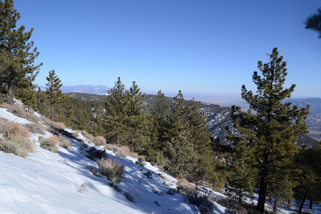
The road hangs toward the south side of the mountain, giving me views I didn't have before. Once in a while through the trees, anyway. There's the bulk of Alamo Mountain and the ripples of the many peaks through the Sespe Condor Sanctuary. I keep going to the next junction, where the icy track makers go the other way. I no longer have to pay much attention to how I place my feet. Just don't step on one snowshoe with the other. A further and I start to get eastern views instead.


Around another corner, there's the electronics at the top. The fire lookout is rather dwarfed by it all. It must be chilly because the camera is getting misty. As dry as it is, I can tuck it into my windbreaker to warm it for a little improvement.
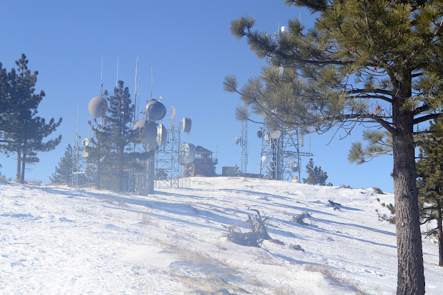
The fire lookout is the old wooden structure painted brown that I remember. Well, it might have been less rickety in 1995 when I last saw it up close. I didn't look at it much then. I'd seen it before. Now the steps require a bit of extra care and the cab lets in everything.


I decide to make the climb. Very very carefully. There is still view from the top to all directions, but sometimes a bit obscured by trees and electronics.


It got a little late as I was coming up, but I wasn't going to turn away just for that. I got to the mid point by an okay time. I grab some food, then get moving. But not entirely. My search for the benchmark was as disappointing as expected. Only reference 1 remains. However, there are two azimuth marks. I didn't want to go down the snowy and steep hill for the second, but I'll have a go at finding the first. Er. Not a very good go because although there is a rock outcrop where there should be, there's no mark visible either there or on the much more likely rock a little further. So much for finding the original azimuth. Then I head down. The icy tracks are along the main road, so they will continue until the end. There's more junctions along the way, but none are likely to be the source of the tracks.


The road has a good layer of snow a long way down. Not much view at first, but I could see it from Tecuya, so I can see Tecuya from it once I'm low enough. It had looked to have a lot of snow and it does. People have walked further up this one than the other one in the snow. It actually looks like one person post holed all the way to the top one day. Many people have gotten about 4 miles up. I only see one snowshoe mark, but maybe those melt to obscurity more quickly. The snow shouldn't be as compacted under them.


The road doesn't have deep snow, but I keep the snowshoes on for the built in crampons. There are breaks in the snow, but I keep as much on the snow and step carefully otherwise. It's still two miles when I take them off. That's about 10 miles of hiking with them on. Then they get back on and off and on. I finally decide to just pack them away. Everyone else has been walking it. I should have got out the spikes. It is mostly ice where the snow remains once it is getting dark. I slip a little on a few spots where the melted water is freezing over again. I really should have got out those spikes. There's one last long section of frozen stuff where a bend is down a deep little valley and it is very stomped down. Really, really should have got out the spikes. After that, I can stay on dry old pavement and don't need the spikes after all.
Ten miles on snowshoes. I guess one can go a far distance on those things. I didn't regret not having my gaiters too much, but I suspect that's because the snow often wasn't all that deep. Still too deep to go post holing all the way.
©2020 Valerie Norton
Written 1 Feb 2020
Liked this? Interesting? Click the three bars at the top left for the menu to read more or subscribe!


Comments