I woke after about 6 hours and took to reading Tortilla Flat at 3AM before getting a few more hours of sleep. That seems to be how too long nights work. I didn't get moving until almost 9AM. Steinbeck helpfully points out that a watch is useless: 7AM is a fine time to be sitting out on the porch in the summer when the sun is already warming it but not in the winter when it isn't even light yet.
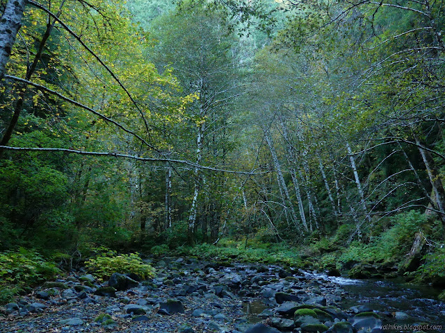
Some of the most beautiful bits of fall color on the creek were just below the camp site, especially in the morning light. Some nice, big trees above the camp.
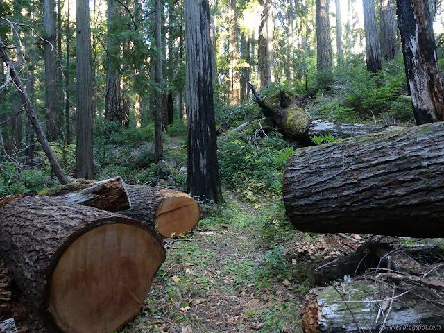
I didn't bother to put on my socks and tried not to think much about the water as I hit the crossing and stepped into it. It didn't feel quite so shockingly cold, but when I stepped out, I could feel the function in my feet was reduced by the chill. Then there were the downed trees to navigate before the last crossing.
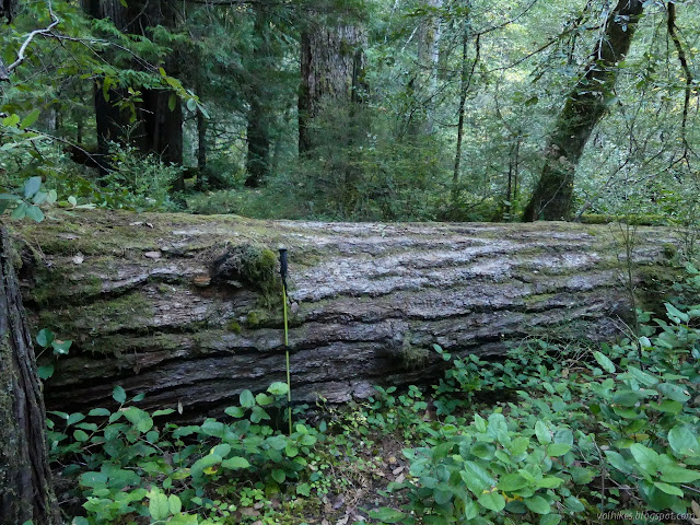
When documenting a log across the trail, it is always good to put something like a hiking stick in for scale. Now, who has an 8 foot crosscut saw? This is a far easier way to pass a log. That was a long way to underbuck on this admittedly somewhat smaller log.
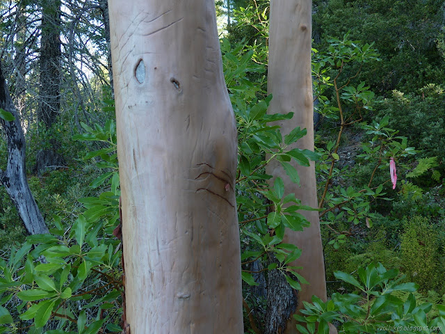
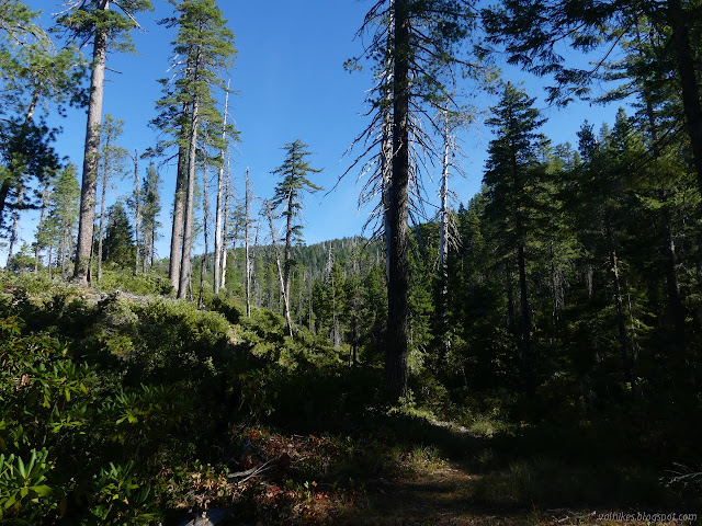
I sat down to wring out as much water as I could before pulling on my socks for the rest of the climb, then noticed what I'm assuming is an old sign post has some odd details. There's a groove cut all the way down one side, a bigger groove down the other, and nails hammered into the top. Fence post? The blazed tree next to it offered no help. It doesn't have a blaze for that direction, either, but there is a trail marked on the old 15 minute quads. I got moving upward. Snatching a little bit of view while climbing the ridge. Everyone has their own way of making trail signs. The bears are enthusiastic on this madrone. A gentle flat to provide some rest before coming some more.
I was dreading that I had let the sun get up so far and have so much time to warm the badly burned areas, but it was distinctly cooler as I climbed, even compared to the same time of the day the day before.
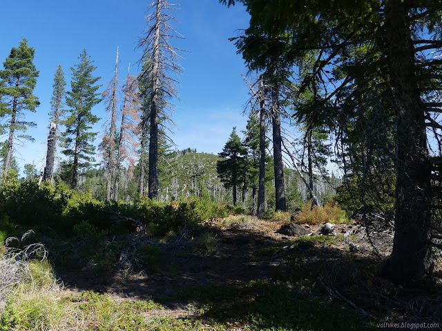
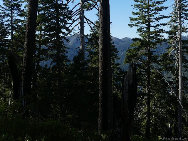
Over the knob and about to dip and climb again. This knob has a funky bit of green rock that looks like an obsidian at first, but is quite crumbly. There's a look at Peak 8 and/or Doctor Rock again, but from too low to see the details I was trying to capture.
So when I moved back into the more forested area, it was just a return to a little more difficult trail and not so much welcome shade. The difficult spots aren't long anyway. There's a place where it scrambles down (but not too steeply) and around a heavily overgrown area with a few logs that I'm sure was once the trail. Otherwise there's almost always enough tread to find trail and, for now, ribbons remain to help.
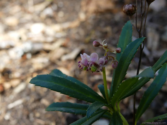
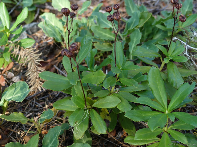
I moved some branches and found a wintergreen still blooming underneath.
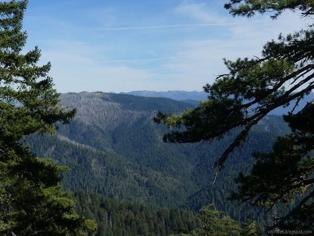
There's a second bump a lot closer to the trail that, according to the old USGS maps, could be just as high as the large, flat peak. It's been smoothed out of existence on the FS quad, but I decided to tag it, just to be sure. It's a rocky point that is easy to walk up and offered some specific views.
Rock Creek Butte is the bit of particularly badly burned trees the road passes through just before getting to the trailhead. North-ish across the rocky little peak.
Then I got moving again. There's a big dip of about 700 feet, all along the ridge line, before climbing again to the top that is not much higher than the peaks along the ridge.
Other wintergreens are far past flowering. (This is actually from a different big group of things that get called wintergreen.) Still failing to find that view of the western peaks. Northwest again. Other specimens of the same sort of wintergreen are also far beyond flowering.
I was chugging along slowly on that last climb back to almost 5000 feet, but quite happy for the cooler day. Muscles were feeling it, but not too badly.
Conifers (mostly) and madrones and a lot of oaks may be evergreen, but the low stuff participates in the fall colors. Leaving the wilderness.
I was a little late if I was trying to get back "to camp" at the car by 6PM, but not too late. I should have got a good sunset, but with no clouds to take up any colors, it was a bit of a fizzle.
Klamath National Forest (Map link.) It has been a couple years since I actually did some trail work besides kicking the odd log and a lot of sticks off the path. There have been some excursions by the Siskiyou Mountain Club that got far enough south to tempt me, but none had worked out thus far. I noticed they would be working out of Clear Creek for five days and that sounded long enough to make it worth the drive. Is it odd that these California trails are getting a lot of maintenance by people from Oregon? Yep. I also notice that the folks driving out of Ashland are actually a couple miles closer to the trail than I am. I'm coming from another county too. Judging by the license plates on the way, it looks like more people from Oregon are using these areas too. In fact, you can find it covered in guide books for southern Oregon. Thursday The lower (last) parking area at No Mans Trailhead with the traditional burn area hazards signs marking the trailhead itself. The wo...
Uncompahgre National Forest (map link) The Forest Service seems to be uncertain if it is Lake Hope or Hope Lake, but more certain that it is the Hope Lake Trail. It consistently marks the road up to the trailhead as a 4x4 road, so I parked in a turnout at the bottom and started up, getting increasingly grumpy about how it is a rather good road with a loose rock here or there. I chatted with some campers about how it was probably great all the way up, but they'd gotten to their rather brilliantly picturesque site and been sufficiently mesmerized by it not to continue on. Talking with them got me sufficiently emboldened to actually stick out my thumb at the truck that came by as I finished the chat. When you're going 5 MPH anyway, it's easy to stop, and he did. Greg was going for the hike too and actually wouldn't mind having a buddy. The road promptly turned to something it wouldn't be wise to try the Scion on. With good judgement, I probably could make it, but...
San Diego Sung has been wanting to actually tour the aircraft carrier turned museum down in San Diego and I said sure, so off we go. Of course we start off just attempting to take in the size of the boat. There is something downright comical about the snack bar and tables at the stern and manikin service men eternally hang about on deck. It gets serious quickly going forward. The length of the USS Midway with snack bar at the back.
Gunnison National Forest DAY 1 | DAY 2 | DAY 3 | DAY 4 | DAY 5 | DAY 6 (orange line, map link ) I got an early start trying to beat the mosquitoes and sort of made it. I noticed the missing bit of sign on the ground to finally discover that there's no camping (or campfires) allowed at the lake. I turned at the post, ready to take it wherever it may go. The couple at the lake thought it was silly to think it might rain in the afternoon because the air was just too dry. Indeed, I'd washed two pairs of socks (in a bag well away from the lake and creek because I'm not a barbarian and I know soil bacteria is needed to break up everything from that and you don't find that floating in water) which were very nearly dry in the morning. It was quite pleasant until I got to the long grass meadows and everything from my knees down got wet anyway. A little bit of view over the meadow still shadowed in the morning. The trai...


Comments