Forks of Blue: descent into lush
Klamath National Forest
Six Rivers National Forest
DAY 1 | DAY 2
Dark blue for day 1. Click for map.
I headed up the Klamath River with about two weeks of plans over four different trips. First up was a trip down Forks of Blue to the east fork far below and maybe the other end of the trail. Since I just have the baby car, I took the paved G-O Road to the trailhead at the top rather than the 4WD road to the bottom end. I found the G-O Road by faithfully turning left at the unsigned road just after entering Orleans and immediately passed a sign confirming my choice. This road is just after the sign for "Eyesee Road" if leaving Orleans. Stick to the paved road for 28 miles and the trailhead is a few feet short of the mile marker with a long paved space for a number of cars to park and a wooden sign board for notices. It has a nice reflective "Forks of Blue Trailhead" sign at the top so you know you've got to the right place when you're there.

I had been debating if I would try to day hike or backpack. The days are short and the climb back is from 2000 feet to 4800 feet and is probably close to 4000 feet in the cumulative sense. With the weather looking good and the weather machine confirming it, I decided to go with an overnight with minimal equipment. I got out the day pack, pulled out the art supplies, then stuffed in about 5 pounds of bulky gear and food. Jacket, quilt, pad, and a bit of Tyvek. No bear canister, so got to bear bag the food. No tent, but no rain remotely likely and I'm not worried about heavy dews with my gear. No stove. The entire region 5 was closed due to the high fire danger and lack of resources because most fires are started by accident by humans. Six Rivers and Klamath came off the closed list on the 1st, but there remains a ban on all ignition sources outside of developed campgrounds, so no stoves. In Klamath, all developed sites are closed except for a short list topped by "all trailheads". For this trail, the trailhead is in Klamath and most the trail is in Six Rivers. The signs I saw coming up indicated stoves were fine with a permit, but my understanding is that the ban is still on. I dumped pearled couscous in with soup flakes I found in the bulk section in the co-op because it's easy and uses stuff I've had bouncing around in the car for a while now. Soak time: about 2 hours. Breakfast is instant pudding full of coconut flakes and chia seeds. I saved a couple dollars and got non-fat milk powder this last time and I'm going to regret that with winter coming on. Fats and oils seem to be the body go-to when looking for calories to turn into heat.

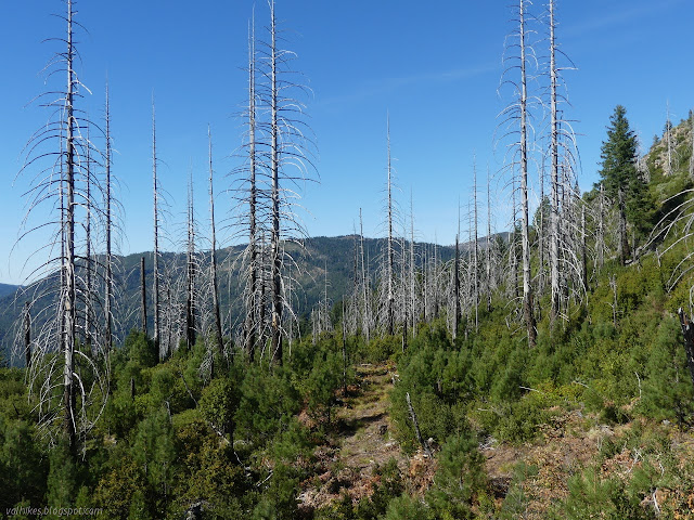
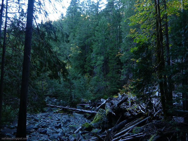
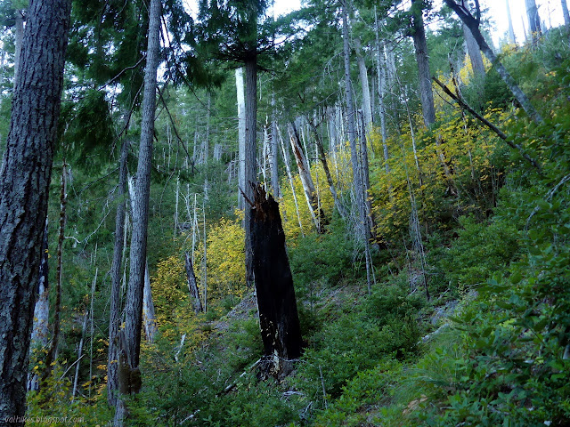
My day pack is 28L and was completely stuffed with my minimal gear. I could see the holes developing in the top that I hadn't really noticed before. Well, I had, but then I forgot about it again. My poor, ripped up pack. I started up the trail to find it follows old roads with some well marked detours where the road catches a lot of erosion. The notice warns of burned areas, but the first part of the trail doesn't show it. I was a little worried because a mile down the road the forest is absolutely devastated by fire. The corpses of fire killed trees stand in a dense array without even a single green top remaining along the road. It is not that bad on the trail. There's a bald spot, but that's due to the rocky soil of the area. Passing into the Siskiyou Wilderness, there's few spots where the trail seems more like old road, but the burn did come and there are a few trees down again.

I got to a much larger bald spot and ignored the big cairns curving down past it to walk out and get the view. It has quite a view. The canyons were looking misty, but I wasn't sure if that was really what they were or if they were full of settled smoke. I was a bit worried about this area for this trip because it does sit sandwiched between the still burning Slater and Devil Fires to the north and the still burning Salmon and Red Fires to the south. Happily, the drama of smoke was far from this particular trail.


As I came off the top, I found myself passing through a wetter area of what I expected to be a dry hike until the creek below. There is even a small pond below the trail. I marveled at how much the water didn't look scummy before moving along.

I got a long stretch of ridge with glimpses of, I think, Peak 8. It could be Doctor Rock. There are two peaks out there that stick up as rocky points with full views and the ridge looks like it was cleared of trees in the last fire although a few are still waiting to blow over. It looks like it could be a nice little climb for an excellent view. I never got a clear enough view of it for a photograph.

Trail climbs again and I wanted to hit the high point along the way. It's got good prominence and a benchmark off the side. I left the trail and followed the ridge avoiding the numerous downed trees. It's one of the harder hit burn areas. There's no good view from the top, so I kept going down the side for a lunch stop. Sometimes those benchmarks have a nice view. I found an unstamped station with some view, but not the best.


I expect had I decided to day hike, the benchmark would have been about as far as I got. Since I packed in some sleeping gear, it's the creek for me! I headed back the way I came tending off to my right hoping the trail hadn't vanished in the short distance. Quite the opposite, it looked like it had had tread work in the last few years. That only lasted until the trail got off the side of the hill and back up onto the ridge line. It was marked with ribbons and the route was sometimes unclear.

It was getting hot, so I wasn't too keen about the trail when it entered another badly burned area. It did get easier to follow as there had been a lot of work clearing the brush that was coming up after the fire.
The trail climbs up and over a knob and there were trees again. Madrones were quite numerous. The brush cutters had run out of time, but the flagging was intense. I added another knot to a lot of them to make sure they stay. There were more conifers again as I got near the bottom.

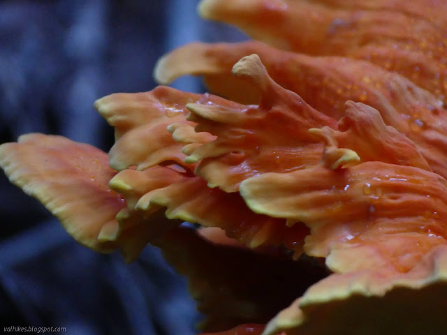
Forks of the Blue ends at a post just short of the first creek crossing. It was once a junction. I found a track for the historic trail that once continued along Blue Creek and connected with another historic trail off Peak 8 along with a more accurate track for East Fork Blue Creek Trail than the line on the map before I started. I pondered the old trail, but only followed it a little because I wanted to check out a massive bit of orange growing out of a cedar stump. The trail looks to be gone. I didn't even see blazes. I thought I saw a cut in a log for it, but then noticed the tree had been felled.

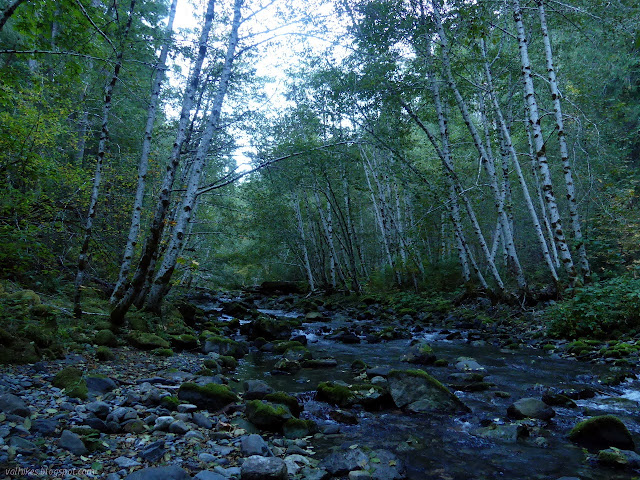
I didn't find the camp site I wanted. I liked the idea that my wet shoes from creek crossing would get all day to dry before I started to climb, but it wasn't to be. I headed down to the crossing. It was flagged although it didn't need to be. I took off my socks and stepped in in just my shoes, finding it rather uncomfortably cold.

I was feeling pretty good about the probable situation with the trees because there were a couple very large ones with recent cuts just short of the crossing. Unfortunately, soon after the crossing, I found one just as big that was a challenging barrier.

I climbed up on the log at one end and walked it to the roots, where there was means to get down again. It looks like I'm not the first. There were two more challengingly large logs before the next crossing, but it was good after that.

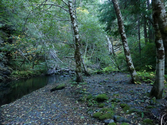
I found my camp site after the second crossing. A little trail helped lead me to it, but the flat areas were visible from the main trail. With that problem solved, I continued along through the next three crossings and started to climb.

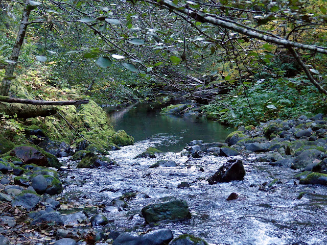
There was quite an impressive log jam in the creek as I followed along through the incredible lushness beside it. The climb is gentle, but it is on the side of a very steep slope. Luckily only small trees were down on the trail there, at least as far as I went. I called it on account of time a little more than a mile from the end because I wanted to be in camp by 6PM.
So I headed back down, marveled at the log jam once more, sloshed my way through three of the five crossings, and arrived a minute to 6PM at the designated camp. It wasn't yet sunset, but it sure looked past by the level of light.

I didn't get the water on my supper as early as I should have, so I had to wait a bit after settling into camp to eat. It wasn't enough food either, so I decided to put in a bit more for the next trip. I went well into dark, but it still felt like an early night when I went to bed, not that I wasn't sleepy already.
Continue to the next day. ⇒
©2020 Valerie Norton
Written 8 Nov 2020
Liked this? Interesting? Click the three bars at the top left for the menu to read more or subscribe!


Comments