Marble Mountains: Bear Lake
Klamath National Forest
DAY 1 | DAY 2 | DAY 3 | DAY 4 | DAY 5
Purple line for day 1. Click for map.
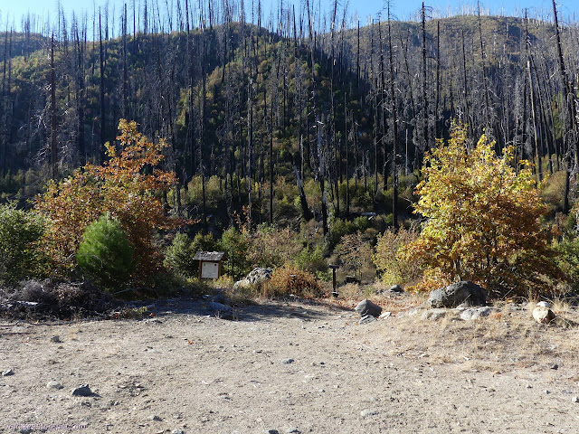
My first plan for a loop through this bit of the Marble Mountains was out of the Johnsons Hunting Ground Trailhead, which is off the side of a 4WD road, and includes Tickner Hole and Rainy Valley, which with the trail from Johnsons Hunting Ground are all or partly secondary routes. (For some reason, Tickner Hole has a middle section that is secondary as if people like to come over from the top or up from the bottom, but never between the two.) I decided in the morning before driving over that it would be better to drive a little further and hike out of Norcross Trailhead, which is next to a campground open year round. (But not right at that moment because it's a developed area not on the list in Exhibit A.) Norcross is at 2200 feet and Johnsons Hunting Ground is up at 5000 feet, which is something to think about when you're edging closer to the first snow of the year and expecting to stay out for enough nights that the weather machine is starting to get inaccurate. I still drove in along the same route which was a bunch of little roads marked "Kelsey National Recreation Trail" on the USGS map. They were all good roads, but very single lane and sometimes sight lines while going around a corner were about 10 feet. They had some spectacular view spots. They were even paved on the very steep bits with rubber gutters to help direct the water off. I have never driven a road where engineers saw the need for rubber gutters like that before. As I passed the junction for Johnsons Hunting Ground, I did notice that the number on it is vertical indicating it is all 4WD road. It looked it and there is parking for at least three cars at the junction. Norcross is really all around a better place to try to drive a Scion. Oh, and the trails are primary except for a stretch high on the rim where I don't get worried so much about it and a pure loop is possible. I do love my loops.
I got my meals packed up the day before but didn't get started until 10:30AM, which ranks as extraordinarily late to me. The morning was 20°F! (But 22°F near the ground because it's still fall and the ground is still cooling. Fall is a more forgiving season than spring in some ways.) I was a little worried that I was mad as I proposed to hike up to Paradise Lake at nearly 6200 feet. If the temperature drops 3-5°F per 1000 feet, that means the temperature up there might be 0°F. Well, I have my puffy pants if I think it'll drop below 40°F, but I added in the Costco quilt too. I have comfortably slept in my unheated trailer with a sheet, blanket knit of Wool Ease Thick and Quick yarn, and that Costco quilt when it was 9°F outside, so it's mostly there. I did also have some cheap down booties and hood that didn't get in the car to get into the backpack. I was a lot grumpy about that, especially when I found my electric thermometer gadget reading 20°F that morning. Happily, it was the coldest morning of the entire trip. The sun got to the trailhead around 9AM and it was a balmy 50°F when I started.
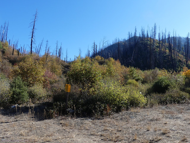
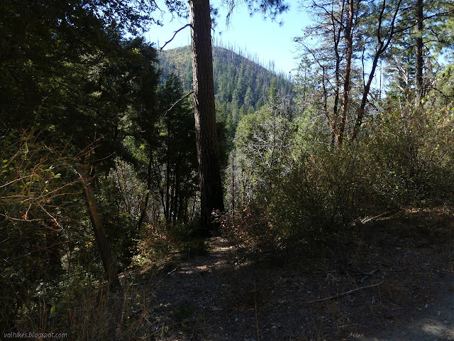
I decided I wanted to go clockwise, saving getting my feet wet in the ford about 100 feet from the start to the very end. I did first have a very good look at that ford to see what I felt about my chances of crossing it were. Very good. Even if I might chicken out, there is an option to continue along the other side for another mile and a bit to Sulphur Springs Campground where an old automobile bridge services the walk-in campers and hikers on Elk Creek Trail. I couldn't help but notice that the trail with the ford is clearly the more popular one getting the kiosk and actually having shoe prints on it. All the better to be confident I could return on it. I turned my attention to the less popular trail. Still primary trail according to the map in the kiosk and a National Recreation Trail according to the Forest Service quad, but going through a big of canyon that was clearly very badly burned. I was quickly hopping over logs. Lots and lots of logs. I thought that with heading to a place called Paradise, I would have Last Resort running through my head all day. I was mostly focused on how to get over the next log with a brief respite of trying to get a look at the waterfall shown on the map. I pushed through a thin bit of brush to stand up on an overlooking rock, but couldn't quite get a look.

The thought that maybe there would be a particularly large tree that I just couldn't get over or under or around to put me out of my misery and force me to just go back may have swum through my brain a time or two. It didn't happen. I could handle the fallen. I could handle the brushy bits when they came. I did have a bit of trouble with the combination. There was a small tree across resting in branches at about chest height. I decided I could just clear it and the branches held on a little bit more than I expected. They were just young pines. I managed to throw myself off balance and went falling face first, but my pinky finger hooked a branch on another young pine. There was quite a sharp pain as my pinky arrested the full force of me and my pack heading toward the ground. I extracted myself and gave the spot a poke, but the pain quickly vanished again. I wiggled and poked and grabbed my sticks and kept on going. Nothing seemed to aggravate whatever injury happened.


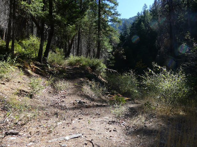
The frequency of downed trees reduced although I was still thinking that maybe I should have tried the flagged trail that seemed to climb to the road from the back of site 4 in Norcross Campground. Eventually, I came to a split in the trail approximately where it is supposed to go up to the road anyway. I started down the lower side, but it had little tangled things to get through as well as big trees. And why was I wanting to battle just a little bit more of the trail instead of going up to the road? I backtracked and followed the switchbacks up. They were also covered in little tangled bits that made it the hardest stretch of trail so far, but that's only 2.5 miles of over 40, so the hike was still young. The road, designated 4WD on the map, looked Scion ready for the short bit to Bear Lake Trailhead.

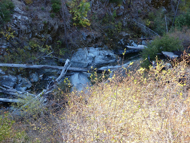
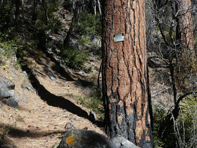
The trail follows the old road briefly before leaving to stick with climbing along Bear Creek. The road was once important enough for a bridge and I could see the support structures where it crosses to climb the mountain, presumably to mining operations.

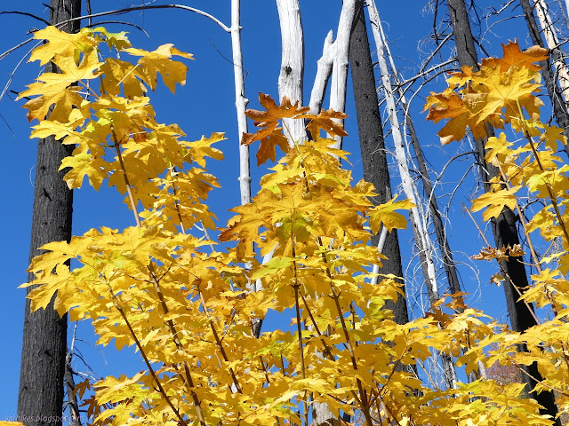
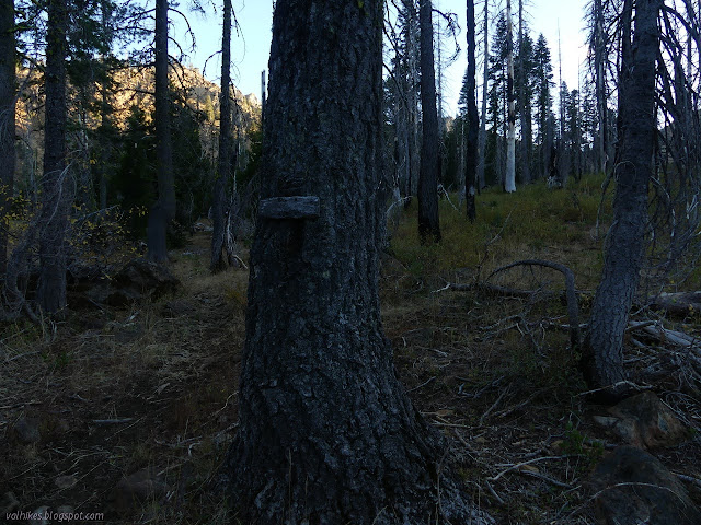
There were a lot fewer trees to clamber over, but I wasn't sure if that was because it gets more work or there just isn't as much work to do. The evidence of recent burn is visible throughout and some areas were badly affected, though not so bad as the lower section of canyon. My hand wasn't bothering me, but my foot was. It felt like the same old mystery injury and it'd been giving me twinges for a month now. I finally sat down and taped it up for the first time in over a year.


The trees started opening up into high meadows which looked quite overgrazed and you wouldn't find it hard to make me believe there had been cattle up there. The area does seem to be covered by a grazing allotment, but the prints I saw were a bit small. It's elk that are up there now. Either way, the trail was getting a lot of competition with animal paths and it was often not clear which path was the human one. I followed a path that I'm sure other humans have also selected. The area looks like it would be pretty easy to camp. Three streams cross the trail, but the only good one for gathering water was the first. I missed it and had to stop and make my way down to Bear Creek instead. I found it warm under the cedars on the way down to the water. The grazing animals clearly noticed this too and had spent quite a bit of time there.

I was finding the visible geology had changed. Tall, rocky peaks were visible. The sort of peaks people like to sit below and gaze up at for a while. It really was quite pretty and a bit golden in the light.


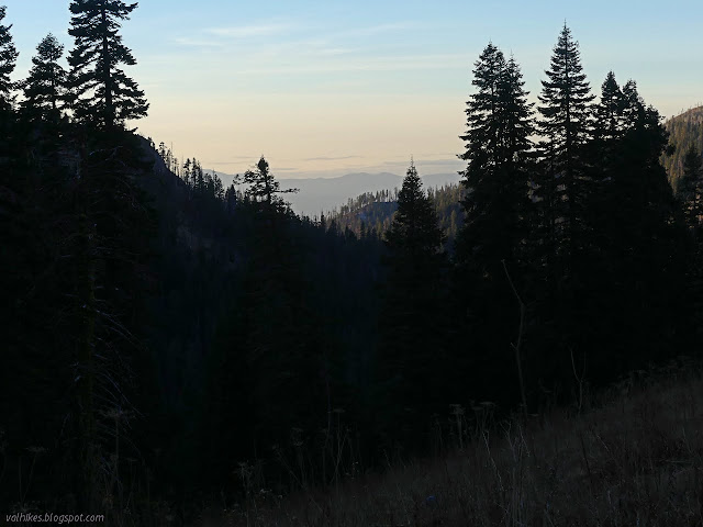
I was definitely not going to make it to Paradise Lake by dark. It was starting to look like I wouldn't even get to Bear Lake. I was feeling a little miffed about being on the "wrong side of the ridge" and there wouldn't be warming sunlight until late morning. I also wasn't happy to see how badly the trees were burned in the area.
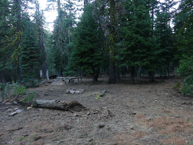
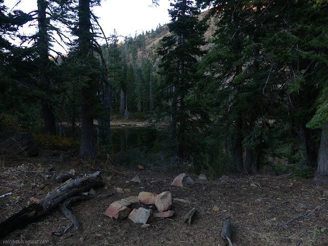
I noted the camp just short of the lake and declared it mine for the night. It was rather overrun by grazing animals too and had clearly been recently occupied by a group with horses. I expected there would be easier trail for a while. First I needed more water and some sleep.
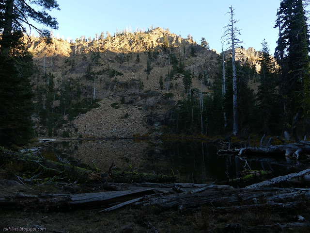
The outflow of the lake wasn't quite as reliable a creek as the various maps, all claiming this was the source of the nicely flowing Bear Creek, said. I went looking for the "true source" and wandered along the trail, which looked like it would go up into the higher flats rather than stopping at the outflow. I didn't get far before getting distracted. I had used my geocaching app to check the what the OpenStreetMap version of things was an noticed I was 250 feet from a geocache. I went over to be 4th to find since 2003, not counting accidental finders. Then I watched a bit of sunset and settled for lake water after all.


My cold supper was crunchy. I'm not sure if that's because it needs more time because it is so much cooler than the first test with pearled couscous or because I now have too much food to soak in a 2 cup container. It might be a little of both.
Continue on to the next day. ⇒
©2020 Valerie Norton
Written 10 Nov 2020
Liked this? Interesting? Click the three bars at the top left for the menu to read more or subscribe!


Comments
You did not want to use Johnsons Hunting Ground Tr. or Tickner Hole Tr. From KlamathMountainTrails.us : "The Johnsons Hunting Ground Tr. is very brushy, with fallen trees, and not recommended by district staff; the Tickner Hole Tr. is in bad shape, with fallen trees, and not recommended by district staff." Or see the trail conditions sheet on the Klamath N.F. Web site.
But I do want to go! I do! Tickner Hole looks like the more interesting area to hike through on the map. Maybe I'll go early season from Norcross up to Ukonom Lake and back taking each route. That should make it particularly a fight more than a hike. Wait, fighting fallen trees isn't really the goal...