Marble Mountains: Granite Creek and Elk Creek
Klamath National Forest
DAY 1 | DAY 2 | DAY 3 | DAY 4 | DAY 5
Red line for day 5. Click for map.
There was no more rock fall in the night, at least not that I noticed. The sun was long in getting there and I took a long time to get started. I only had about 10 miles to go, which was quite a long day for this trip, and I wanted to finish it by 4PM when Norcross loses the sunshine at this time of year. I just sort of wanted to be able to be in the sun once I had wet feet, but it is all downhill so I didn't rush. I finally noticed the little bit of ice that was down by the lake inlet although it wasn't freezing up in the trees.


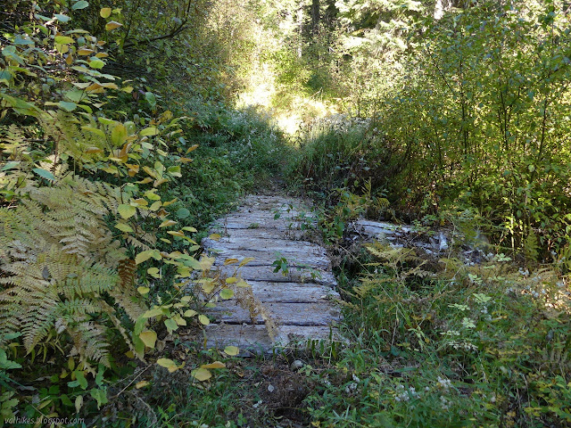
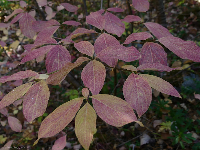
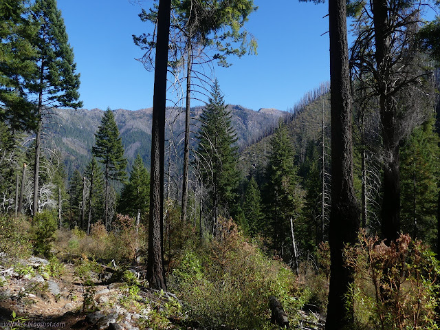
I got going a little before the sun finally hit the main camping area. It must make a great area for the hot summer months. From the junction, there's a few more switchbacks before travel turns to parallel Granite Creek. The next section of the trail frequently passes water and even has a little footbridge, but not where it says there is one on the map. There was a nearby camp that was well used and a large wash that drains most of Tickner Hole and probably makes an easier way to scramble down to Granite Creek. No water was visible as I passed, but the fall color display of the maples was the best of the trip.


After the wash, trail was quite dry until reaching Tickner Creek, just past the junction with the trail. Just below the crossing, I found another well used camp. Along the way, I began seeing charred trees and then open areas. To add insult to injury, the madones were mostly leafless with thick webs from a tent caterpillar infestation.


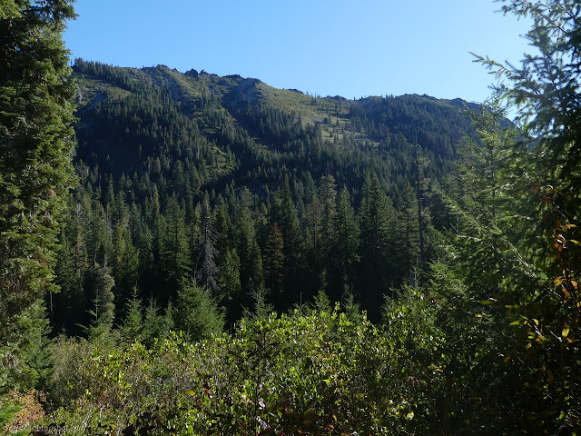
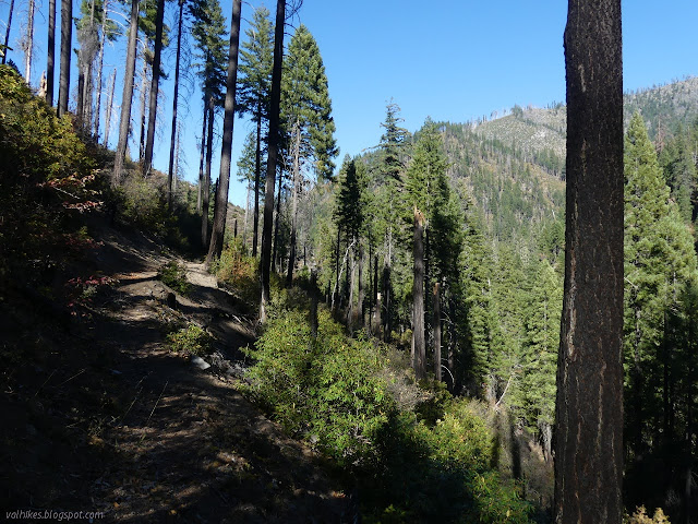
Tickner Creek is a pretty little flow. Granite Creek, on the other hand, retreats further behind steep slopes. The trail gets out onto more steep slopes in an area that was triggering my fear of heights just a little bit. I wanted to hug up against the upper side, which never does good things for balance.


I came to a crossover trail to Rainy Valley on the other side of the creek and found a pile of nuisance crud across the trail that stays high. I bent to clear it to make life easier for the next person when I noticed the loose sign next to it. "Not passable for stock." So that was the end of my nice, only recently downed trees, trail for a bit. Stock was asked to take the east side alternate. I was still determined to keep my feet dry. I stayed high. The first few little logs I came to had been cleared and looked recent.
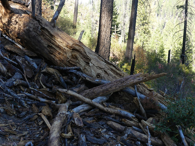
They really made me work at keeping me feet dry. I didn't want to follow the footprints down the steep hill to get a branch based foothold to get over one log, so I yanked out the 4" bark piece underneath to have plenty of room to crawl under. After that, even the little stuff had been left. The little stuff wasn't a bother. The last one came right up to here [imagine 5.5 foot human with a hand at her sternum] and was in two pieces. First, sitting along the trail. I noted a small log ramp and took it right up to the top to walk along it, then jump down. People going the other way were battling a mess of branches and worse along the side of the log. The rest of the tree was lying across with maybe 30 steep feet to climb around the top and a bit more to go around the bottom. I went up with the rest of the footprints. So, yeah, impassible to stock.

Then the trail dropped down to another junction for the other side of the "east side alternate" beside another well used camp. It climbs again after the junction and rolls along through increasingly bad burn, but with only a couple little trees to step over.


It was a few minutes short of 4PM when I finished. I didn't make it to the creek crossing while it was still in sun, but the parking lot was still. I'm not sure it made being in wet shoes more comfortable, but it didn't last long. An excellent loop except for the nasty 2.5 miles to start it.

©2020 Valerie Norton
Written 15 Nov 2020
Liked this? Interesting? Click the three bars at the top left for the menu to read more or subscribe!


Comments
We still do that kind of thing on the Orleans District. Happy Camp District has had troubles in recent years. There are some positive things happening that may, fingers crossed, improve the situation starting next year.
Except that first 2.5 miles, hiking was quite pleasant. I was quite warm under the summer quilt and down blanket although my mat is hitting its limits. There was a time when I expected it to be freezing in the morning. The cold just takes a little mental fortitude to handle at the mid-20s to mid-30s. The real price is the 10 hour days instead of 14 hour days. That's nearly 1/3 of the day missing. There is also the nagging worry that some quick moving and serious weather will come along.
Marshy areas are a bit different issue. Phil Pierard in Orleans has over the years replaced a lot of wooden structures, that have limited life spans and have occasionally burned in forest fires, with rock and fill causeway. That kind of improvement could last hundreds of years. A properly-done causeway has little impact on hydrology, because most of the flow is subsurface, and the deep porous soil isn't disturbed in the construction. It's just important to put in a sufficient number of cross channels to allow the surface water to be distributed.