Marble Mountains: Black Marble Mountain and Spirit Lake
Klamath National Forest
DAY 1 | DAY 2 | DAY 3 | DAY 4 | DAY 5
Green line for day 3. Click for map.
Since my primary reason I didn't want to go up the mountain the day before was that it would get cold, it was not lost on me that although it wasn't freezing yet when I had my 3AM read before going back to sleep, it was mid-20s when I got up. Once I got out of the sheltered area of my camp, I found that that came with an arctic wind, too. I didn't bother to take off my puffy pants and jacket to start hiking.
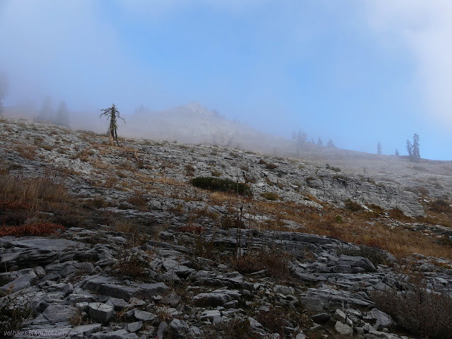

I kept drifting into the rocks, which didn't seem like it would be so bad, then encountering sinks and short cliffs and generally rough terrain only a few feet from easy going dirt. I got faster as I started paying more attention to staying on the dirt. I was finally getting warm in spite of the wind by the time I got to the rim of the depression and hid behind it and some brush to swap for my rain coat.

I found quite a bit of willow looking vegetation along the rim and had to drop one way or the other to get around. I chose into the depression and may have chosen wrong. Others had tried the same before me and helped trim away a few branches on the thinner vegetation there. The wind bit away at everything that wasn't guarded.
I got below a false peak I could see from camp and came to the end of just wandering along the dirt. It was edging along the crest instead. There is a little bit of a trail, although it is hard to say who makes it, humans or animals. I guess it's usually both anyway. As I went, I did try going around to the right at one point, but really got no advantage from it, just made a better target for the wind.

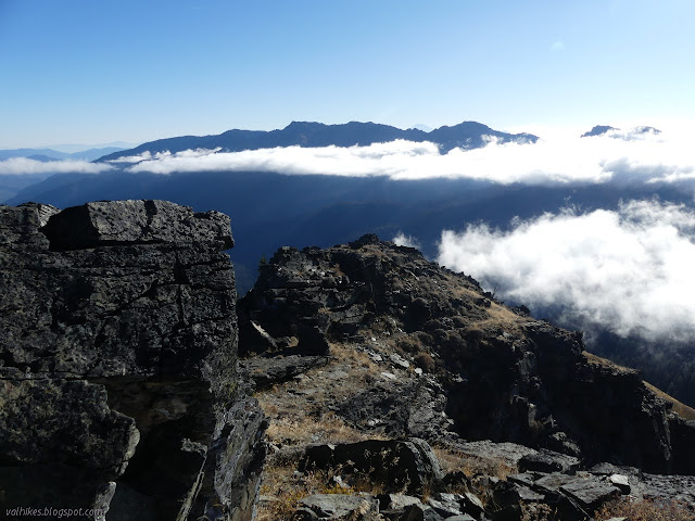
Suddenly the top was right there with all it's view. I hid from the wind behind the tall rock and got dressed a little more warmly again. It still wasn't even up to freezing. I poked around some rocks off to the side that looked like the good spot to put a register only to find it tucked into the rock I was hiding behind. I tried to take in the rest of the view, but mostly got the same one I'd been looking at coming up because of that wind. Admittedly, it's quite a good view.
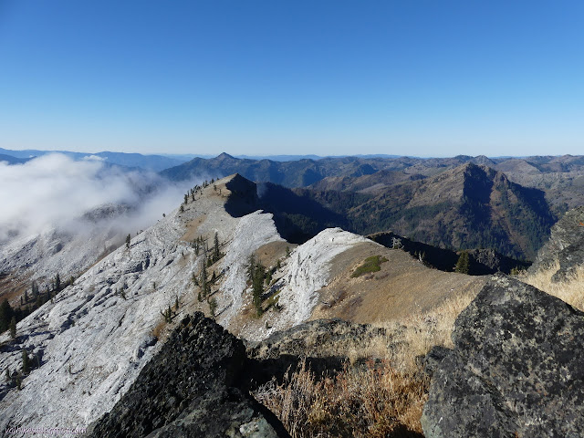


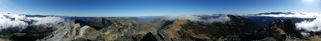
I didn't go on to what Peakbagger has marked as "Marble Mountain", the next peak over. It makes more sense that either Black Marble is the named high point of Marble Mountain, in which case I'm already on the top, or the next peak along that is more distinct from Black Marble is Marble. It had got above freezing, but it was still blowing a wicked wind.

I headed down, keeping to the south side of the crest, then around the east side of the vegetation on the lip of the depression. It worked better than the way up. I also wandered through the trees that I thought were a potential camping area to find some good spots I wouldn't be using. I got down to my own just big enough spot and packed it away, enjoying the warm of the sun, then back to the trail, which quickly wasn't warm at all.

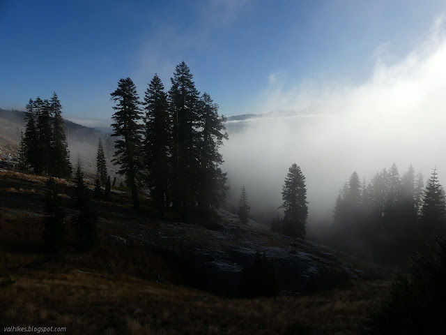
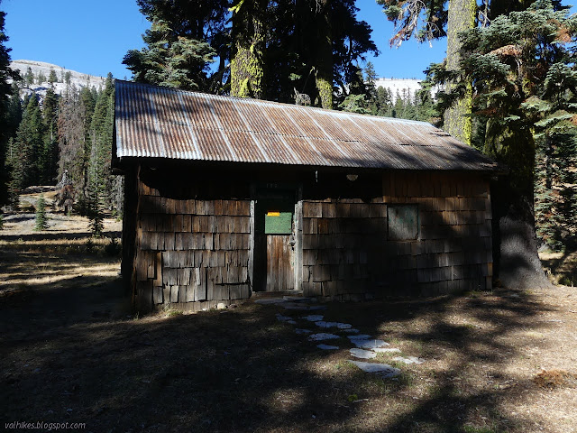
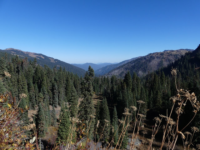
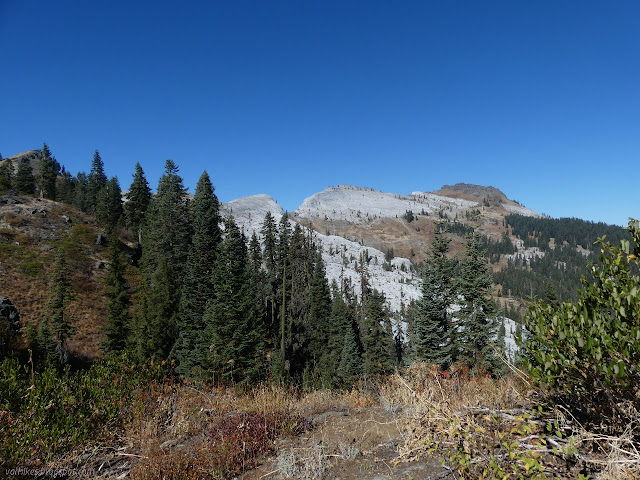
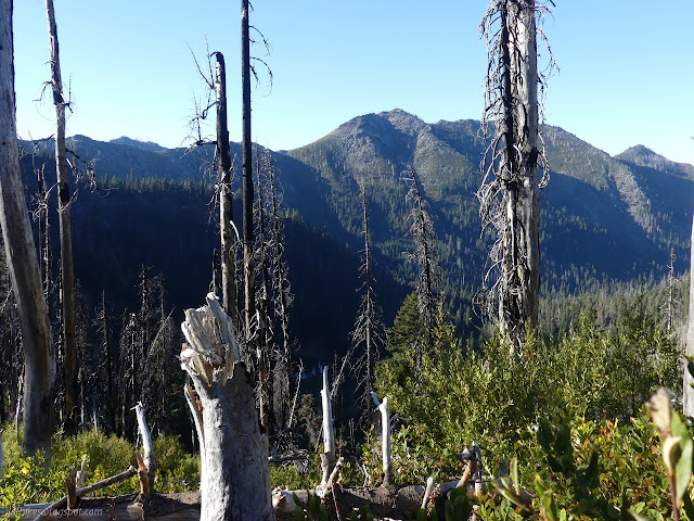
The glimpses of the stark Marble Mountain are not quite so amazing as from high up, but there are a few spots that aren't half bad. I did wander off trail through some trees for the best of them, but there were some good clues to suggest that wander. Marble Valley is the more traditional space to find a camp and there's even an old guard station in it.

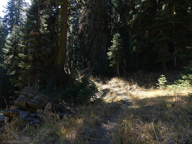
The trail climbs up through another outcrop of white rocks. I was getting a little chilled even while hiking and pulled out my rain jacket again when I stopped for snacks. It was fine in the sheltered place I stopped, but once I got going again, I think the wind had gotten colder because I was getting a lot chilled even in the jacket.

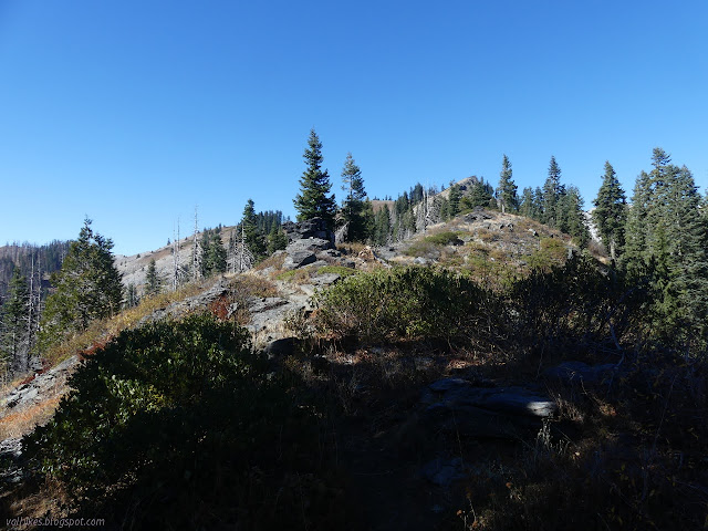
I crested a ridge and came to the end of my small section of PCT. There was one single tree down on it, making it a remarkably clear bit of trail in my book. Haypress, the straight direction, drops down to Big Elk Lake and also gets a bit of attention. Marble Rim seems to be the last thought and I soon encountered a few more trees. Anything large had well established walk-around paths.

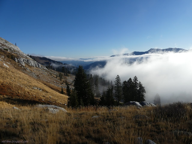
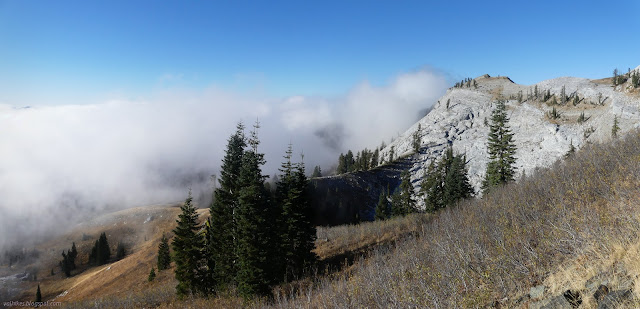
There's only the smallest section of the trail that gives that rim edge feel, but it does deliver. Cliffs drop straight down into Rainy Valley and follow along little peaks in both directions. After that, it gets out on the south slope, which was quite nice for sheltering from the wind.


I followed switchbacks down through a lot of fire killed trees to find Haypress Trail once more. Looking at a map, I think Marble Rim should be the better used trail, but the feet were clear that most go the other way. Better used it may be, but the bear prints were the most recent. It was good to be on a better maintained trail. There are a couple spots where dense fire killed trees up to 18 inches have been falling over by the dozen and it was nice to only have to step over a couple.


I had thoughts about going up Elk Peak, which looks like a nice easy walk about a mile from the trail. It has over 1000 feet of prominence and should be quite a good spot to sit for a bit. I ran out of water when I put supper to soak, which seems to be the norm. It was annoying me to even have to think about end of the day food sometime in the middle of the day and I clearly wasn't budgeting my water correctly for that situation. In the cold, no water was just a nuisance, but I wanted some if I was going to go an extra mile and back off trail. The brush looked easy enough from afar, but was starting to look like an impossible tangle up close. I made further excuses about time being not quite enough and so I missed it. But it would have been great to be at the top. I got to Spirit Lake with plenty of light instead.

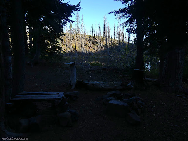
There were some ducks floating around in the lake when I got there, but when I started down, only the unmatched one stayed. It stayed for so long, I started to think it was some sort of solar powered decoy, but it managed to stay on the far side of the lake from me wherever I might be. The horse prints showed they started down the trail to the lake, but didn't get far before deciding against. It got mildly brushy, but was good trail all the way down and around. I passed a flat spot with no fire ring, a fire ring with no flat spot, then at the end there is a packer style site with a table of sorts. It's a little short, but I like tables. I claimed it.

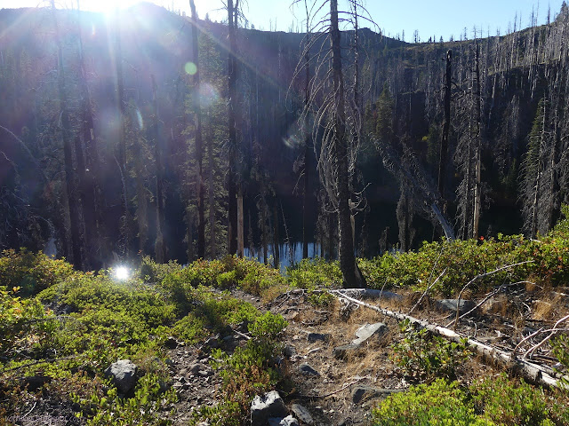
I followed a scrappy bit of trail further around the lake to what I thought would be impossible for a lake so high on the ridge, particularly this late in the dry season. Inlet water! In spite of all the dead trees, Spirit Lake jumped up high up in my ratings. It was hard to get at, but the past efforts of others who found it helped out greatly.

I picked the spot closest to the lake to sleep reasoning that while lakes are generally cold places and just a little way up into the trees will be warmer, right now things are trying to freeze. Water stays right there at freezing until it's done, although being water, it has funky caveats due to the frozen form being less dense than the liquid. Water is a nutter of a substance. Just saying as a chemist. Anyway, if it goes below freezing, that lake is a great big heat source. I was pretty sure it would go below freezing.
Continue on to the next day. ⇒
©2020 Valerie Norton
Written 12 Nov 2020
Liked this? Interesting? Click the three bars at the top left for the menu to read more or subscribe!


Comments