Big Elk: working the Bigfoot Trail
Klamath National Forest
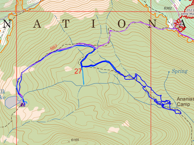
DAY 1 | DAY 2-3 | DAY 4 |
We got up, had a breakfast that couldn't be beat, selected some tools, and headed off to the Bigfoot Trail. Through here, north to south, the Bigfoot Trail follows the Pacific Crest Trail (so it wasn't much of a stretch for them to work that bit) to Haypress Trail, but turns onto the Wooley Creek Trail quickly and turns of again at Big Meadows. Our target was this upper section of Wooley Creek. This first day would be logouts and a lot of brush so we had a lot of saws, big and little, and loppers. There's a few tread tools, too. The brush tends to ceanothus, but it's a nice

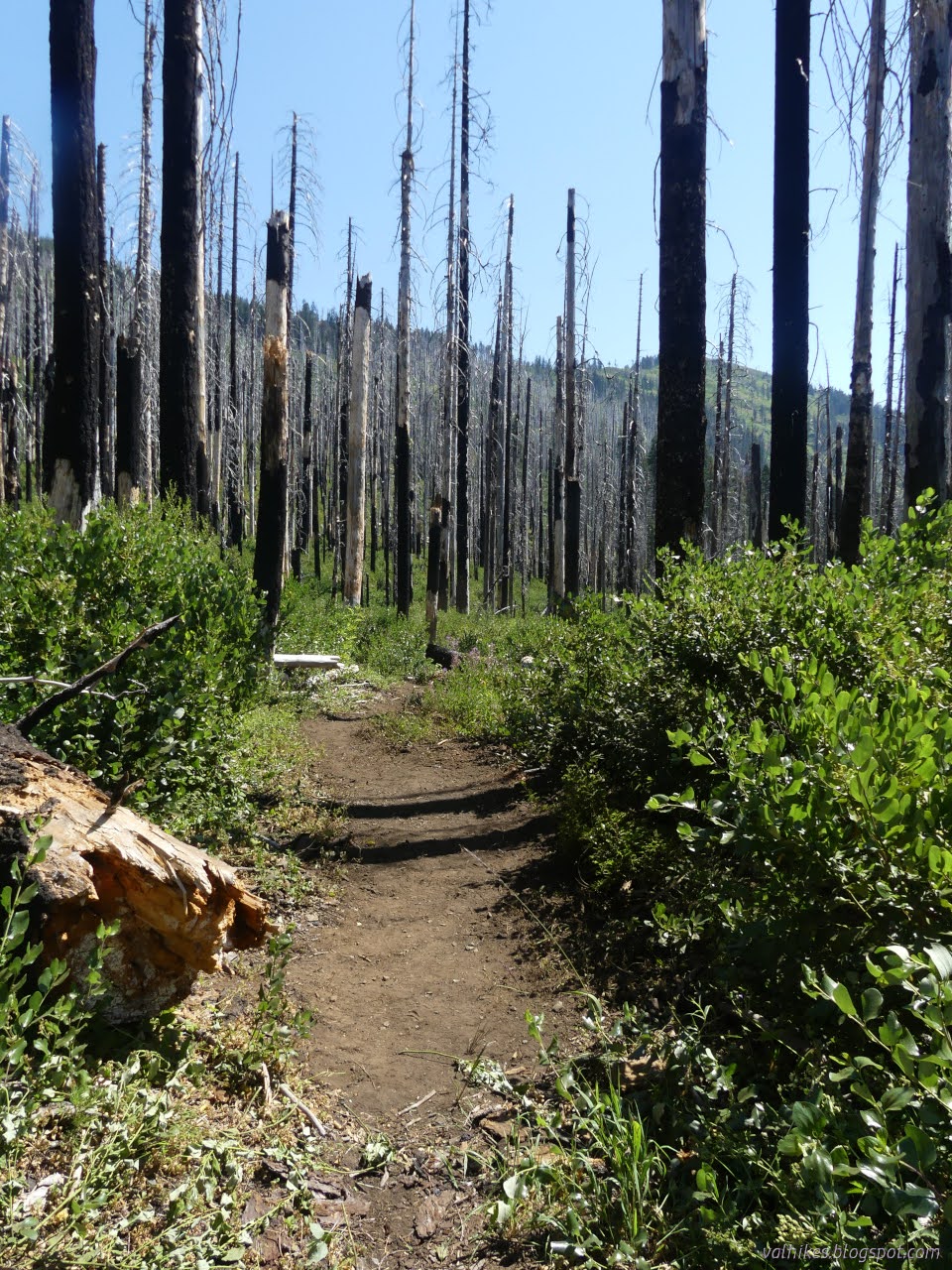
And apparently I was a bit too involved with cutting back the ceanothus throughout the day because that's it for the before and after photos. And there were so many trees. Tree after tree after tree. Big ones! We retreated to a thin trail that goes out to a packer camp on the little creek that is the Big Elk Fork of Wooley Creek for lunch. The crew before had dubbed this "the oasis". It was cool in the shade, but even nicer next to the water. Sometimes I wondered what we were doing in statistically the hottest week of the year out here working, but it barely got to 80°F. The previous crew had it worse. Clouds moved in to shade us for the afternoon just as it was starting to feel too hot.
After lunch, I got hold of a pulaski and hacked ceanothus root balls out of the trail. We'd actually started to run out of brush to hack back, so I was trying to make less work for the next year. It seemed like every other fallen tree had been protecting a ceanothus from getting stomped, plus there were plenty more. I dug at them until it felt like my arms couldn't lift the tool, waited 5 minutes, and hacked some more. So many ceanothus root balls.

We got back and had a dinner that couldn't be beat and settled into bed. We didn't stay settled. I had mentioned that there was a small chance of thunder storms until 11PM and some took this to mean it was a good idea to put the rain fly up. These people got to stay settled. However, I'd gone on to mention that this was likely just the granularity of the forecast. They cover 6 hour chunks usually, sometimes 3 hour chunks. The chances always end at 11PM. That doesn't mean it's really still there. I'd only had my fly up for two nights this trip and regretted it then. My summer quilt is a little warm for these summer nights and it was even warmer with the fly up and there hadn't been anything to keep off. I didn't put my fly up.
I'm not sure what woke me, but at a quarter to 2AM I noticed some rather bright flashes on down the valley. The rumbles came along after them. "I saw it, I saw it," I mumbled at this weather that kept repeating its warning as I got up and pulled the fly over the tent. I got it so tight it felt like the fabric would rip, but of course it was dry and would sag dreadfully once the rain actually came. I tucked in again and the rain hit hard at 2AM. It didn't last long and just dribbled a bit for hours after. I pulled out my "Trail Sense" app, some random collection of offline outdoor tools I found in the FOSS (free and open source software) package manager F-droid, and selected the lightning distance bit. I timed many flash and clap combinations. Only two of them were more than 2 miles away. Oh, and if you're doing one count per distance unit, you're overestimating by a lot. If distance unit is kilometer, you're closer. It's more like 4 seconds per mile.
Tuesday
So after the dramatic night, we had a quite normal morning. Everyone who hadn't put up provisions against water falling had got them up in time and camp was quite the same as we left it. It was smokier, but otherwise the breakfast couldn't be beat. We headed out with more tread tools. We would hit actual green trees and see less brush to clear, but trail was actually harder to find.
At first, game trails are competing well with the people trail. Later, it was just hard to see through the annuals. We went searching for Ananias Camp and probably found it. There's barely a flat spot, but it's almost clear enough to use, and at least three nails stuck into two trees. Something like a trail connects to a switchback just after Wooley Creek Trail crosses Big Elk Fork on its way up. There's water in the tributary on the other side of camp and while Big Elk Fork is nice and quiet, that bit of tributary water is full throated. It's a loud camp.

Across the creek, we could easily tell where the trail was roughly. The alders had been hacked back. Turns out they were taken back a bit further than one might expect and a second trail had formed a bit higher than the actual trail. This one doesn't quite connect up with trail once the line of alders no longer defines the location. From there, someone dropped down and found certain trail below. We followed it up to find an erosion channel of trail lower than the first. Maybe they were trying to get a new tread going? The problem is there's a big rock in the way to connecting it to good trail past this section. Should we try to connect it better or clear the erosion channel that the trail has become? We ultimately cleared the channel.

Just before lunch, I heard something like a deer running and looked up to watch a whitened trunk tilt just on the other side of the creek. And then there was the bang. And adrenaline. Not that you'll be getting out of the way of one of those things coming down even if you see it coming. We had lunch in a shady spot back a little way from the creek, then got back to defining the trail a little better.

It was a bit longer back. A bit more climb. Quite a bit of climb.

We had no chance of rain in the weather report for this day, but just as we got back to camp, the rain started. It was slow at first, but it got harder and it kept being harder. Our amateurish roof was most definitely tested. It held! The water pooled a bit and there were some splashes, but we kept pretty dry and could cook in spite of the downpour.
Same trip, next day ⇒
*the photo album*
©2023 Valerie Norton
Written 21 Sep 2023
Liked this? Interesting? Click the three bars at the top left for the menu to read more or subscribe!


Comments