Big Elk: Canyon Creek
Klamath National Forest

DAY 1 | DAY 2-3 | DAY 4 |
Finally on to the second week of volunteering with the Bigfoot Trail Alliance! This one wouldn't be quite so varied in terrain as the first week in the Trinity Alps Wilderness. It actually wouldn't even be as varied as an earlier week in the Marble Mountain Wilderness where they opened up the trail to our camp at Big Elk Lake and did some maintenance on the Pacific Crest Trail. (Apparently the PCTA can't find enough folks to keep this area clear.) There's a lot from Humboldt, a few from way off south, but not many from Redding. They're closer and the big population center and after three of these, I just have to call it out. Where are the Redding folks? Maybe they're distracted by things to the east.

We had nearly 8 miles to travel to camp and got to offload some of our gear onto the mule team that was bringing group gear, tools, and food as well. What luxury! So we dropped off gear and started up Canyon Creek from Lovers Camp. It's a very well used trail as might be expected. There's a paved road to the high start and it bulges often enough from one lane that even negotiation with an oncoming horse trailer isn't so hard. Not that I had to.


Canyon Creek is far below the trail and hardly ever seen, but there are frequent streams crossing the trail to feed it.


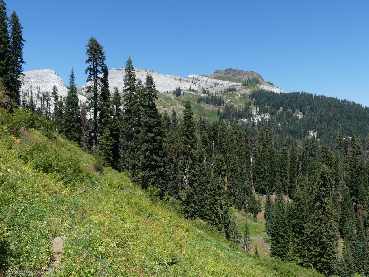
Coming into Marble Valley, we started to get spots with real views.


We stopped by the cabin for lunch. It's familiar to me from a mid-autumn trip. The mules passed by as we ate.


The hill was a bit warm in the afternoon sun. The memory of how cold it was the last time I climbed it came over me, but somehow didn't help with the heat. The view provided excuses to pause.


We arrived at the saddle and waited a little at that intersection. Last time, I went high on the secondary Marble Rim Trail. This time, we go for the Haypress Trail, a primary trail that crosses much of this large wilderness. This isn't its best stretch. The 2014 Frying Pan Fire really got this area. It's sort of the reason there's so much work to be done.


We walked through the trees continuing on to Big Elk Lake. The trees keep on until they suddenly stop. Then we had soggy meadow to navigate instead. There's a few trees around the lake itself, but finding a spot away from potential killers is not so hard. (Incidentally, there's a Little Elk Lake a couple valleys to the east. It's bigger.)


The leaders had a distinct idea of where the good spot is, so that's where we set up. We each selected spots, scattering wildly, and got the kitchen area set up. We even strung a tarp up high over the tables. It was quite the amateurish affair. The space was way too small for it and there was much drama in the doing, but we had a sort of roof in the end and wouldn't be having to cut string and leave any in the trees. Victory! We said, sure it wouldn't be tested anyway.

Same trip, next day ⇒
*the photo album*
©2023 Valerie Norton
Written 20 Sep 2023
Liked this? Interesting? Click the three bars at the top left for the menu to read more or subscribe!


Comments