Big Elk: Sky High Valley
Klamath National Forest
DAY 1 | DAY 2-3 | DAY 4 |
This third day was a rest day with people allowed to wander off on their own (or in groups) to do what they want and see what they might. I was rather uncertain what it was I wanted to do with it, but finally came down on the side of going to the top of Elk Peak, which is a p1k that I didn't have time for while passing by 2.5 years ago. I was hesitant because, again, the stretch of Haypress Trail that gets there is just not so nice, especially near Whiskey Camp. Over by the lakes to the west, it's wonderful. This bit gets a yuck. And it was even smokier.

We had a message that the Forest was removing their crews from the Wilderness. And what does that mean for us? If they've just decided they suddenly have different priorities for how they use their paid employees, it means nothing. If they've decided that the Wilderness has become extra dangerous and it's easier to save lives before they're in danger, we'd be hiking out. We asked for clarification. Pack up camp and leave was the reply. August. It's become quite the gamble in recent years.

So camp was packed and gathered to one location. Our comical but usable tarp came down along with all of the line that held it up. Just enough folks said they had the oomph to hike down and collect the tools to the junction. The long saws simply must get out, the rest is just stuff. The packers would be by the next day. (This really happened, too. Nothing had actually erupted into dangerous conditions for the knowledgeable and aware by then.)


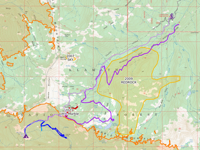
Back at the saddle where Haypress Trail ends at the Pacific Crest Trail, I pondered my route. I had wanted to pass through the Sky High Valley on my way down, but that was before there was a small fire burning in it.

I debated for a long time before starting down toward the old cabin, the way I'd come up. And then I stopped because: 1) I really wanted to see Sky High Valley, a very popular area, before it burns, and 2) Coming from the top means I can get a good look at the situation before committing to being in it. I climbed back to the saddle and took the PCT south briefly.

The junction with the Sky High Valley Trail is signed and the trail obvious. I paused to take in what view I could in the muck that was air before going over to the other side. There were an extraordinary amount of dragonflies zooming around.


The valley looked a little less smoky than the surrounding area, somehow.


Once down to the valley, there's multiple well used trails. It is impossible to tell official from use trails. I probably got on a mix while I wandered through, at least based on which trails are closest to the line on the map.


There's a building marked on the map and I decided the burning was far enough off to have a quick look to see this cabin. It's actually an old shelter of a design you can find in a few spots still. It's not in good shape.

Enough exploring, I got back to hurrying through the valley. There hadn't been footprints on the trail above, but down in the valley there were a few on a couple of joining trails on top of the rain speckles in the dirt. The thing is, the fire was burning before the rain with plenty of time to chase the valley campers on down the mountain. They might not have got any rain on this side of the divide.


Sky High Lakes Trail seems to follow along a high ledge into the forest and back to Canyon Creek Trail.

Back on Canyon Creek Trail, there's also one last look at the smoke. It seemed a little more disperse as if from a larger area, but I doubt it had grown much. The breeze was still the barest movement of air. I found others to walk with and learned one pulaski hadn't been found (or the count was off). Didn't we find a pulaski head at the other Canyon Creek? What comes around goes around, I guess. But if found, please return to BFTA?

But before I bumped into the others, I had a nice cool sitting in the shade by a creek and attempted to photograph some impossible to photograph flowers.


Ribbons decorated the sign for Lovers Camp when we got back. A new sign noted the Wilderness is now closed. My original leaving plan included finding out if the Scott River Road is just as scary as the Salmon River Road. (Sounds like the answer is yes, or at least nearly.) A fire at its junction with CA-96 made that not an option. I had to go south and around instead. It's a long drive, even longer than what I'd been hoping to do.

The journey home was dark with smoke, but managed not to be closed or even delayed by the fires that had sprung up in the last few days. The construction crews were still working, so there were frequent delays from that.
Some equipment notes:
Pack
So how has my Durston Kakwa 55 been in the heat? It's developed a bit of a stain over the back, but has been quite workable. It has migrated toward wearing like an external pack. I'm an external frame pack wearer at heart and this seems to happen to them all. I keep looking back at the Zpacks but they're expensive and eventually I'll drop 40 pounds in it and expect it to carry still and it won't. This is a solid option instead.However, it is developing a hole already. It's now approaching 200 miles, almost all with a bear can stuffed in the top. There's a spot toward the top on the curve of an edge of that can that is wearing thin. A bit of proactive patching is probably in order.
Shoes
The Lems Primal Pursuit Mid are a mixed bag. I ordered from a page that indicated they were women's shoes. They came marked as "unisex". Half of us know with great certainty that there's no such thing as unisex. The other half of us stamp it on the men's (or at least wider foot people) stuff to get the women (or at least narrower foot people) to buy it too even if it doesn't fit right. I don't get men's shoes because my heels move around in them a lot. If there's a seem along the middle of the back, they really eat into the back of my heel. These made some massive blisters there over the first two weeks. They were approaching broken in after that, but before they were breaking my heels something fierce. (I neglected to bring any other shoes I'd like to backpack in, so was stuck in them.) They don't fit right.For barefoot shoes, the Lems are very stiff in the sole. They started to get a little flexibility after 100 miles. I guess that's another way they need to break in. These are waterproof, which was extra nice when encountering mud or water. I walked across things that would have made my other shoes soggy and miserable at least for a few hours without any change to the feel. And the material on the bottom is wonderful. It sticks to the rocks in the wet! I've had so many slippery shoes recently. This was great to find and in a situation where it really counted.
Since they are mid-height, I felt a little constricted. The inside doesn't dry as fast as it might if the shoe were shorter. On the other hand, I didn't smash or flip a single rock into my ankle because there's protection there. Those occasional rock flipping incidents can really hurt. I could lace them lower, maybe. The provided laces are way too long even using all the eyelets. Fixable problem.
They seem to be durable. I really beat them up the first two weeks. Sometimes I kicked sticks off the trail, including big piles, for miles. At the end of that, there's one small blemish showing. There's a decorative raised grid that has come slightly loose along two of the boxes. It would have been enough to put a hole all the way through my old Lone Peaks. Plus those were slippery.
So besides lying to me about being women's shoes, these do seem to be a solid pair of boots. I did have one pair of men's shoes that, once broken in enough, was solid for hundreds of miles and had to be given new insoles rather than replaced because everything else couldn't measure up. Thinking of those, I didn't send the offensive "unisex" shoes right back. But it was close.
*the photo album*
©2023 Valerie Norton
Written 21 Sep 2023
Liked this? Interesting? Click the three bars at the top left for the menu to read more or subscribe!


Comments