Boulder: Boulder Peak and Second Valley
Klamath National Forest
(blue and purple lines, map link)
DAY 1 | DAY 2
With morning, I had a cold breakfast because I'd run out of everything for a warm breakfast on the previous trips. The sun arrived early and I packed up camp.


I walked out on the track to the trail above, passing a rather official looking sign telling me of destinations higher up on the way. It has an impressive foxtail pine (Klamath subspecies, no doubt) as a sign post. I found the official trail with no trouble and continued up, mostly still in shade.


Arriving at Upper Wright Lake, I liked my choice to stay below. The obvious camp site barely has room to lay down, but there's also an obvious trail climbing to what might be a better site and a much larger site on the far southeast edge. I strode down to the water to see what I might see.

Then I followed the trail around the edge.


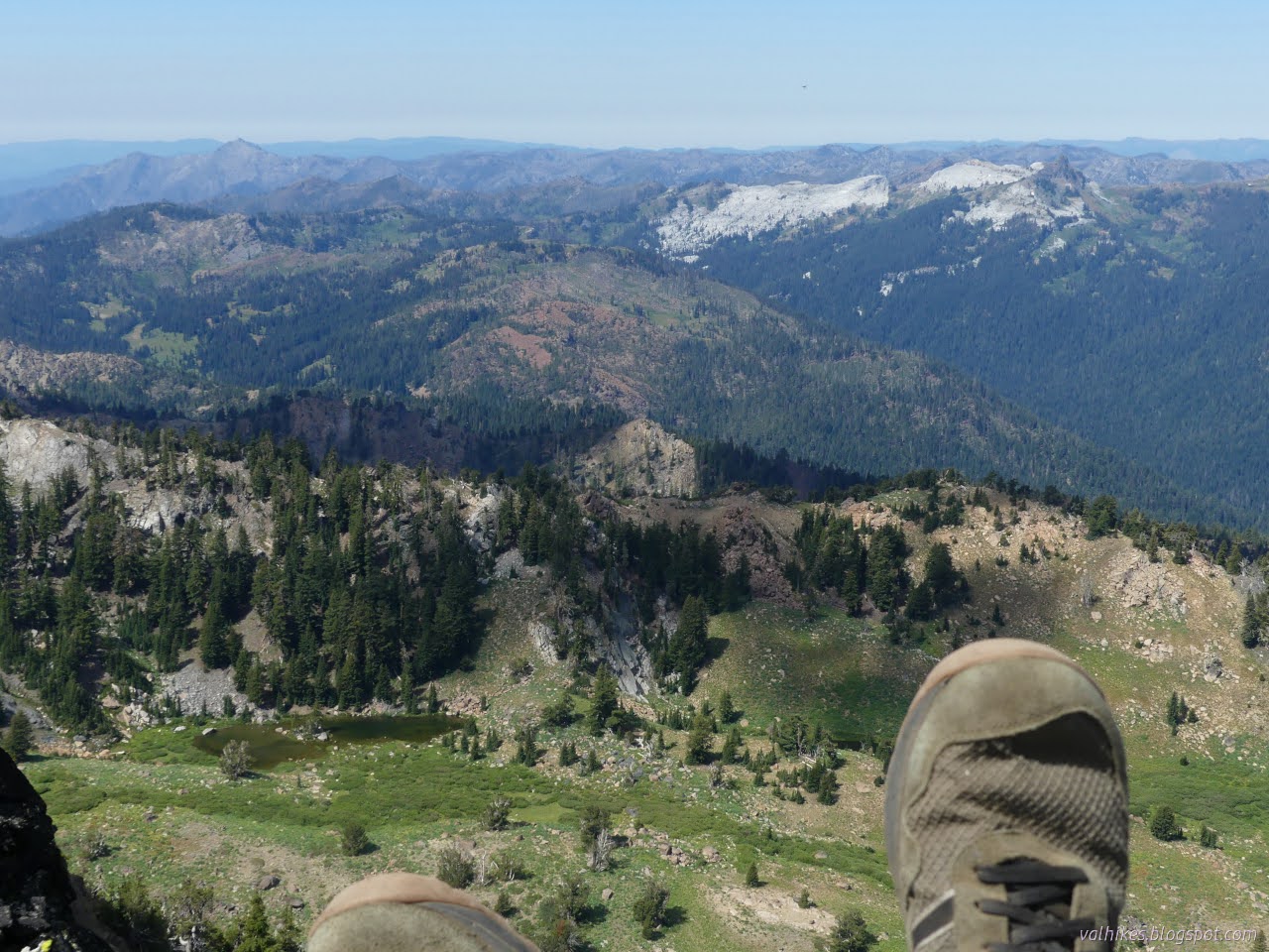
From the lake, there's a little more climb to reach the ridge above. It's solid and constant and comes with quite the reward.

This is where I leave the primary trail system for a secondary trail and turn onto Second Valley Trail. It is signed and easy to see. (And the destination stated is Boulder Peak even though the map shows that as a fair distance from the trail.) I just wondered if it would all turn away up the peak leaving no trail where it officially goes.


I didn't find any trail continuing on where the map said there should be some. It all went up. I didn't spend much time looking for any such trail either.

I followed the main trail as it wound upward past a tree cut but not cleared. (I think the piece didn't have room to roll out and it's a big tree.) Did they think this was official trail? Then I wandered over the top and back down the other side, away from the peak, shortly. Maybe it was the official trail? It certainly looked like tread even if not used much. I backtracked for one of the smaller trails up to the actual peak. Wouldn't want to leave the last little bit of this peak undone. It's a simple walk from this side. I didn't spend much time at the absolute highest point due to the wasp orgy swarming around the area. (Although, they looked an awful lot like ants, just they all had wings. Particularly like the ants that were by camp which had an overabundance of those with wings but weren't all winged. Only male ants have wings.)


After a while, I headed down to where the trail popped over the ridge. Is it the trail? The map claims it circles around and over the ridge about 400 feet vertical lower, then puts in some switchbacks that are definitely artistic rather than accurate. I've seen lines that bad on these maps before. Or maybe it's an old trail. Maybe it's just gotten that much use, but there was that tree cut on the other side where the map says the trail isn't. It's too wide for a game trail. It was something I knew was there and visible and I decided to give it a try.

As near as I could tell, the area where the trail should be coming down according to the map doesn't look very hospitable to hiking. There are big boulder chutes. I dropped down on dirt in little wiggles never quite feeling too too steep.


I got to a bit of trail where it seemed to clamber through the thick green around a small stream. I stopped to gather water above where the cows frequent, but decided agaist crossing all the growth. That left me downclimbing a rock staircase with much higher than regulation steps. I could see a few crossings below, one of which actually looked attractive. Others were churned to mud by cows.

I had a snack among a circle of trees that looked like it could be a nice camp except the cows agreed, then crossed over and found some tread to follow. It was in approximately the right place according to the map and looked like it could really be trail. Cows can put down some very nice tread when they want to. I continued being in approximately the right place on down the valley.

That was fine until I got to the spot where the map said I should go back over to Second Valley Creek and cross it. I just found big boulders where the trail was supposed to be, and navigating those, there still wasn't anything like trail and the vegetation was way too much. I retreated and gave the landscape a good examination noting that it didn't always look like there was room bewteen the creek and steep slopes to walk further down. My first instinct for trail was down the other side, staying a little high and out of the vegetation. A bit like the route the cows were running away from me on. Truthfully, there's a choose your own adventure of cow paths through the valley.


My western route worked very well. There was sign of good trail on the east side as well. Someone had stacked a cairn or two on the paths I chose. Choosing the way up would have been a challenge as the paths divide frequently.


Suddenly I arrived at a trail covered in footprints. Deep Lake Trail number 5535! That must be a popular hike. Maybe I should have prepared for a wander around to spend a second night over there. I probably had the time. I didn't have the food, so back the way I came. Besides a small cairn near where I hit the trail, there was no sign that there was an intersection there. There was even less sign on the east side where the map puts it.


I plunged back under the trees shortly before the junction to travel up or down on Wright Lakes Trail (5537) and couldn't help but notice that most choose up. I chose down, stopping once at that rocky ridge for the brief view and a snack, then on down past the parking to my car on the old ford approach.

Nothing came of all those clouds clustering by the peak. I settled once more into my camp. One more wilderness high point achieved!
*the photo album*
©2023 Valerie Norton
Written 17 Sep 2023
Liked this? Interesting? Click the three bars at the top left for the menu to read more or subscribe!


Comments