Posts

Showing posts from November, 2023

Easy Chair Crater

Image
Tonopah Field Office BLM ( map link ) One of the larger cinder cones in the volcano field around Lunar Crater is Easy Chair Crater. There is a thin, but smooth enough, road off the scenic backcountry byway past Lunar Crater at the first (from the north) cow water, then keep left at the Y. There is a small dirt lot and a sign for Observation Point Trail. It's a short route from the parking area to the low point of the crater. Lunar Lake and the nearby buttes of the Pancake Range from the edge of the parking area. The trail to the edge of Easy Chair Crater. My plan was simple: head up to the observation point and then around the edge of the crater. The high point is marked on Peakbagger as "Easy Chair Butte", so I figured I'd tag that when nearby. The crater is particularly asymmetric and the high point is off the edge of it. There is an Earthcache that suggests it is possible this crater grew out of the side of an older one to make it so lopsided, but the...

Lunar Crater

Image
Tonopah Field Office BLM ( map link ) I traveled the Extraterrestrial Highway (NV-375) looking longingly at the several good roads extending north past varied and beautiful mountain ranges. All missed on this trip. It's much more interesting than the area to the south, which is off limits testing grounds and supposedly includes "Area 51". Circling around on US-6 and then following an actual sign for my destination, I arrived late in the afternoon at a small volcano field full of little craters and the odd lava flow. Among all these little cinder cones is one oddity: Lunar Crater, a maar crater. Lots of cinder cones in the distance. While the nearby craters are formed from pressures deep within the earth finding a weak spot to spew new rocks, which then collect in the vicinity, the maar crater forms when water suddenly encounters hot magma and the resulting water vapor provides the explosive energy to blast away the rocks already there. The maar crater called...

White River Narrows

Image
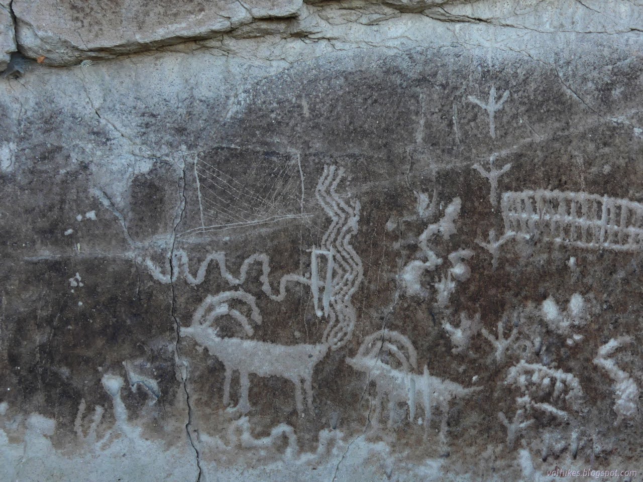
Basin and Range National Monument ( map link ) The three rock art brochures I picked up at the Caliente Field Office included one for the White River Narrows. When I had iffy signal, I had seen, but not kept, the printable map from this site . That would have got me to the sites, but the brochure has more to say about them besides don't touch, not even to take a rubbing. (But also, don't touch. Especially not to take a rubbing. It's illegal for a reason.) I did try to visit anyway, but it didn't work out well. I debated if I really wanted to backtrack out of my way 24 miles to try again, but while flipping through the Rock Art book from the Nevada Rock Art Foundation (also available in PDF here) , I spotted a particularly interesting panel and found it is part of the site here. Okay, I do. But first, this is what it is like to visit without the brochure in hand: 20 Nov 2023 I was traveling from the Wayne E. Kirch Wildlife Management Area toward Caliente with...

Crystal Wash Petroglyphs

Image
Caliente Field Office BLM ( map link ) I picked up three brochures for petroglyph sites at the Caliente Field Office including the one for Crystal Wash. Between the rough location of #98 Crystal Wash Petroglyphs on the Ely District Recreation Opportunity Guide (on the wrong side of the highway) and the description in the brochure, which referred to mile markers that have almost entirely vanished from the highway, I guessed my starting location was a little further down an unnamed road than geocache GC14GG1: I'd Go a Mile for a Smile-Elephant Poop . It is another one saying you could take your mamma's Jetta down the road, and this road is smooth. The sagebrush down the middle still provided some very audible bumping and the faint wash near the start could get worse over time. Still, I got to the end and found a small dirt parking area and a register. (Infrastructure! Confirmation of correct location!) The register seemed to think one could expect to find brochures in the b...

Big Rocks Wilderness and Pahroc Spring

Image
Caliente Field Office BLM ( map link ) Camping at the edge of Big Rocks Wilderness by the "Welcome to Mecca!" sign, I decided that my goal for the day would be the Big Rocks Wilderness high point, which is also the North Pahroc Range high point. However, I did not want to walk up the road I had driven, nor did I want to risk driving it again with my inappropriate car, so I wouldn't be starting from the points west of the unnamed peak where the most successful attempts have originated. I would be traveling from the south, probably along a ridge. The one person who had traveled similarly from the north indicated that this was some of the most taxing terrain they'd been on. There is also a lower benchmark that would have been a more reasonable goal from my starting point, but no, it was not mine. I've been getting high points and here was another 4 miles off and I had all day to do it. I wanted another high point. Sign to welcome folks to Mecca. It's not...

Geocaching and Finding Mecca

Image
Caliente Field Office BLM After stopping by the Oak Springs Trilobite Site a second time , I had a relaxed program of travel aiming at Mecca, #19 on the Ely District Recreation Opportunity Guide. It has a toilet and picnicking, so it would be easy to find although these circles aren't always well placed. (Crystal Wash Petroglyphs is marked on the wrong side of the highway, for instance.) It's not far, so I added in stops for a couple geocaches on the way. They were supposed to be stops during the first pass along this road. This time, I hit the "toggle talking" on c:geo so I could actually stop in the right place for these. It's annoying, but the Lincoln County High School radio station kept finding dead spots leaving nothing at all for my driving entertainment. I'd Go a Mile for a Smile-Yuccy Dead : Says it's "on a road you could take your mamma's Jetta." This really is a good road except for a little washboarding and part of the road t...

Meadow Valley Wash Linear Park

Image
Caliente Field Office BLM ( map link ) I was off for a day in the city, mostly library time and a stop at the BLM field office. I'd also found a few feet of trail to follow in a loop about the city. First, on the way in, I had to stop and find a geocache hidden in 2001 , partly because it is so old. (I don't think much of the current craze to "refresh the gameboard". Let the old ones remain.) Then it was off to the park, then, since there was plenty of time, I poked around the local cemeteries. Newman Canyon There is quite a big area to park beside the highway here, but no trail to get up high where the geocache is. They've given it a high terrain rating because of loose rocks and steep slopes and they aren't kidding. I found a way along some very minor ridging that did look like it gets walked from time to time. The view at the top was quite rewarding. I'd spotted this canyon from the top of Grey Dome, but it's more interesting to see closer...

Grey Dome (Sugarloaf)

Image
Caliente Field Office BLM ( map link ) Nevada boasts the first "nationally recognized" OHV trail system in their Silver State Trail . I suspect this is a similar status to a National Recreation Trail, but for motor vehicles. It spiders the area of Lincoln County between US-93 and NV-318. There are five developed trailheads that also serve as small campgrounds. I stopped at the Chief Mountain South Trailhead with the plan to hike to the top of Grey Dome. Since my Ely District Recreation Opportunity Guide says there is hiking at this spot, I expected to see some designated hiking trails shown on the sign, but there are only the practice trails for motorcycles. It is all unstructured hiking. Or on roads and ATV trails as most of my planned hike would be. The road past the trailhead still looks rather Scion ready, at least to the saddle. I headed out along a connector from the trailhead sign to the road I came in on. It gets visibly rougher, but I could still drive it ...

Oak Springs Trilobite Site

Image
Caliente Field Office BLM ( map link ) I spotted the trilobites on the list of BLM recreation sites on my Ely District Recreation Opportunities Guide and drew some little bright lines around it so I wouldn't forget to stop at #18. There's actually two signs to help the public find the spot and a short piece of maintained road to parking with a toilet, trash, picnic tables, information signs, register, even tools. Well, the public has been a bit too hard on the tools, so there was not actually a rock hammer when I looked. They suggest you have one for best experience. And eye protection. And you are allowed to keep common stuff like plants and trilobites so long as it is for your own personal having. I haven't got a hammer so I am dependent on what might already be visible. (I decided against bringing along the hatchet that doesn't get any use.) Parking and picnicking and information. Oh, and there's Joshua trees . Beside the sign and register, there...

Dave Decon Campground

Image
Wayne E. Kirch Wildlife Management Area Location: Dave Decon Campground More weather passed through and I must admit to some regret that I had not dragged the little trailer along for this trip. I figured it would be easier to face the roads that my car isn't really up to if backing up is possible. A tarp helped close up the spaces between the slats of a provided shelter to keep the rain off my breakfast as the wind blasted north. When it stopped raining, but started blowing very hard to the south, that tarp took the brunt of the blast, too. I did have to get out in that wind and move the tarp. This weather brought an excellent rainbow. Complete arc. Double. There it is, doubled. Some more coming rain to renew the start. Light playing in other parts of the sky too. The starlings continued to waft in a group from tree to tree. The grackle continued to be loud from various branches.

Tule, Haymeadow, and Cold Springs Reservoirs

Image
Wayne E. Kirch Wildlife Management Area ( map link ) The plan for this day was to visit the three smaller, further reservoirs starting with the furthest. It had rained heavily overnight and even the main road felt a little off, but I was really regretting leaving the driving to after the rain when I got to the last two miles to the Tule Reservoir Dam. After the turnoff for Haymeadow Reservoir, the road becomes narrow and lesser maintained. The turnoff for Tule Reservoir is so rough that I pulled out of the way of traffic at the corner and walked it. There's lots of room for parking at the intersection even though it is not marked as an official parking area on the reserve's map. Tule Reservoir from atop the dam. A little cloud and distant rain remain. Old road on the far side is trail now. A look back over the occasionally flooded areas below the dam and back up the road. The great amount of reeds, for which the reservoir is named, got me to thinking I wouldn...

Dacey and Adams-McGill Reservoirs

Image
Wayne E. Kirch Wildlife Management Area ( map link ) The Wayne E. Kirch Wildlife Management Area boasts numerous habitats, each attracting a different collection of birds and animals. The open water of the reservoirs both deep and shallow, tule choked waters, periodically flooded lands, shoreline, and surrounding scrub can all have their adherents depending on the season. Some pass through and some nest. I set out to test again if there was really no hiking (as indicated by the Ely District Recreation Opportunity Guide that Ely District BLM prints, but does not seem to make available in electronic form) in the Kirch WMA with a planned triangle of large reservoir visits. Again, I simply started in the campground. The tall cottonwoods planted there don't seem to be mentioned as a habitat, but they do attract their own set of birds. Starting today's birdwatching at "home" with a singular and noisy great-tailed grackle . I headed out of the campground and down ...