Moriah: Hendry's Creek
Humboldt-Toiyabe National Forest
(blue line, map link)
DAY 1 | DAY 2 | DAY 3
Prior to wandering out to the sky islands of Humboldt-Toiyabe National Forest in 2017, I procured a bunch of maps from the USGS store, mostly covering the Ely District. This resulted in owning maps I have never hiked. That's not right! I was despairing of the idea of fixing this for the Mount Moriah Wilderness map due to the roughness of the access roads around the wilderness when my neighbors at Eagle Peak Campsites expressed the opinion that surely I could get to Hendrys Creek since the mine was up and running again and, well, that's how roads get maintained in Nevada. It'll be good all the way there. This is almost true. There's generally a bit of "the last mile" which goes to the trailhead instead of the mine that remains in a poor state. In the case of Hendrys Creek it literally is just a mile and, if one stops short of the trailhead, it's mostly Bureau of Land Management surrounding and thus also legitimate parking so long as one can get out of the route of travel.

There were three signs to direct me to the trailhead. There's a Humboldt National Forest access sign at US-6 (and US-50), this one happening to be just a few hundred feet west of the road to Baker, so a brief jog left after leaving Great Basin National Park. Going northeast on it, one passes a faded sign with mileage to four of these access points. Hendrys Creek is the first, closest, one at 15 miles. Pass through a spot of houses, then barrel northeast on good gravel right on into Utah. There's a sign for Hatch Rock (the mine) to turn left at and return to Nevada. Then, if fortunate in picking roads at a couple more intersections, there's a "trailhead" sign pointing left at a skinny Y in the road. The other road goes to a second tiny patch of private property. Except for my needing a second try toward the end, I and the Scion managed well right up until a camp on the right. I was very tempted to stop there among the willows on the creek. I walked the rest of the road, tossing off a couple rocks hidden in the sage growing down the middle and eventually did drive the last quarter mile to the trailhead. This included a lot of shrubbery rubbing the bottom of my car and a small wash crossing where the little car's nose was almost too much. That put me in a large parking area just inside the forest boundary with plenty of flat space for camping. The map says these eastern access points are the easy ones.


Meanwhile, my unseasonably warm and dry weather was coming to an end. The forecast for the next week was populated with rain except for tomorrow, which was a shining jewel of sunny and little wind. That's my peakbagging day for Mount Moriah. Hendrys Creek is about the longest approach, so the day before and after were needed to get close and then get back. There would be some weather to deal with but only while deep in the canyon. It is the middle of fall and I figured that dealing with a little weather is just the way things will be from now on. I got out the waterproof Lems and tucked in silnylon poncho and long skirt for the trip. Food and water and gear and camera for this trip came out to 26 pounds. That includes the extra puffy jacket again plus the Costco quilt for luck. If it was going to be wet, I wanted to be extra certain of warm. For the start, it was looking like a beautiful morning, warm and dry. Could it really be getting ready to drench the area?

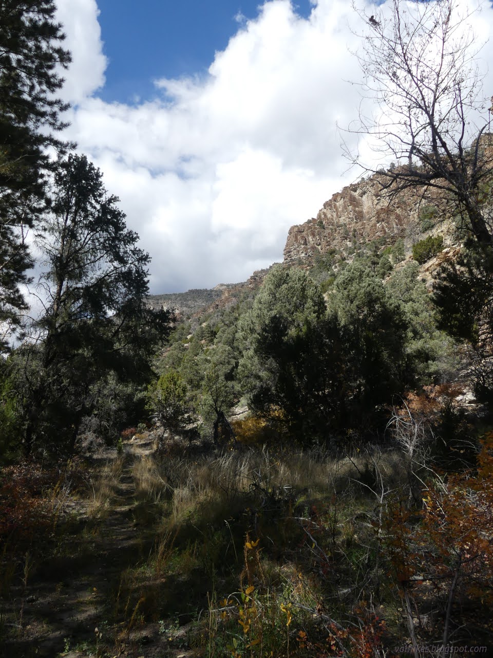
All the information I had stresses this wilderness is hard to access and remote, so I was quite delighted to see the trail is well used and quite clear. After the first quarter mile, it is following old road, which makes it even easier to follow.

Some old berries on a plant of shriveled leaves were triggering my poison oak alarm even though it shouldn't be growing in a few hundred miles of here. It is a different sumac. I hadn't noticed it in the south part of this ecological island. More new plants were tall pines with very familiar puzzle piece bark. There seem to be observations of these plants there, so maybe it's just that I'm starting off at a lower elevation.


The creek crossings weren't frequent, but they also weren't well established. Most included stepping into shallow water at least once, so the waterproof boots were a good choice even if it wasn't going to rain.


It is almost 2 miles before getting to the wilderness. There are mining (or quarry) areas above the canyon cliffs on either side that presumably pushed the boundary west here. I sat by the water and a remnant of fencing for a snack.


It did look a bit like rain further up the canyon. I felt a little irrational to be heading up into it.


I saw evidence of wild horses from time to time. One had stopped frequently and scraped away two lines of dirt in the trail. What could be the reasoning?


The rain did come. I found a nice umbrella of a tree to eat under beside the first camp I had seen. It looked like it was originally a mining camp. People like to scrape the flat area before putting up their tent, gradually digging out a hole. With just a little bit of rain, it had become the only puddle I encountered and quite a deep one.


With a turn toward the north, there got to be aspens. There were more camps, or at least fire rings among the small and large meadows among the aspens. I wasn't entirely sure where people actually put their tents in these areas. Maybe they just carved the trees without sleeping. Cliff, for instance, must have carved a hundred trees on September 11, 1932 with a spattering of trees carved on other trips before and after.


After a couple hours of raining, it stopped. Between the creek crossings and the dribbling off my poncho, my boots had failed at being waterproof. My feet were wet and would stay that way. They weren't slushing, but they weren't happy.

The trail has some sections skipping the road, which had some particularly desperate segments through narrow canyon with seeping springs. The users of it probably just went up the creek in a couple spots.

I was hoping to get 9 miles along the trail, but suspicious that the water would run out before then. The creek split with the trail following the smaller portion first.


There was one space that looked the most likely to have a warm morning, having a certain amount of sage, but I was wanting to be closer to the peak. After another half mile, the water dried out. I kept going a little and it kept being dry.

I kept going after the water dried up and found an area that seemed a bit dry overall in spite of the rain that was falling earlier. I found a flat spot big enough to sleep on with enough clear sloped space around it to set up the tent and decided I could make it work. This would be my camp. Only 7.5 miles up, but quiet, dry, and a short walk to running water. Who could ask for more? And before dark. It was dark before I finished fixing food, so barely in time, too.
Same trip, next day ⇒
*the photo album*
©2023 Valerie Norton
Written 25 Dec 2023
Liked this? Interesting? Click the three bars at the top left for the menu to read more or subscribe!


Comments